Maps · November 2026
Hookito maps for the #30DayMapChallenge 2026
The #30DayMapChallenge is a community event: one map a day through November, each on a theme. These are ours, made from the same data as the rest of Hookito.

Maps · November 2026
The #30DayMapChallenge is a community event: one map a day through November, each on a theme. These are ours, made from the same data as the rest of Hookito.
Each map takes one dataset Hookito already uses: the capitals and facts behind the country pages, the outlines from the countries list, the paintings in Art, the album lists in Audio and the night side of the globe. The boundaries combine Eurostat GISCO and Natural Earth data. The world maps use a plain equirectangular projection, cropped at 84° north and 58° south.
Spotted a mistake? Write to submissions@hookito.com.
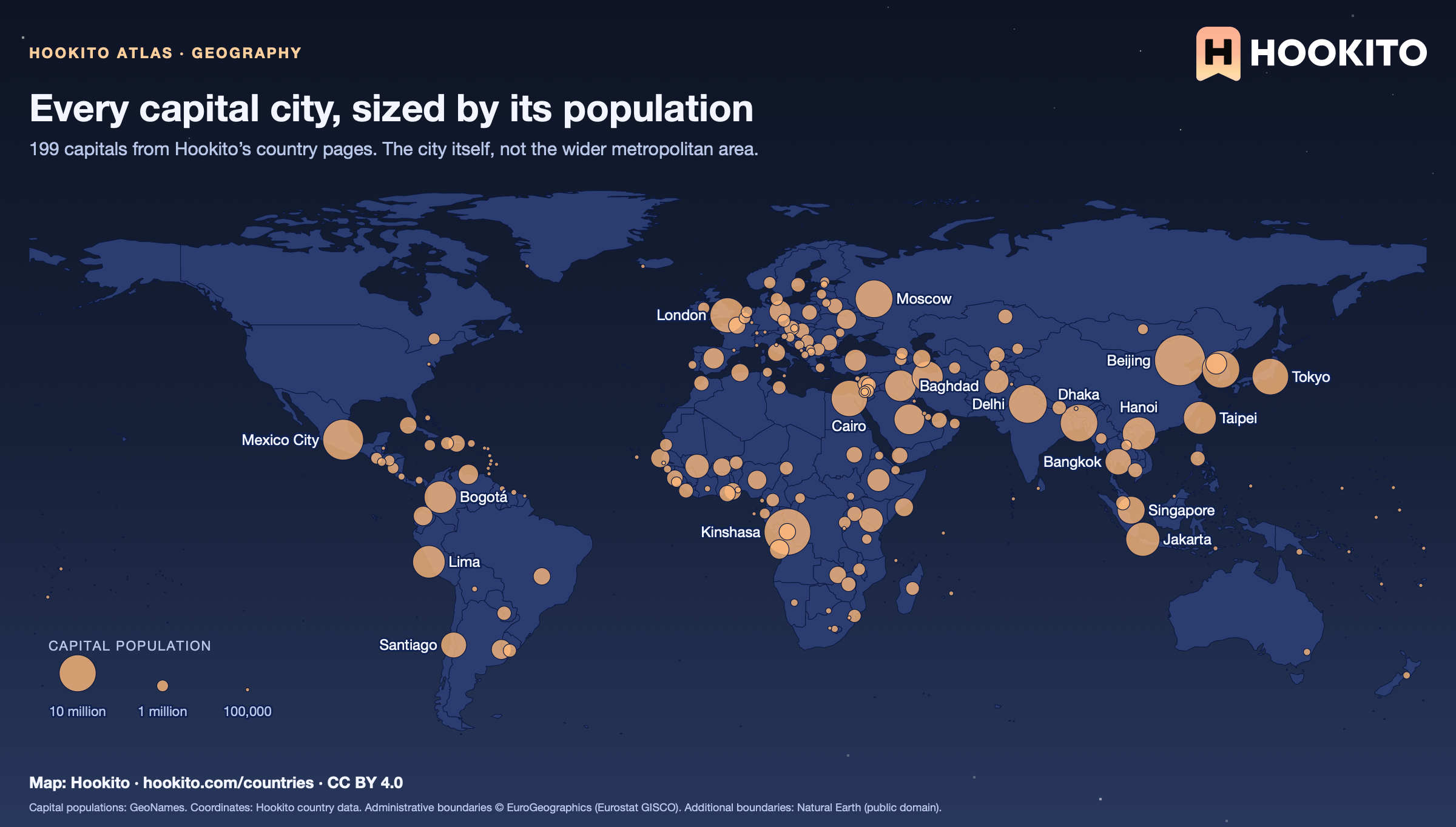
Day 1 · Points
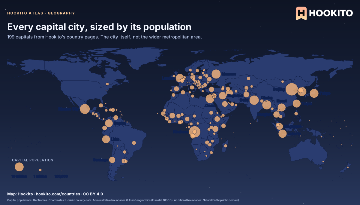
Beijing, Kinshasa and Mexico City are the largest dots. At the other end, 25 capitals have fewer than 50,000 people. Each country page lists its largest cities.
Capital populations: GeoNames. Coordinates: Hookito country data. Administrative boundaries © EuroGeographics (Eurostat GISCO). Additional boundaries: Natural Earth (public domain).
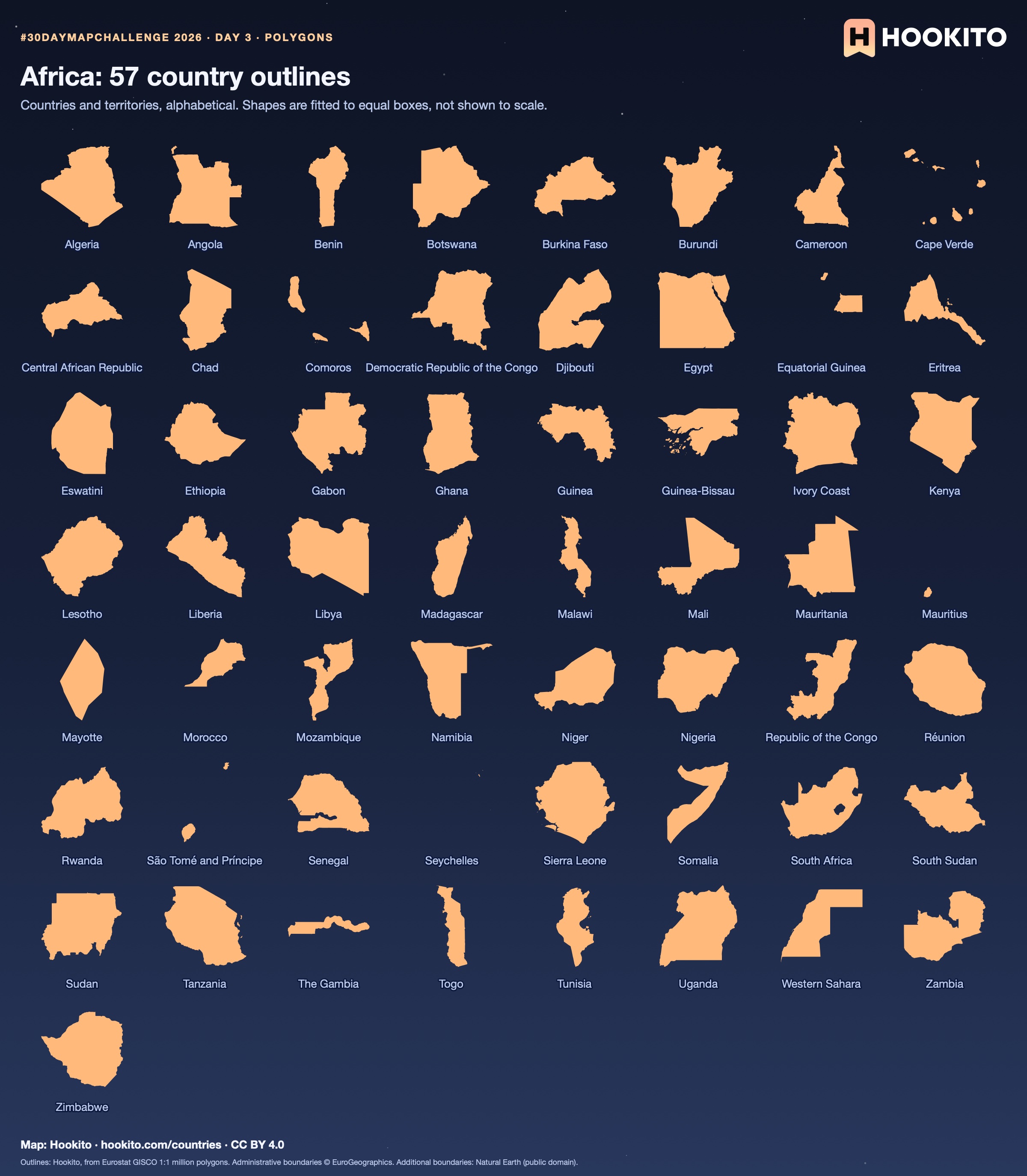
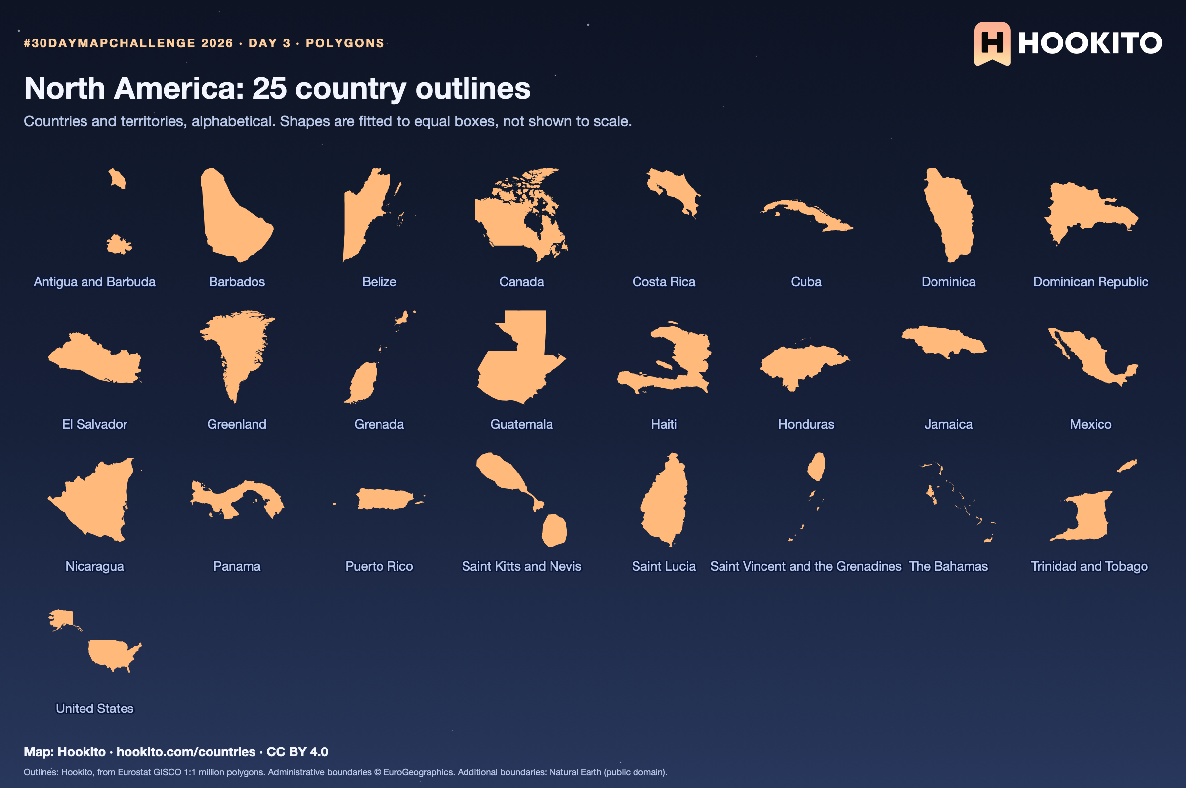
Day 3 · Polygons
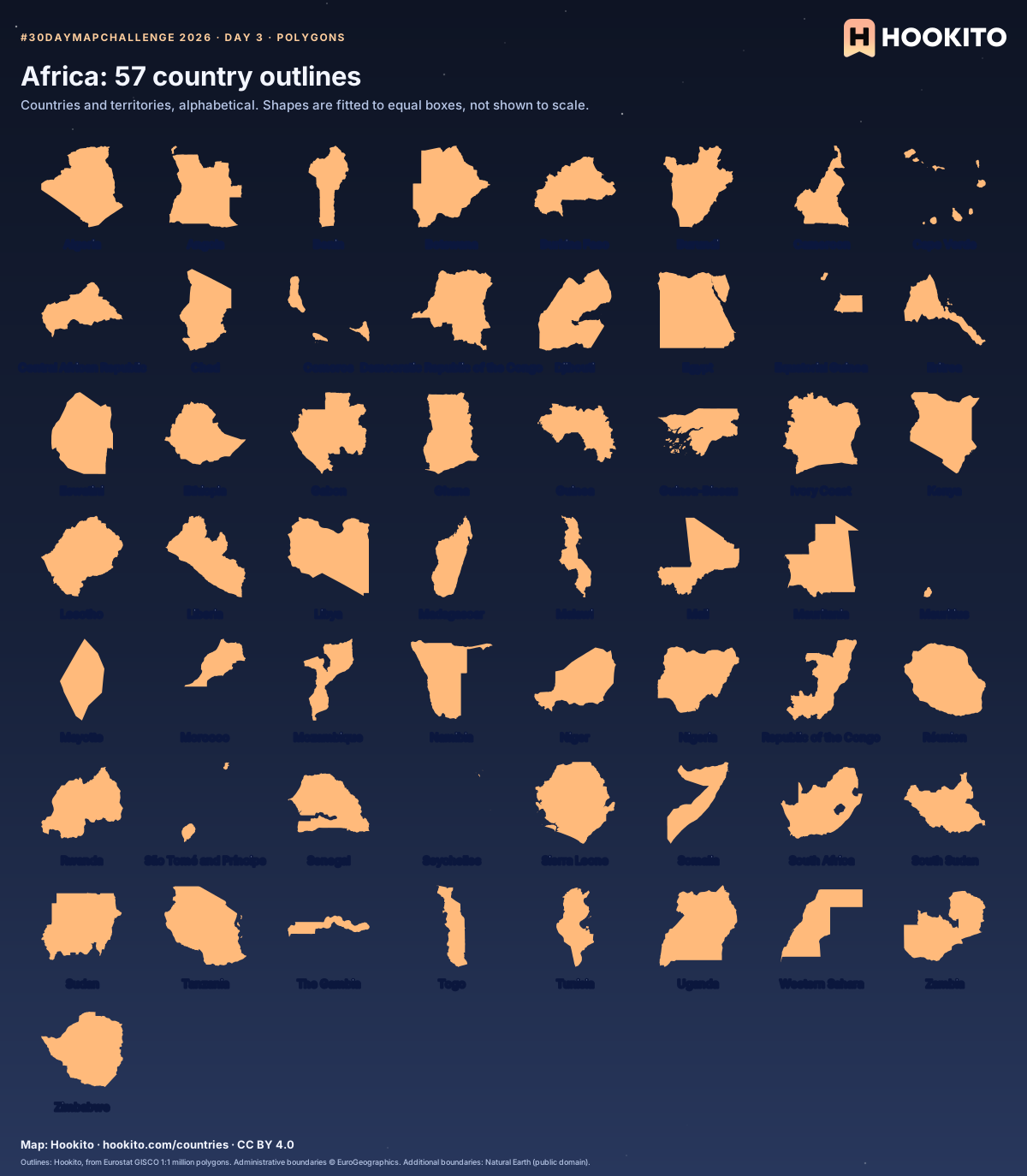
Some countries you’d know from the shape alone; others only once you read the name. Cover the labels and see how many you get.
Outlines: Hookito, from Eurostat GISCO 1:1 million polygons. Administrative boundaries © EuroGeographics. Additional boundaries: Natural Earth (public domain).
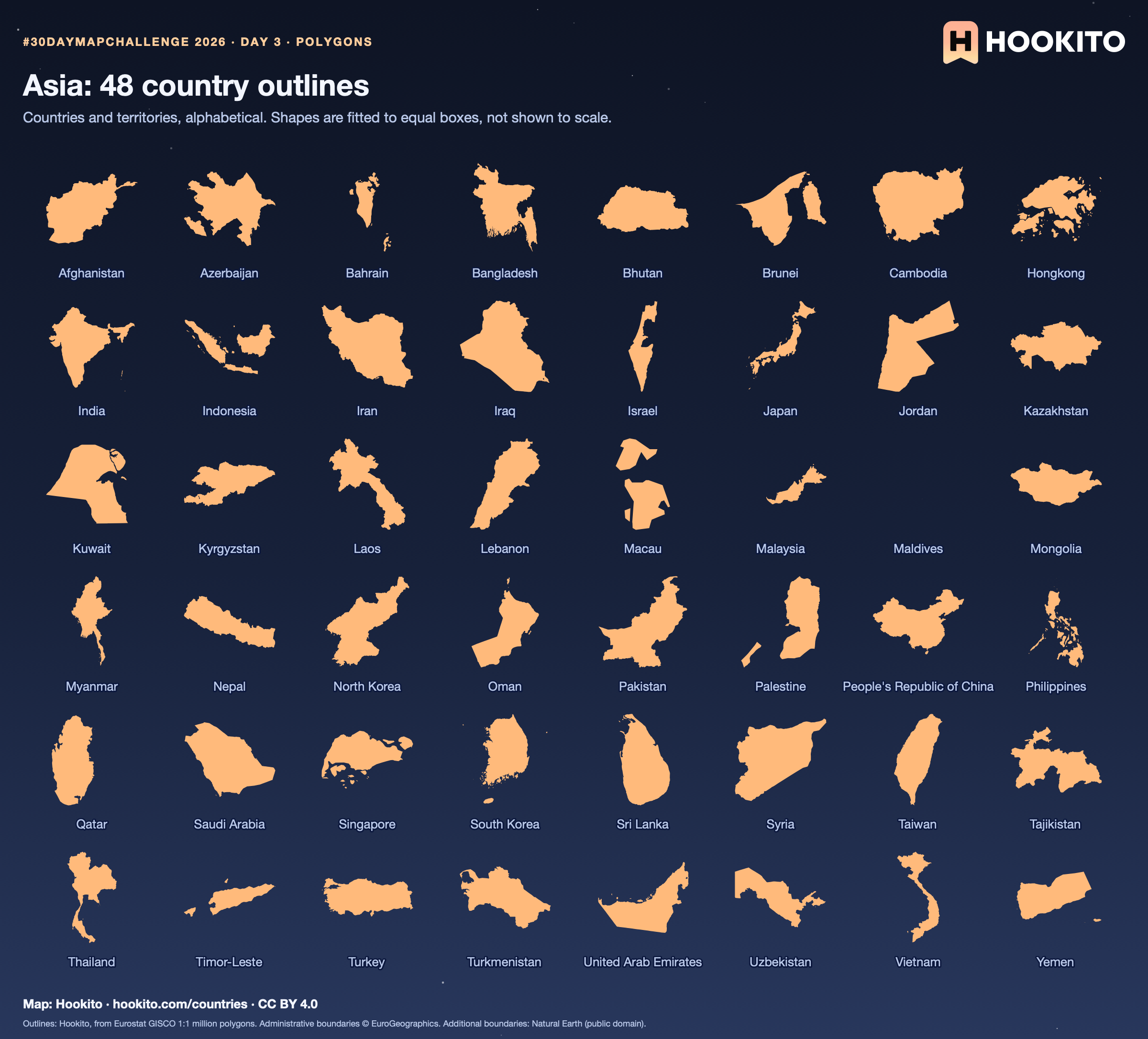
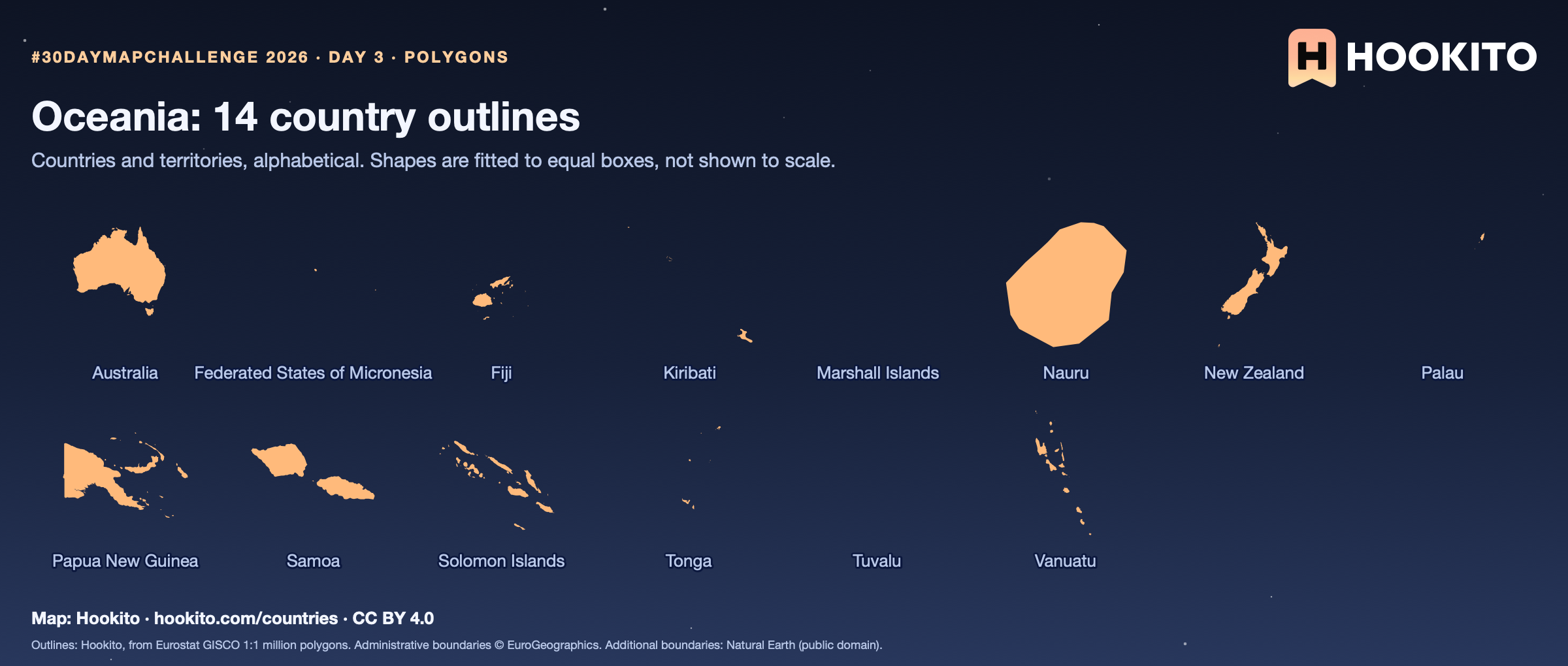
Day 3 · Polygons
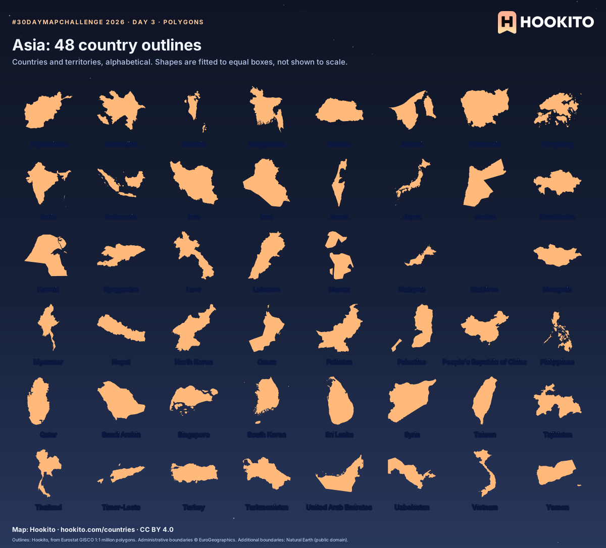
Some countries you’d know from the shape alone; others only once you read the name. Cover the labels and see how many you get.
Outlines: Hookito, from Eurostat GISCO 1:1 million polygons. Administrative boundaries © EuroGeographics. Additional boundaries: Natural Earth (public domain).
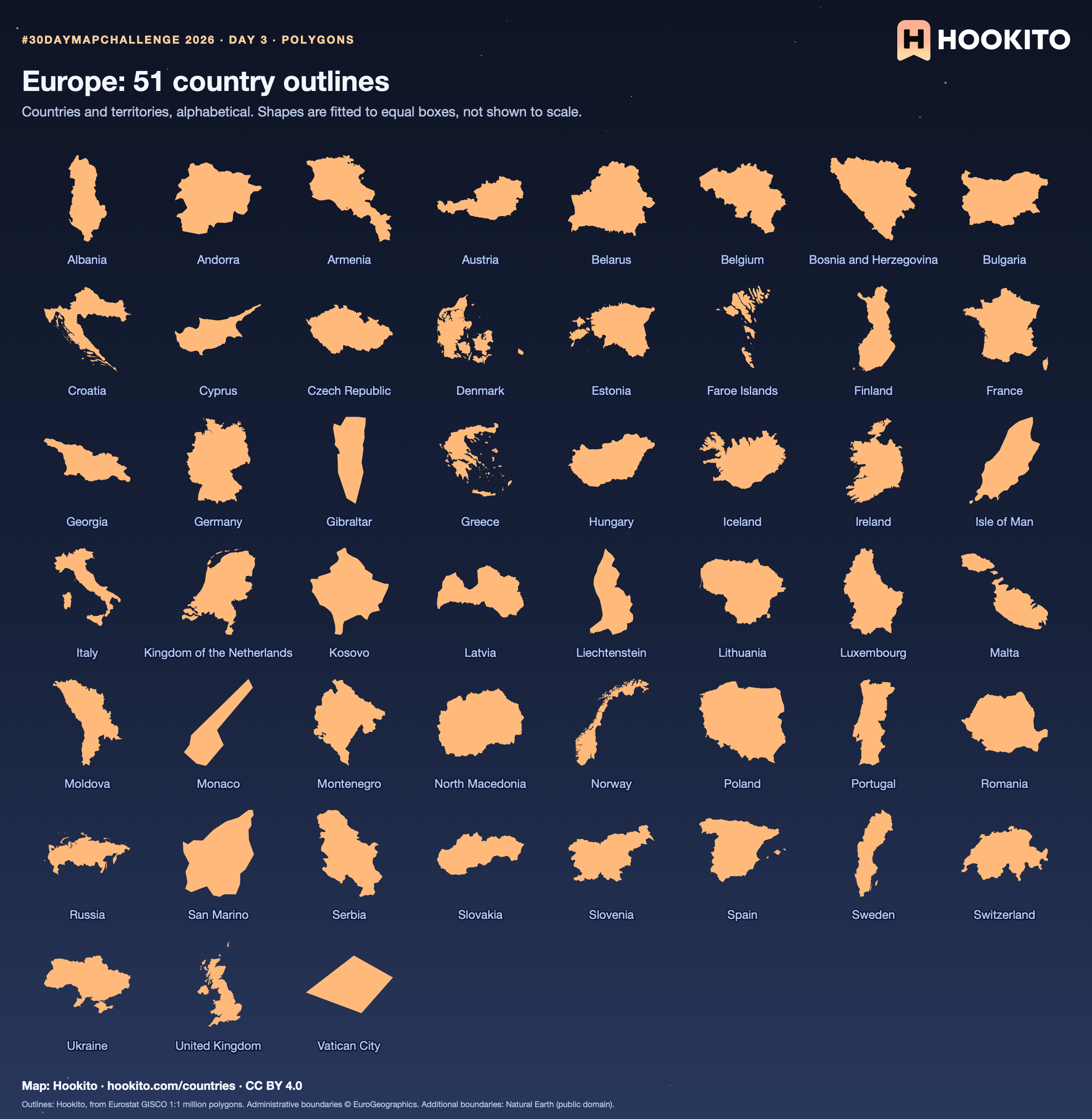
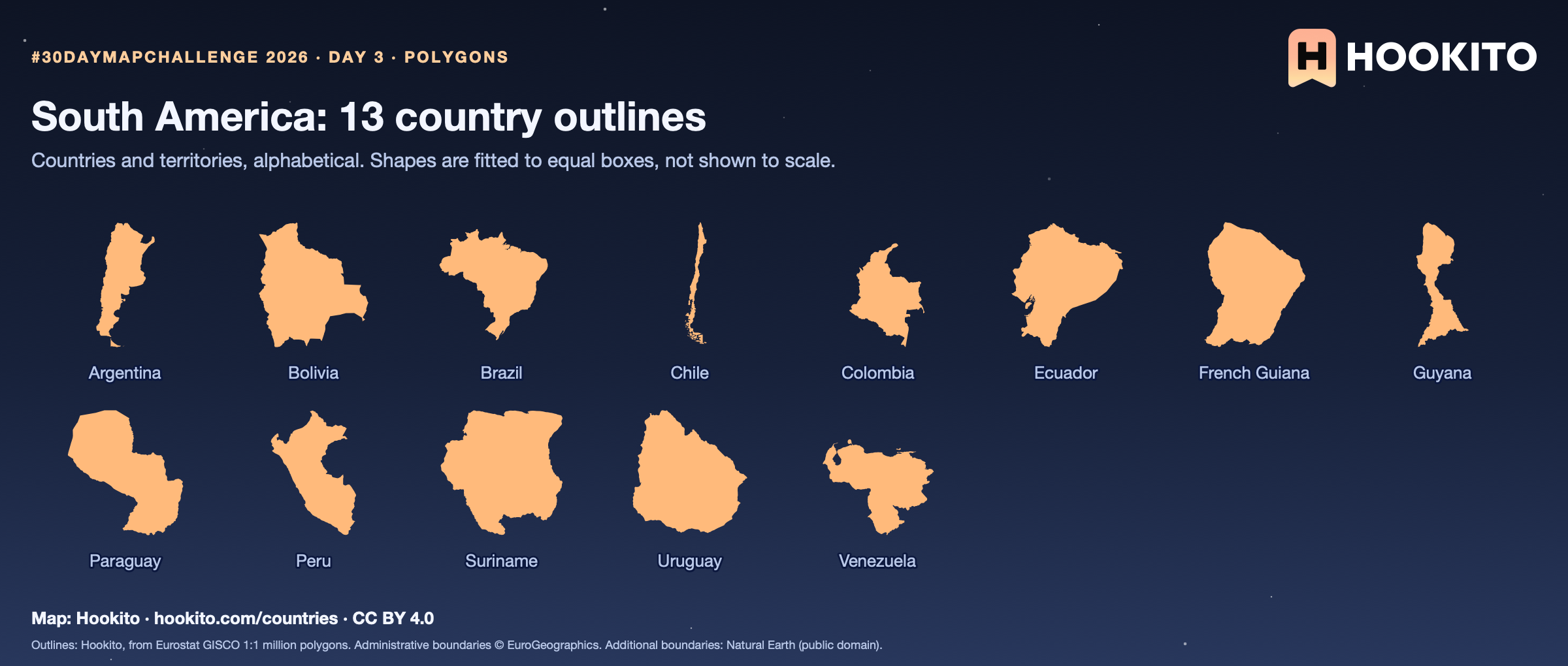
Day 3 · Polygons
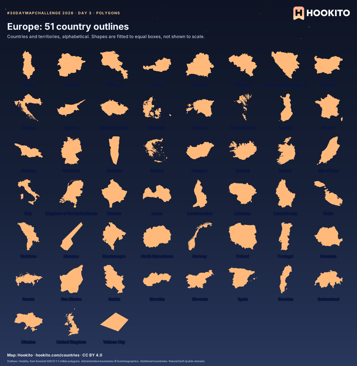
Some countries you’d know from the shape alone; others only once you read the name. Cover the labels and see how many you get.
Outlines: Hookito, from Eurostat GISCO 1:1 million polygons. Administrative boundaries © EuroGeographics. Additional boundaries: Natural Earth (public domain).
Day 3 · Polygons
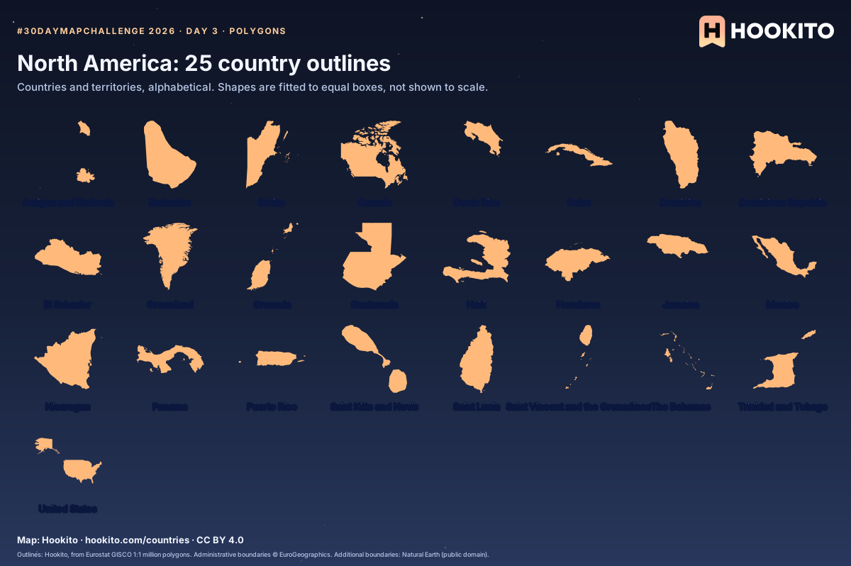
Some countries you’d know from the shape alone; others only once you read the name. Cover the labels and see how many you get.
Outlines: Hookito, from Eurostat GISCO 1:1 million polygons. Administrative boundaries © EuroGeographics. Additional boundaries: Natural Earth (public domain).
Day 3 · Polygons
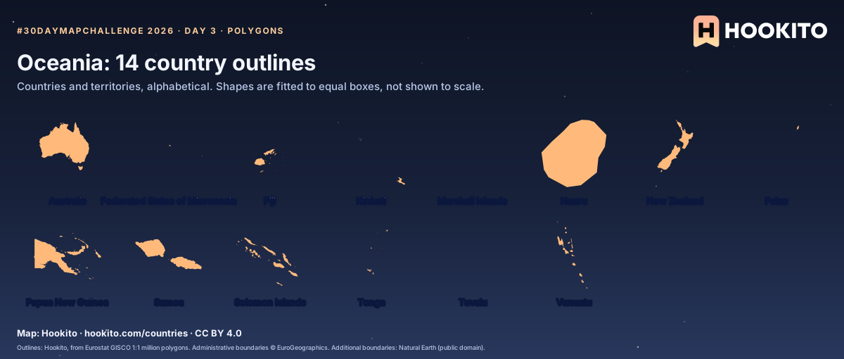
Some countries you’d know from the shape alone; others only once you read the name. Cover the labels and see how many you get.
Outlines: Hookito, from Eurostat GISCO 1:1 million polygons. Administrative boundaries © EuroGeographics. Additional boundaries: Natural Earth (public domain).
Day 3 · Polygons
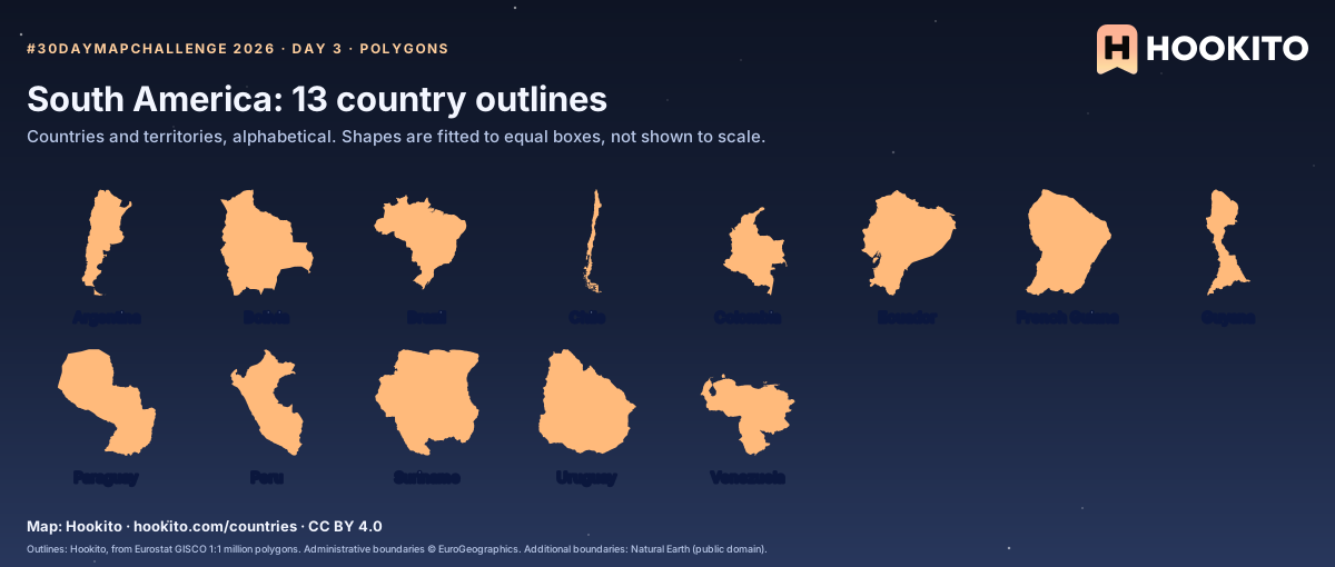
Some countries you’d know from the shape alone; others only once you read the name. Cover the labels and see how many you get.
Outlines: Hookito, from Eurostat GISCO 1:1 million polygons. Administrative boundaries © EuroGeographics. Additional boundaries: Natural Earth (public domain).
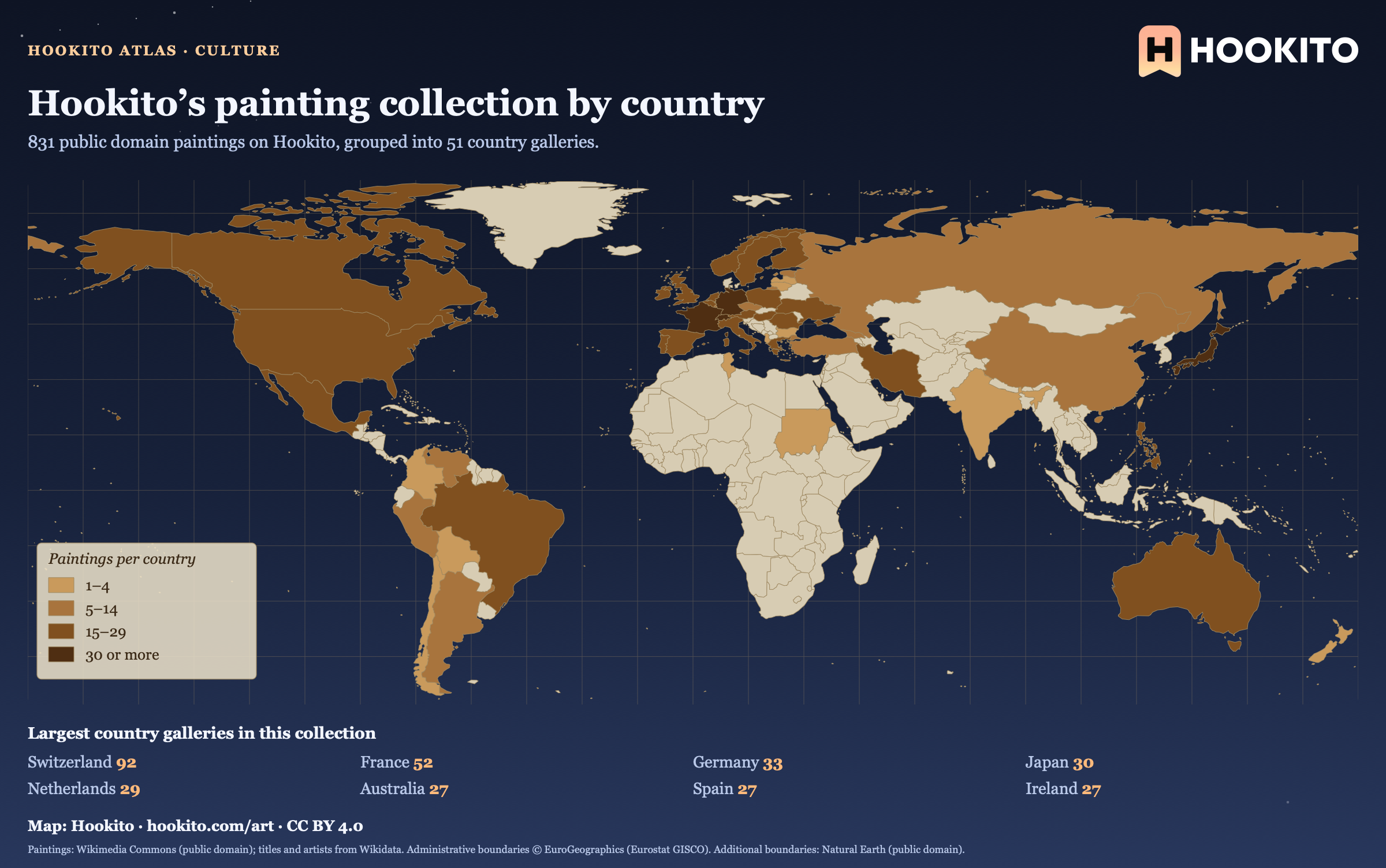
Day 6 · Vintage
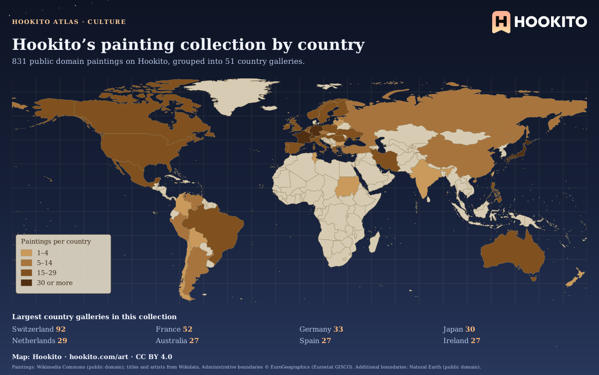
This map counts the paintings listed in Hookito’s country galleries. The country grouping comes from the artwork metadata and does not establish where a painting was created or where it is displayed today. Unshaded countries have no paintings in this collection yet.
Paintings: Wikimedia Commons (public domain); titles and artists from Wikidata. Administrative boundaries © EuroGeographics (Eurostat GISCO). Additional boundaries: Natural Earth (public domain).
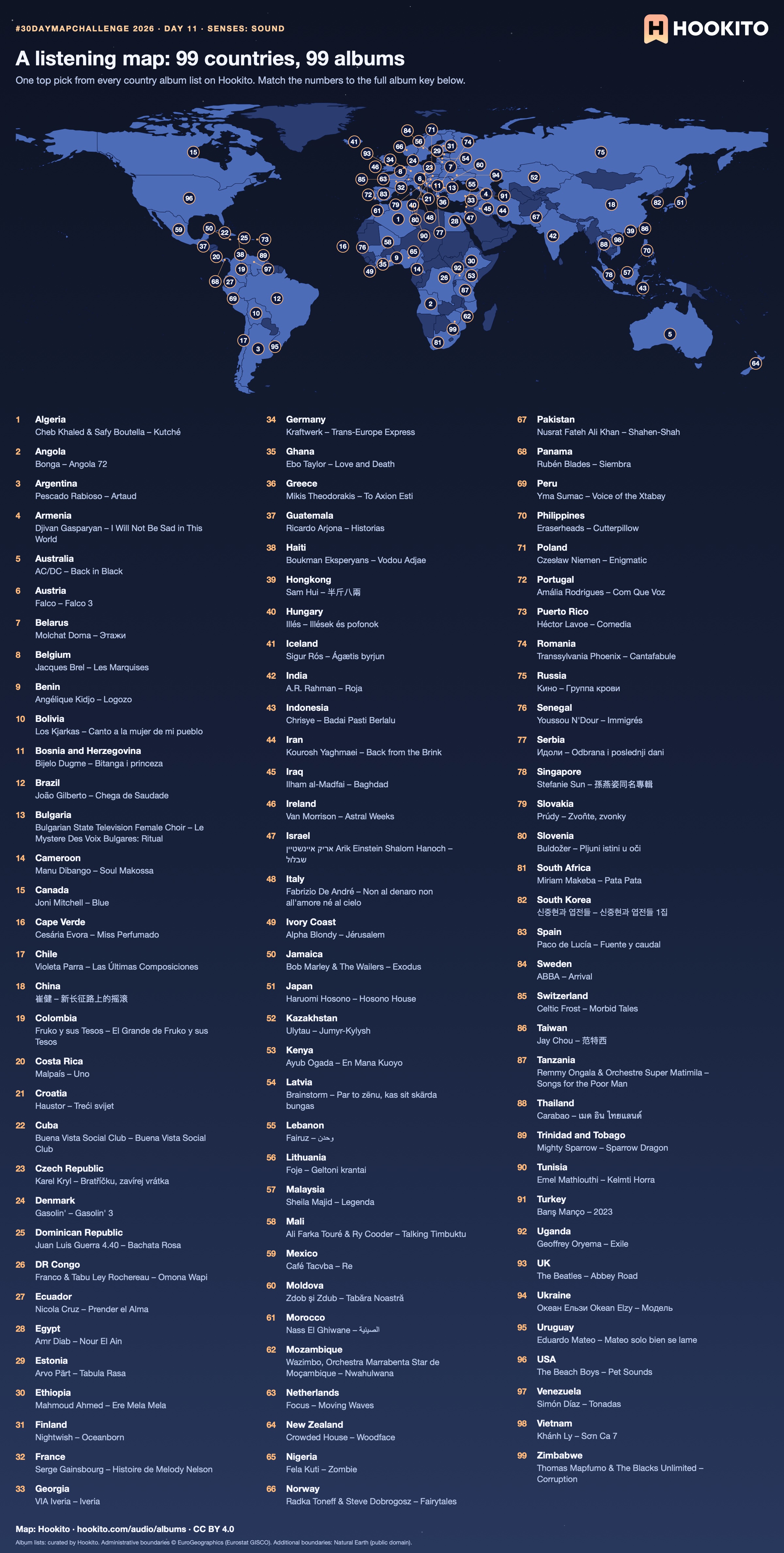
Day 11 · Senses: Sound
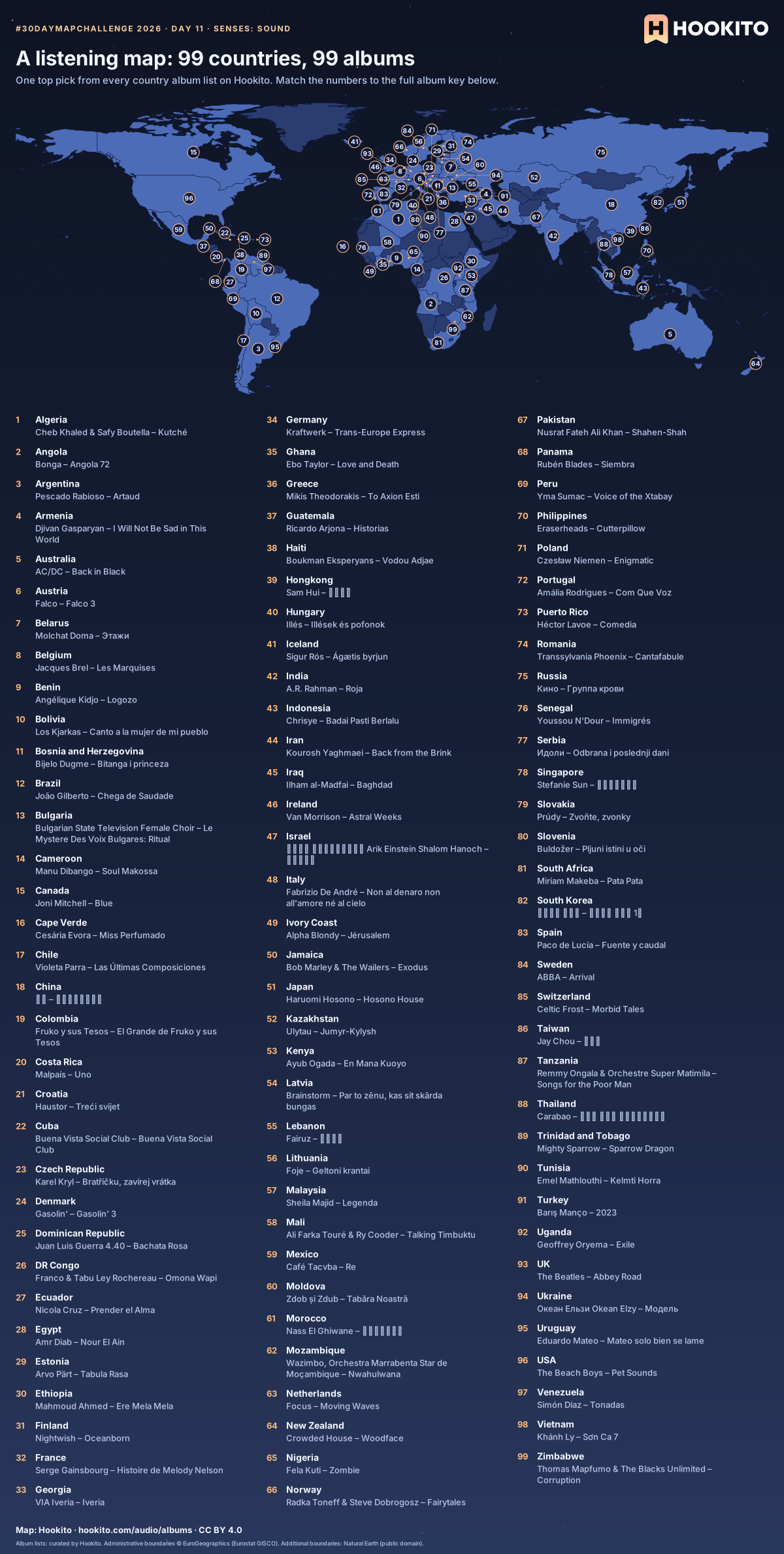
One album from each of Hookito’s 99 country album lists, with every artist and album named below the map. Numbers follow country names alphabetically; short lines connect displaced numbers to their countries where markers are crowded. Blue countries have a list; dark countries do not yet.
Album lists: curated by Hookito. Administrative boundaries © EuroGeographics (Eurostat GISCO). Additional boundaries: Natural Earth (public domain).
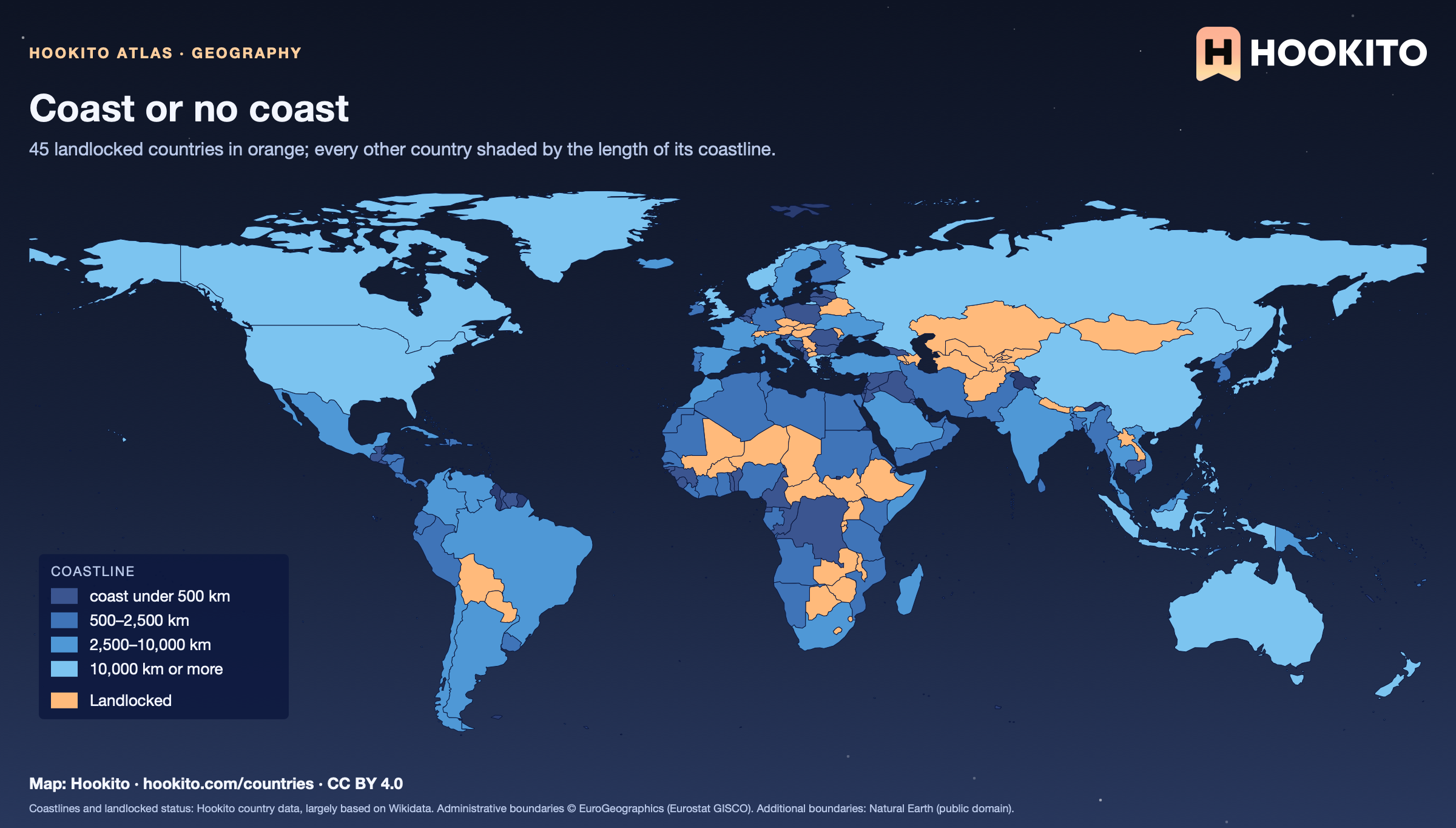
Day 26 · Water
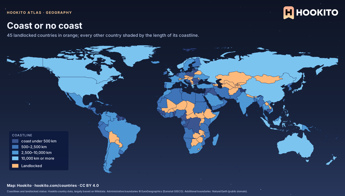
45 countries have no coast at all. Liechtenstein and Uzbekistan are surrounded only by other landlocked countries, so the sea is at least two borders away; Canada has the longest coastline, about 202,080 km.
Coastlines and landlocked status: Hookito country data, largely based on Wikidata. Administrative boundaries © EuroGeographics (Eurostat GISCO). Additional boundaries: Natural Earth (public domain).
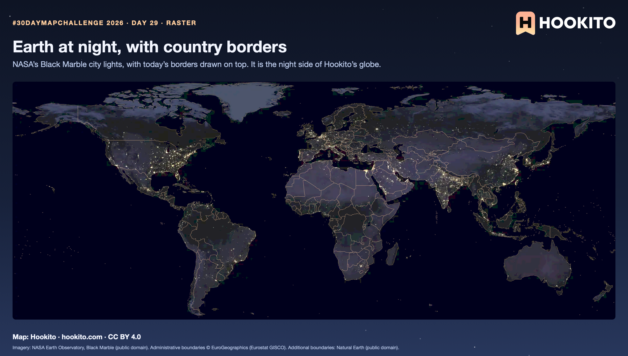
Day 29 · Raster
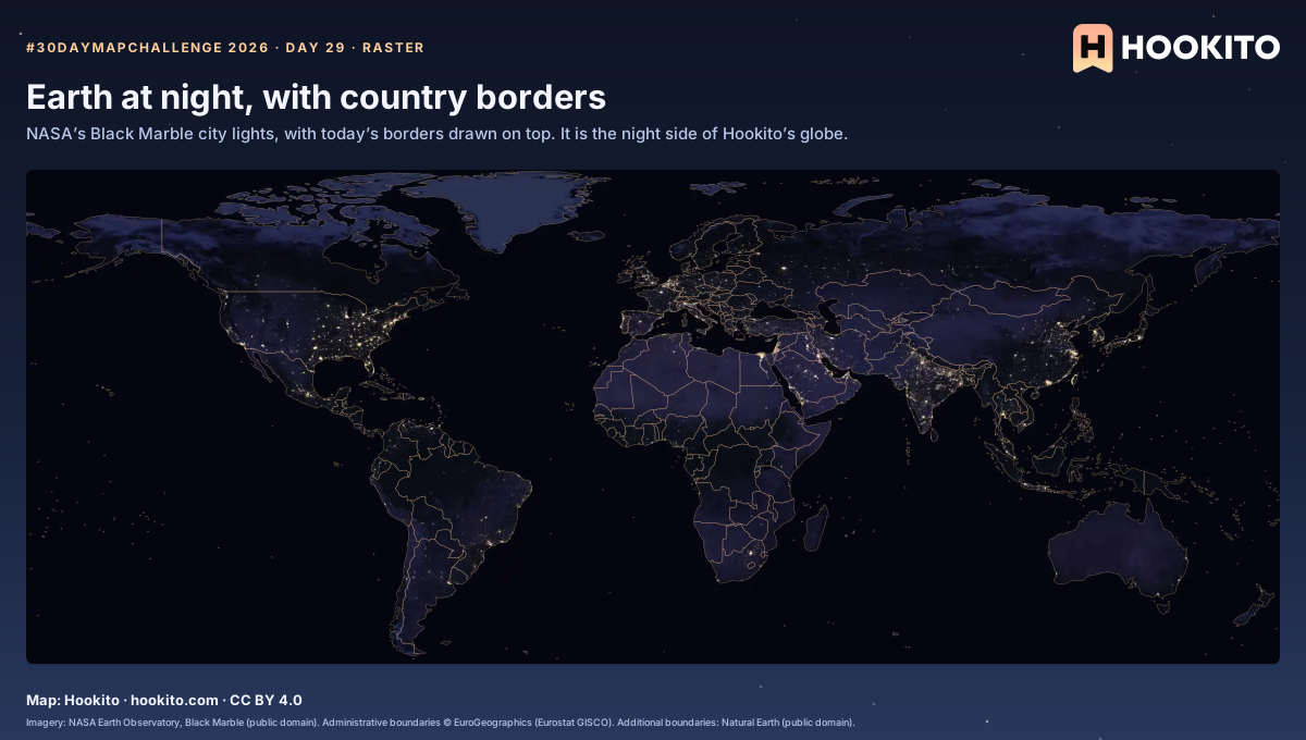
City lights follow coasts and rivers more than borders: the Nile shows as a thin line of light through the desert. The borders are the only thing on this map you can’t see from space.
Imagery: NASA Earth Observatory, Black Marble (public domain). Administrative boundaries © EuroGeographics (Eurostat GISCO). Additional boundaries: Natural Earth (public domain).
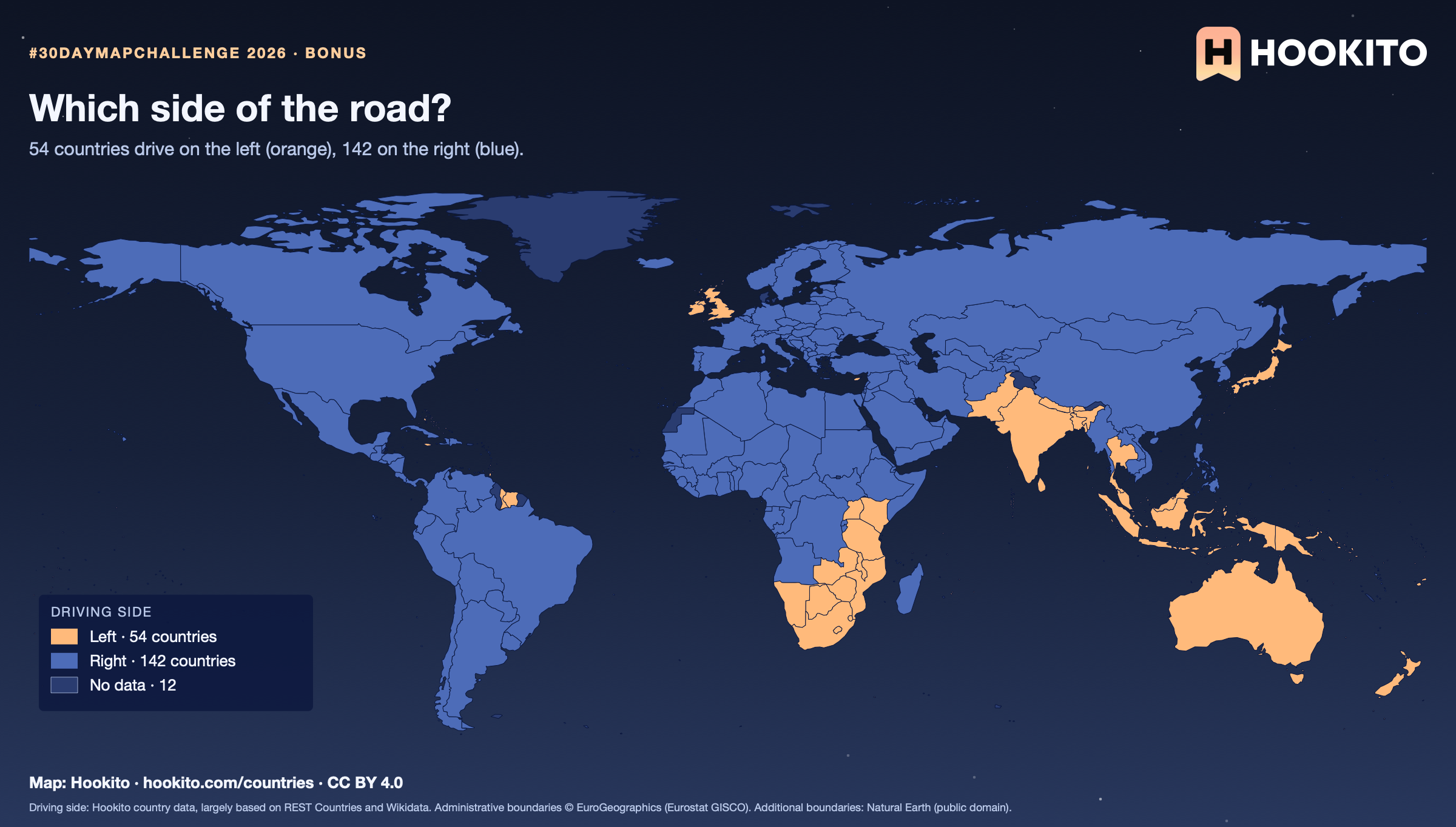
Bonus map
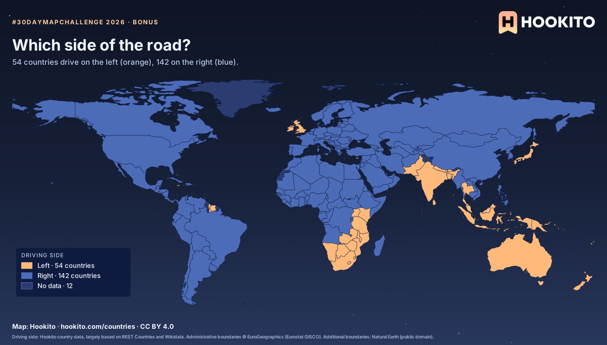
The left side survives mostly where the British Empire left its mark, plus Japan and Thailand. Where a country has no value in the data it stays grey: 12 of 208.
Driving side: Hookito country data, largely based on REST Countries and Wikidata. Administrative boundaries © EuroGeographics (Eurostat GISCO). Additional boundaries: Natural Earth (public domain).
Bonus map
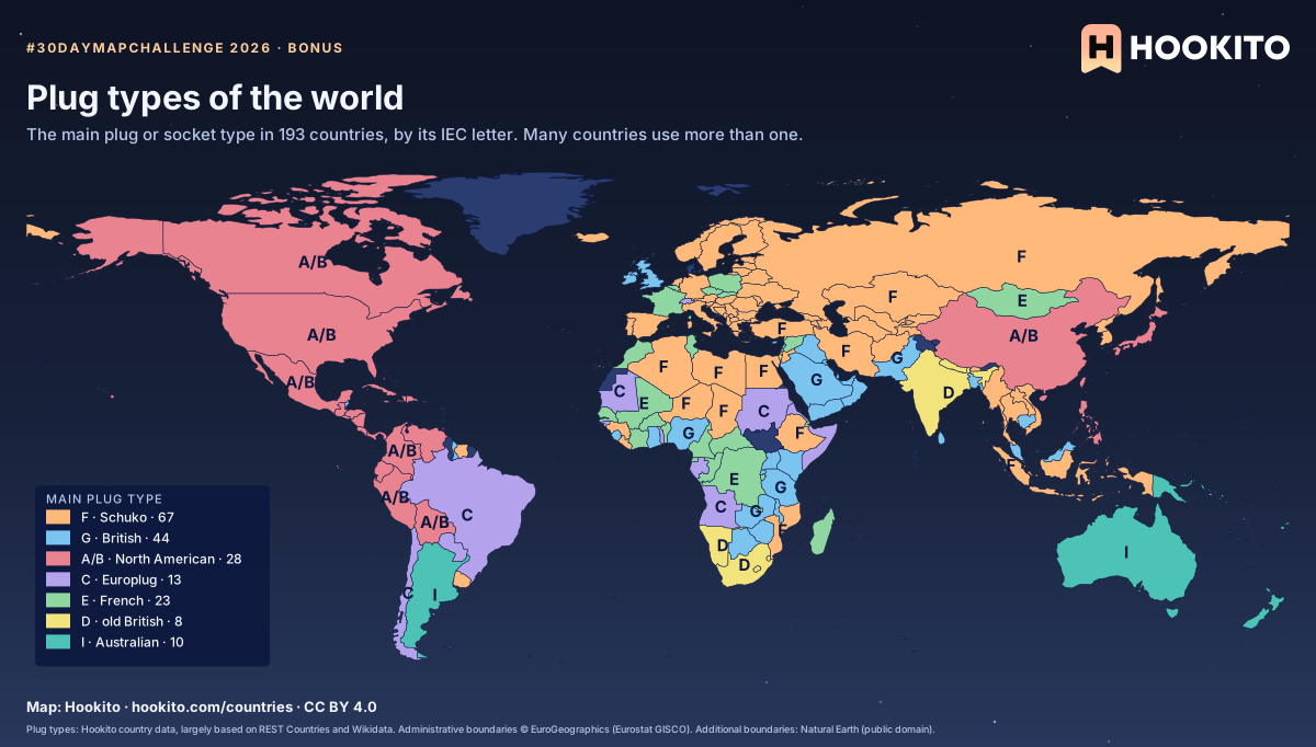
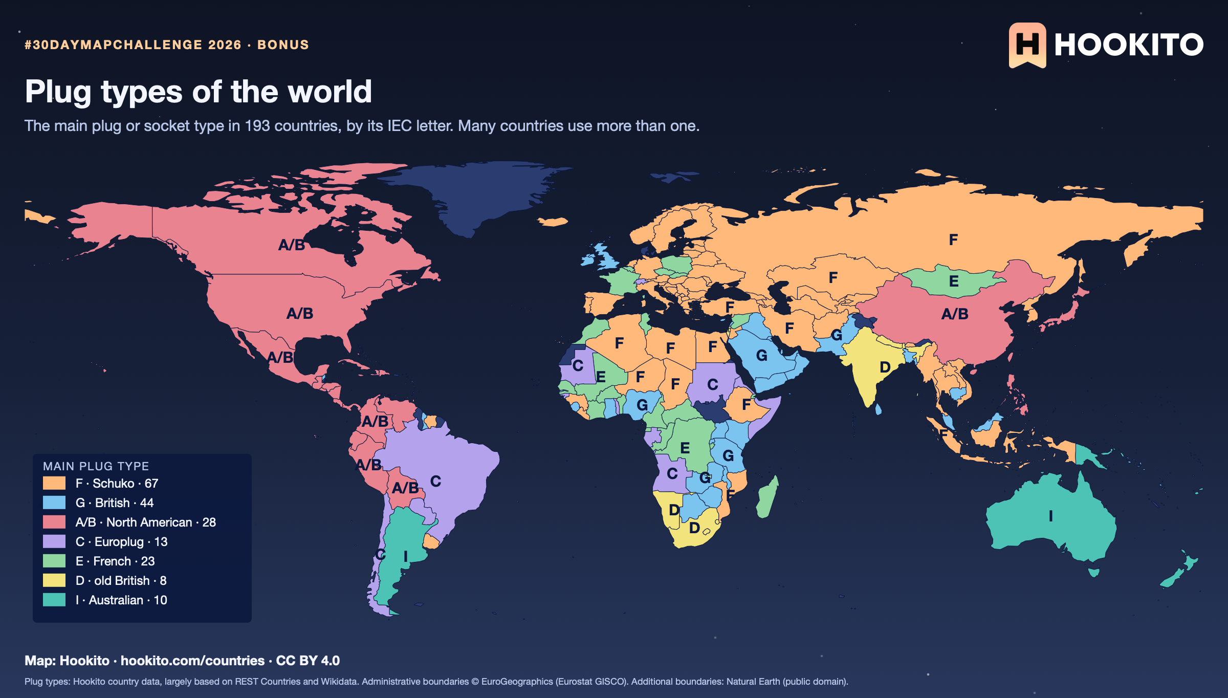
Type F leads with 67 countries. Where a country lists several types, the one most countries use is shown. The Europlug (C) only wins where nothing else is listed. Check the country page before you pack an adapter.
Plug types: Hookito country data, largely based on REST Countries and Wikidata. Administrative boundaries © EuroGeographics (Eurostat GISCO). Additional boundaries: Natural Earth (public domain).
Bonus map
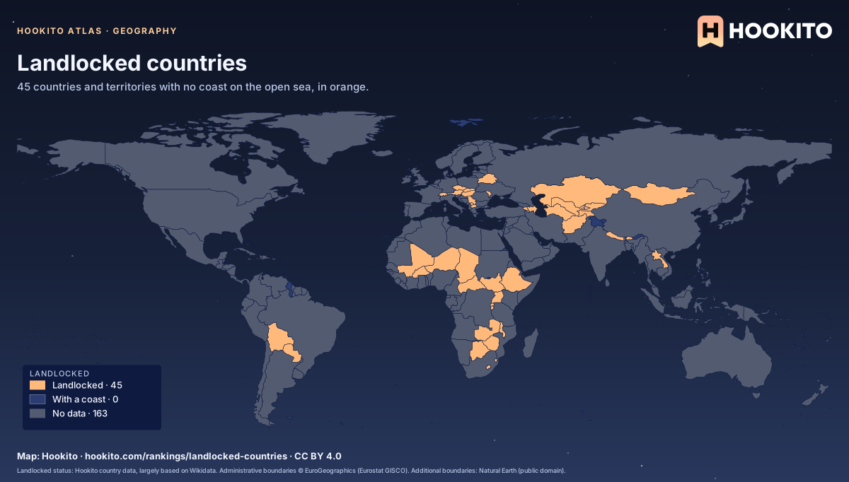
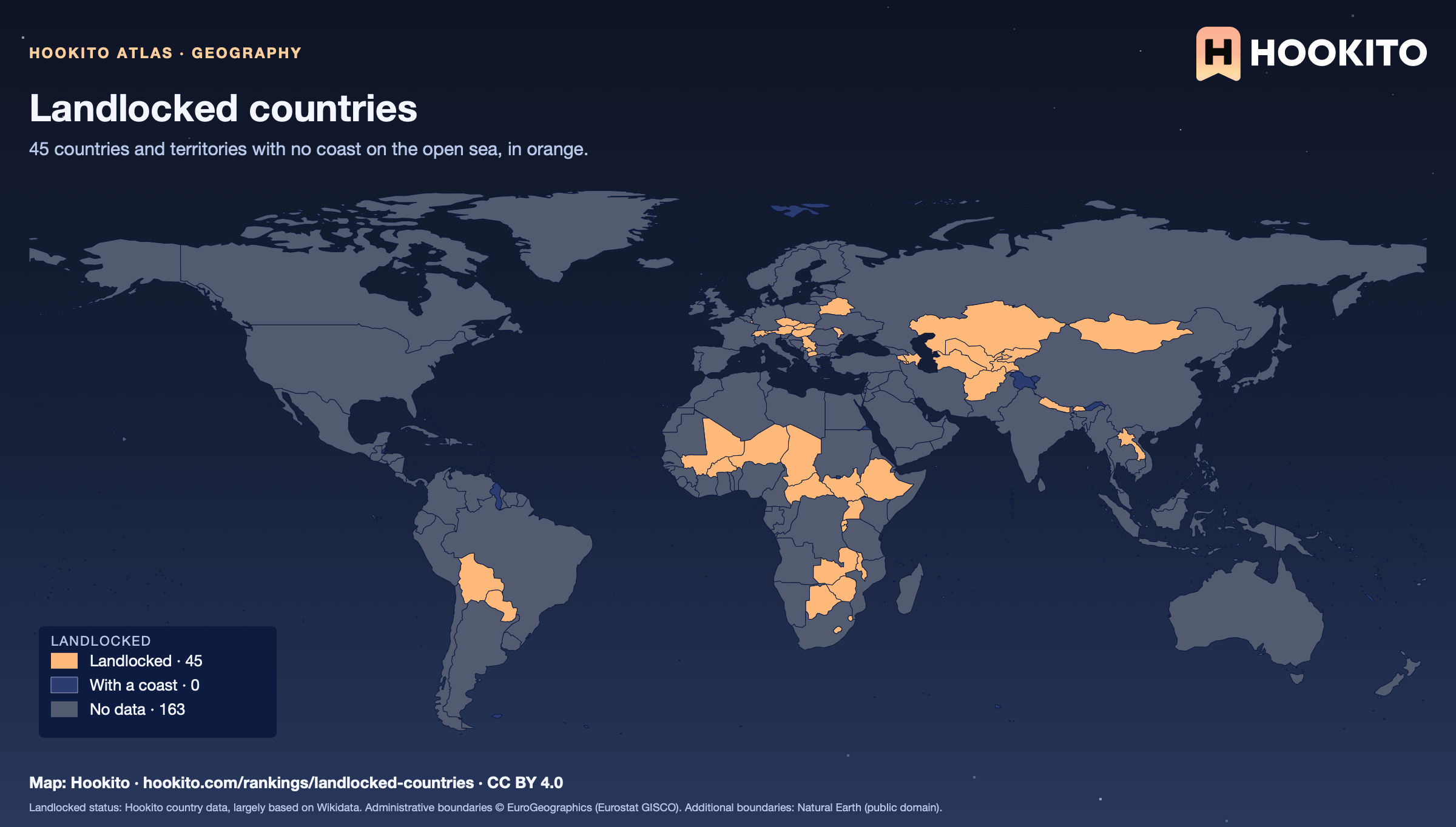
Africa and Europe have 16 each; Kazakhstan is the largest landlocked country. Liechtenstein and Uzbekistan border only other landlocked countries.
Landlocked status: Hookito country data, largely based on Wikidata. Administrative boundaries © EuroGeographics (Eurostat GISCO). Additional boundaries: Natural Earth (public domain).
Bonus map
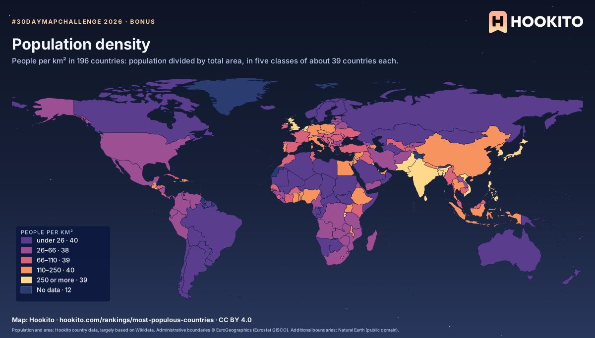
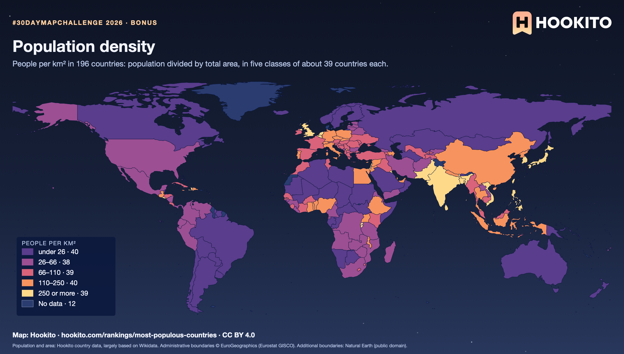
Monaco is the most densely populated (19,212 people per km²) and Mongolia the least (2.2). Of the larger countries, Bangladesh leads with 1,162. The figure spreads people over the whole area, deserts and ice included. 12 countries without a population or area figure stay grey.
Population and area: Hookito country data, largely based on Wikidata. Administrative boundaries © EuroGeographics (Eurostat GISCO). Additional boundaries: Natural Earth (public domain).
Bonus map
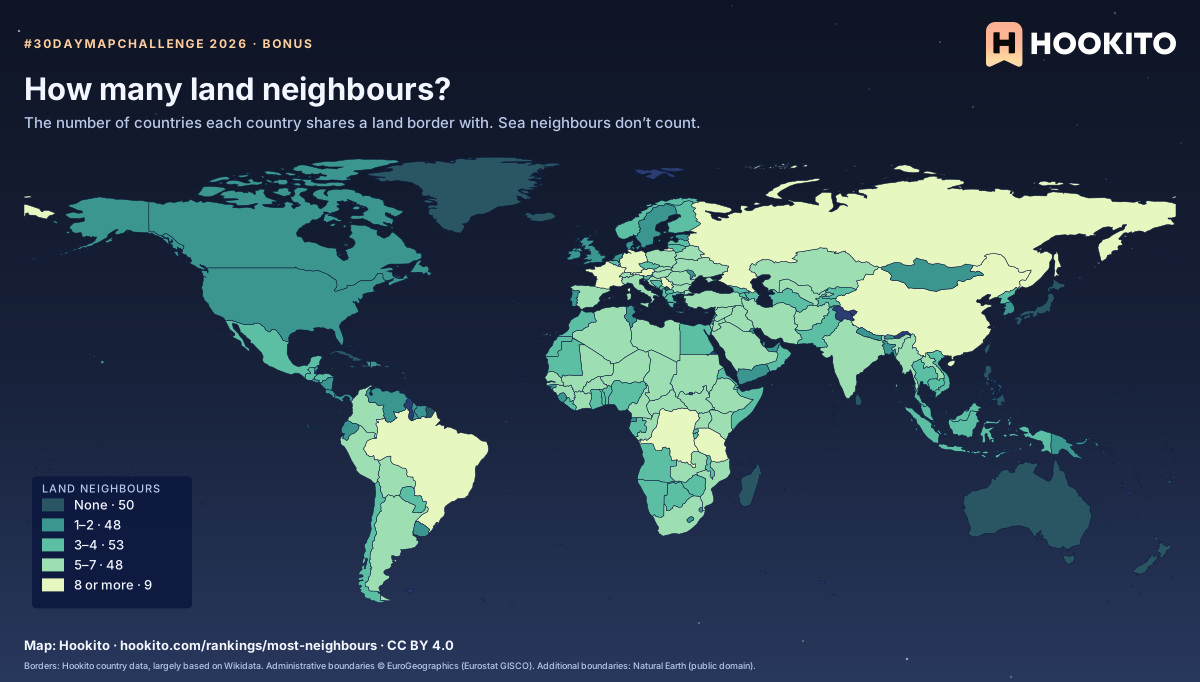
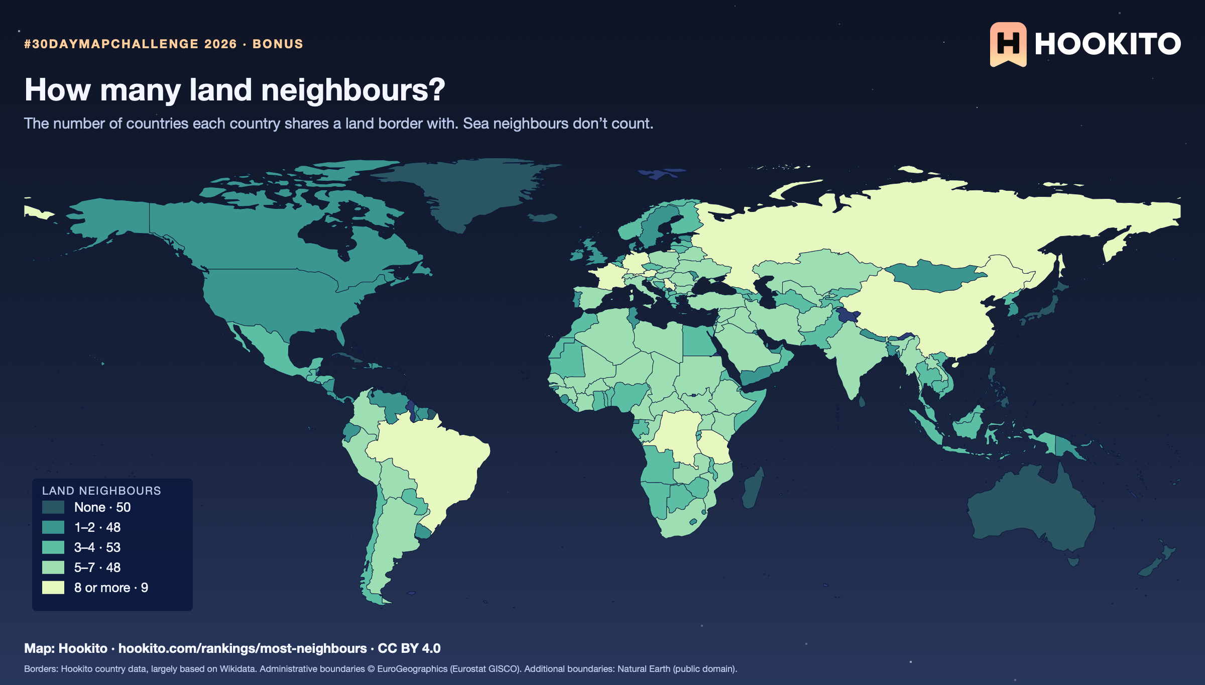
Russia has the most land neighbours (14), then China (13); Brazil, DR Congo and Germany have 9 each. 50 countries, most of them islands, have none. A border counts where the country data lists it and the GISCO map shows the two touching.
Borders: Hookito country data, largely based on Wikidata. Administrative boundaries © EuroGeographics (Eurostat GISCO). Additional boundaries: Natural Earth (public domain).
You’re welcome to share, print or adapt these maps. The renderings are licensed CC BY 4.0: credit them as “Map: Hookito, hookito.com”, with a link to this page where you can.
The underlying data keeps its own terms, so keep its credits too. Administrative boundaries © EuroGeographics (Eurostat GISCO), which also applies to most country outlines. Additional boundaries are from Natural Earth (public domain). Each map lists its other sources: Wikidata and GeoNames for country facts, Wikimedia Commons for the paintings, NASA Earth Observatory for the night imagery. The maps are offered as finished images only; the boundary data itself isn’t available for download here.