Hookito

The Hookito atlas

Language maps: words, languages and literacy

All world maps →

See everyday words across Europe’s languages, the languages listed in Hookito’s country data, and literacy and schooling estimates from Our World in Data.

About these maps

The collection brings together data Hookito already uses: the capitals and facts behind the country pages, the outlines from the countries list, the paintings in Art, the album lists in Audio and the night side of the globe. The boundaries combine Eurostat GISCO and Natural Earth data. The world maps use a plain equirectangular projection, cropped at 84° north and 58° south; the continent and Europe maps are zoomed from more detailed boundaries.

Spotted a mistake? Write to submissions@hookito.com.

6 maps

Languages & literacy

Languages in our country data, words across Europe, literacy and years of schooling.

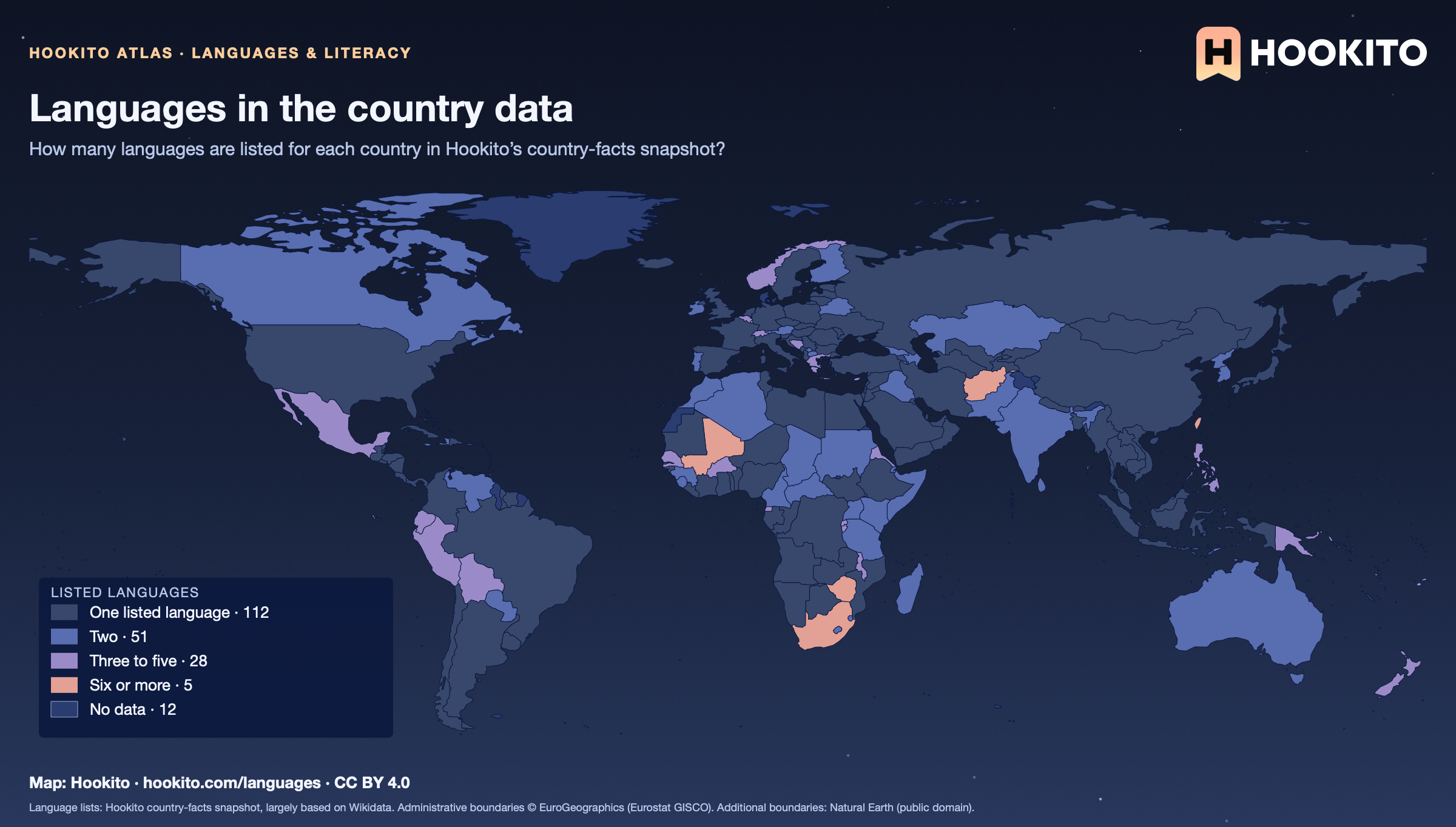
Languages in the country data
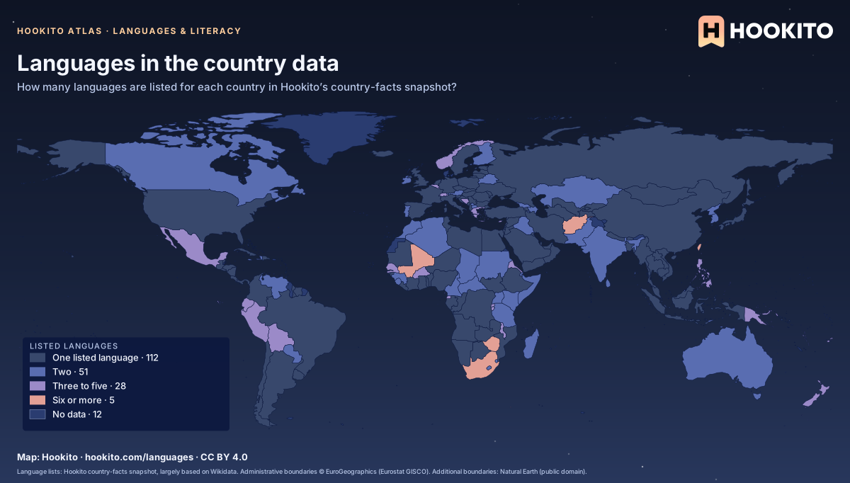
Languages in the country data: world map coloured by listed languages, with 196 countries classified and 12 without data.

This counts the language names listed in the country facts. It is not a count of every language spoken in each country, or a measure of language diversity. Open a country’s spoken-languages section to see its list.

Embed this map

Language lists: Hookito country-facts snapshot, largely based on Wikidata. Administrative boundaries © EuroGeographics (Eurostat GISCO). Additional boundaries: Natural Earth (public domain).
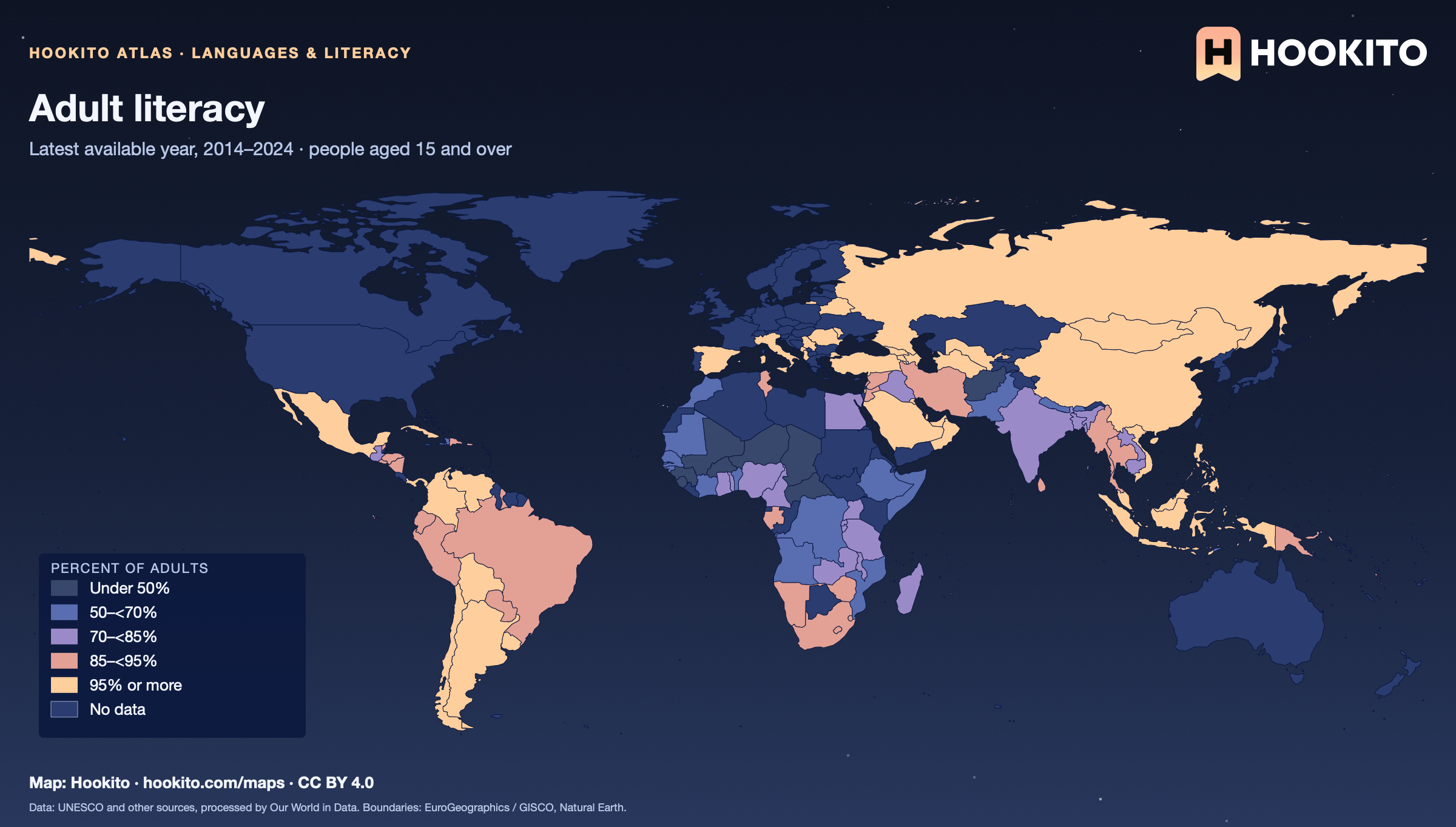
Adult literacy

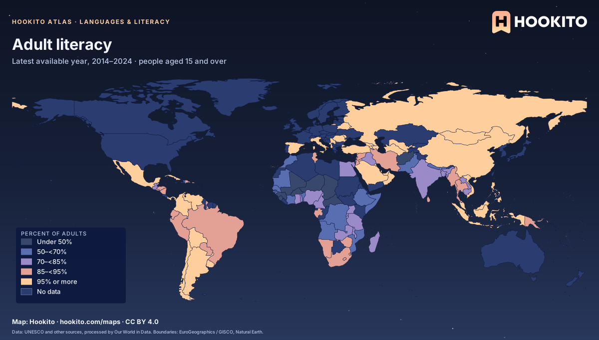
Adult literacy, world map with five colour bands and missing data.

Latest available estimate from 2014–2024; definitions and survey methods vary. Countries without a recent estimate are uncoloured, including many high-income countries that no longer measure it. Grey-blue indicates no data. Source details and reuse terms: https://ourworldindata.org/grapher/cross-country-literacy-rates.

Embed this map

Data: UNESCO (1957) and other sources, via Our World in Data (https://ourworldindata.org/grapher/cross-country-literacy-rates). Administrative boundaries © EuroGeographics (Eurostat GISCO). Additional boundaries: Natural Earth (public domain). Source data and citation ↗
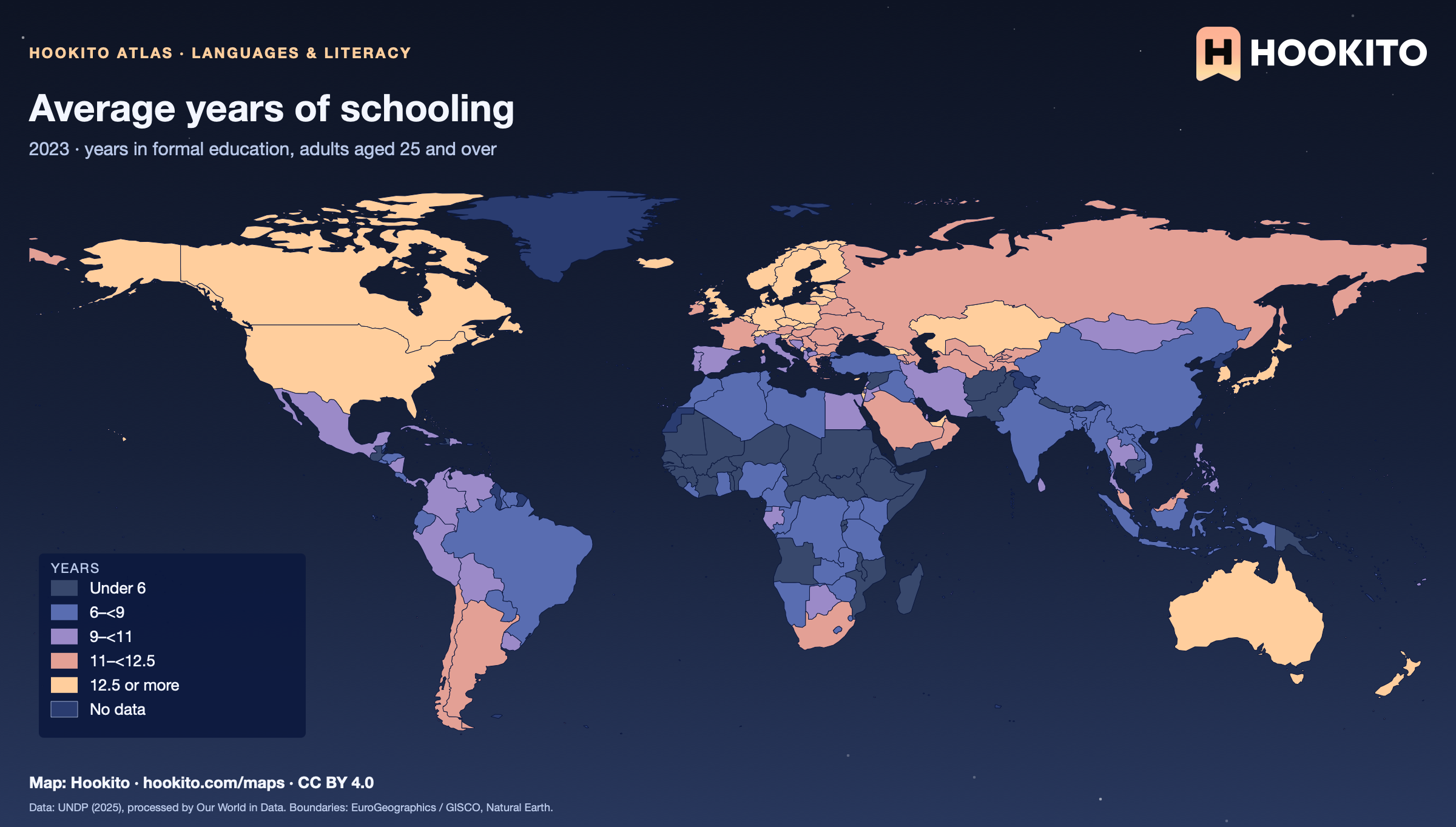
Average years of schooling

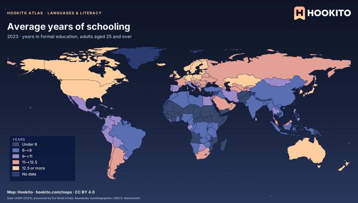
Average years of schooling, world map with five colour bands and missing data.

The average number of years adults aged 25 and older have spent in formal education. It counts time in school, not what was learned. Grey-blue indicates no data. Source details and reuse terms: https://ourworldindata.org/grapher/average-years-of-schooling.

Embed this map

Data: UNDP, Human Development Report (2025), via Our World in Data (https://ourworldindata.org/grapher/average-years-of-schooling). Administrative boundaries © EuroGeographics (Eurostat GISCO). Additional boundaries: Natural Earth (public domain). Source data and citation ↗
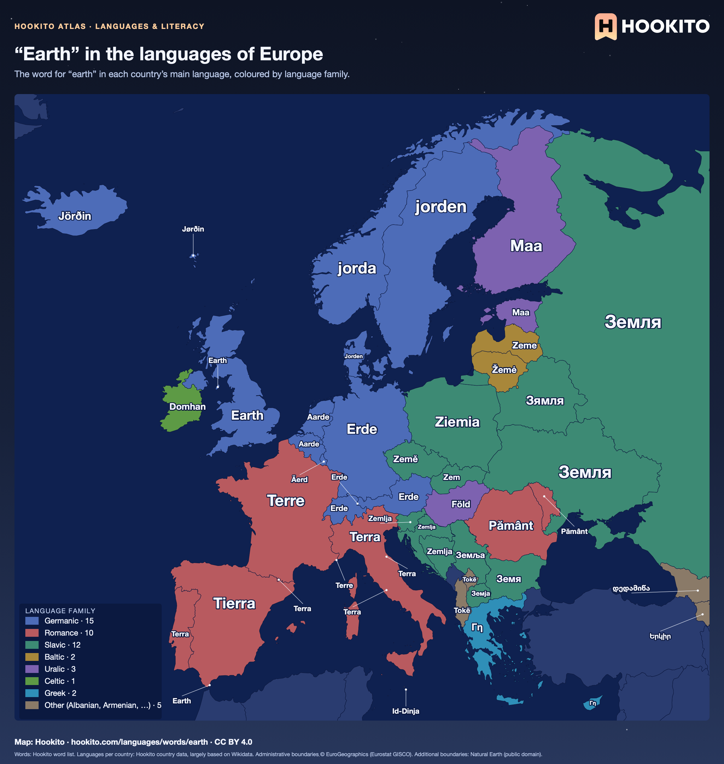
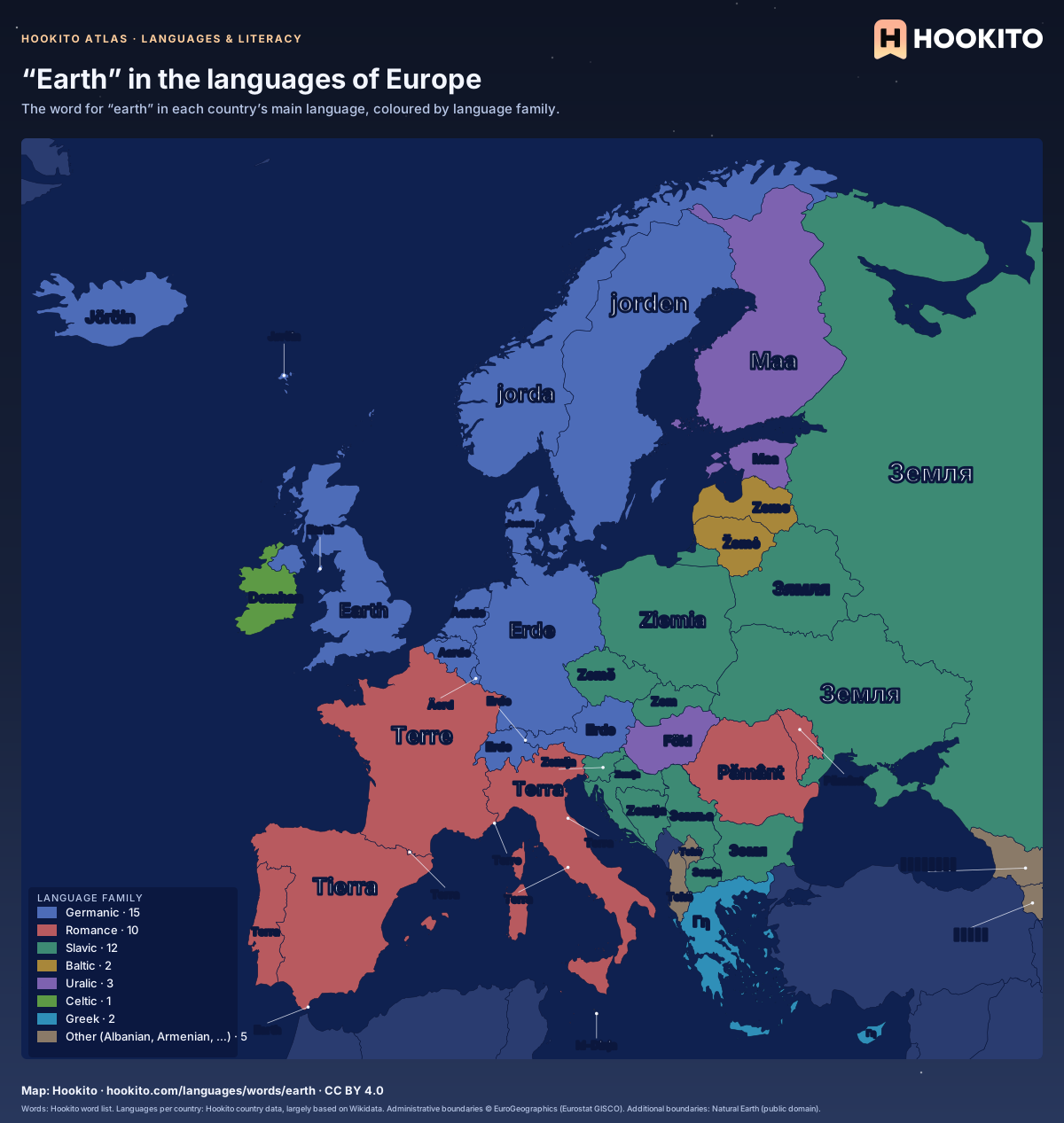
“Earth” in the languages of Europe

Map of Europe with the word for “earth” written across each country in its main language, such as Erde (German), Terre (French), Земля (Russian), Γη (Greek).

Each country shows its main language, the majority or national one where several are official (German for Switzerland, Dutch for Belgium, Nynorsk for Norway, and Croatian for Bosnia and Herzegovina, as Bosnian is not in the list). Montenegro stays blank: Hookito’s word list has no entry in its language.

Embed this map

Words: Hookito word list. Languages per country: Hookito country data, largely based on Wikidata. Administrative boundaries © EuroGeographics (Eurostat GISCO). Additional boundaries: Natural Earth (public domain).
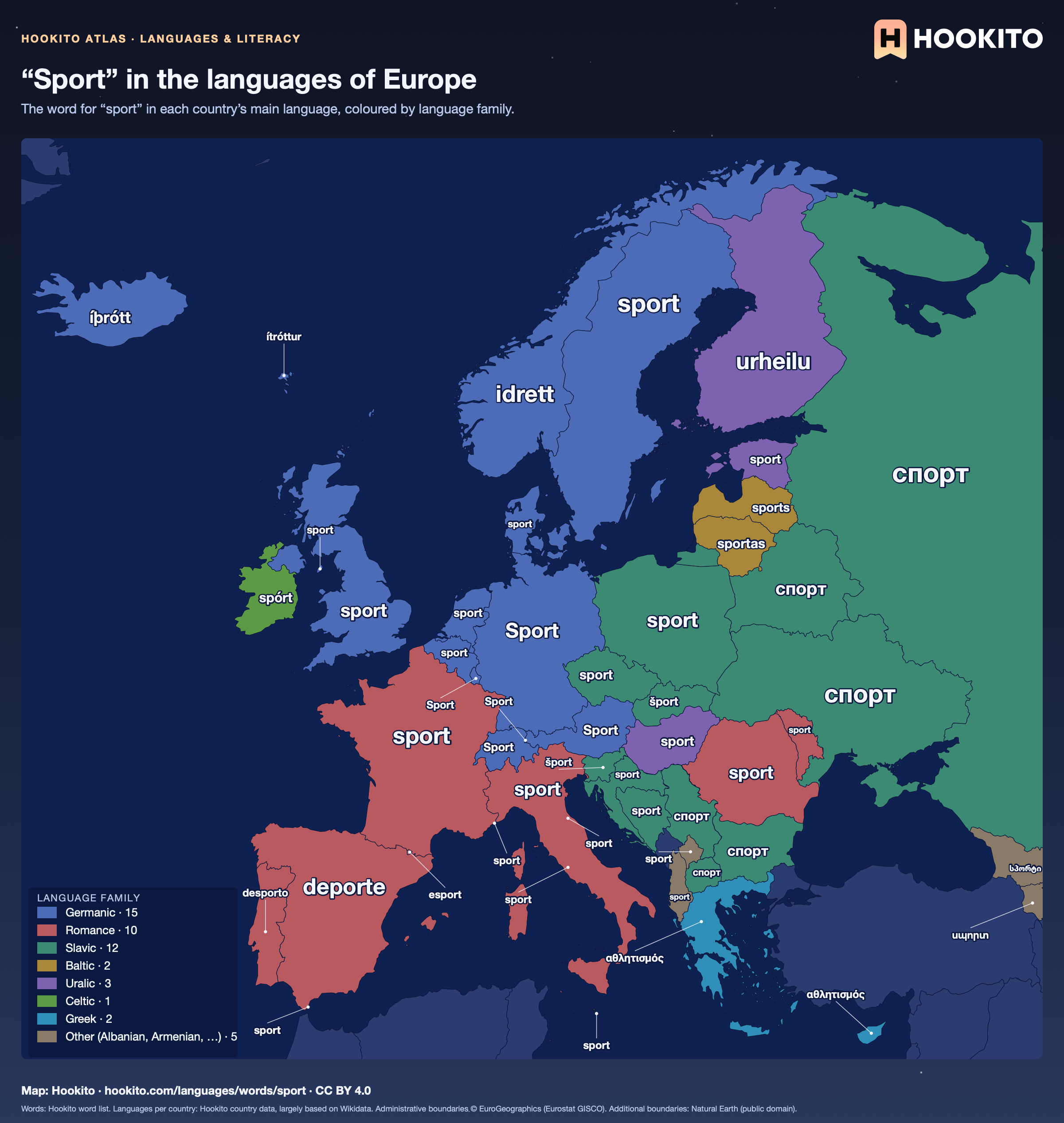
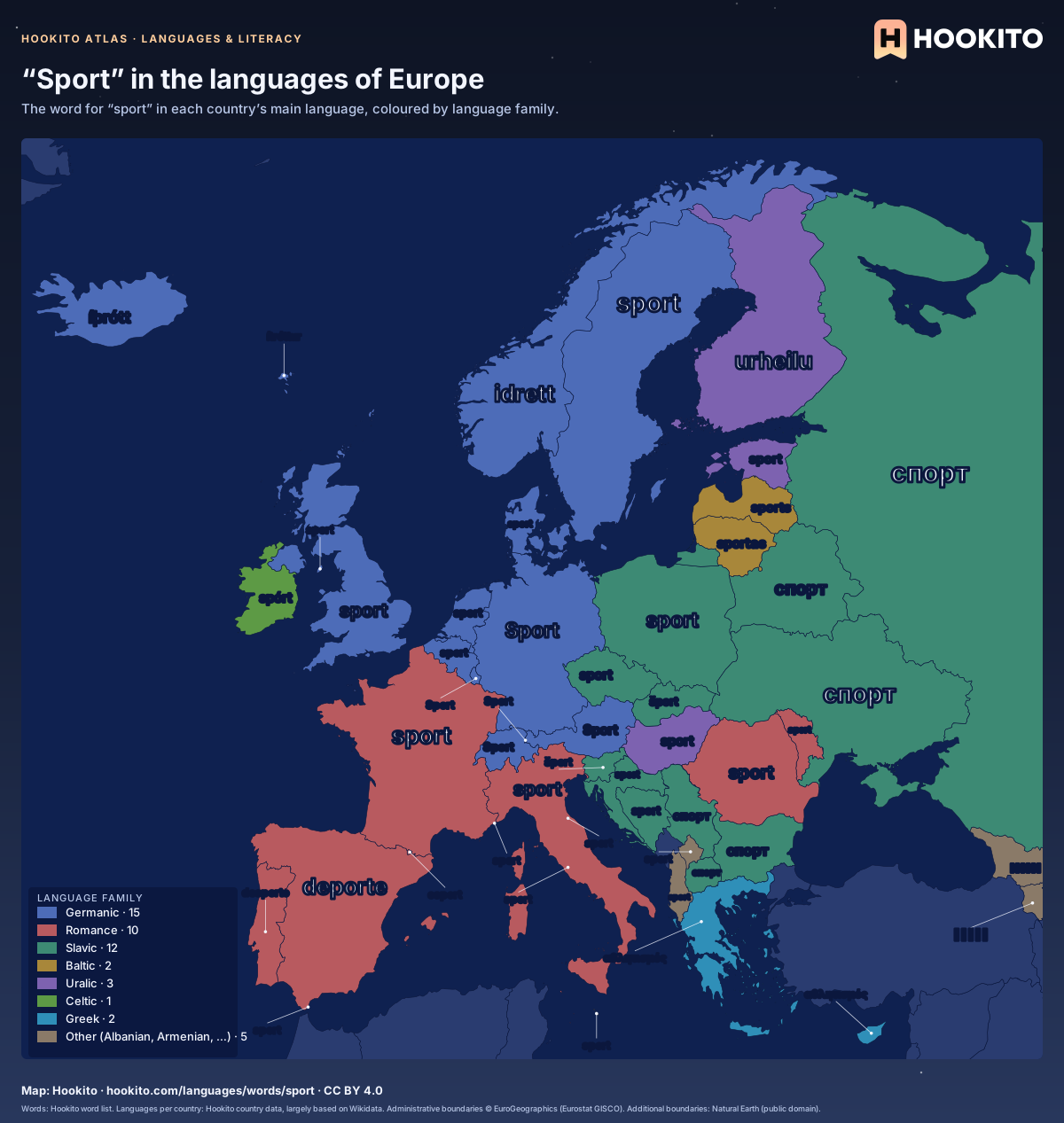
“Sport” in the languages of Europe

Map of Europe with the word for “sport” written across each country in its main language, such as Sport (German), sport (French), спорт (Russian), αθλητισμός (Greek).

Each country shows its main language, the majority or national one where several are official (German for Switzerland, Dutch for Belgium, Nynorsk for Norway, and Croatian for Bosnia and Herzegovina, as Bosnian is not in the list). Montenegro stays blank: Hookito’s word list has no entry in its language.

Embed this map

Words: Hookito word list. Languages per country: Hookito country data, largely based on Wikidata. Administrative boundaries © EuroGeographics (Eurostat GISCO). Additional boundaries: Natural Earth (public domain).

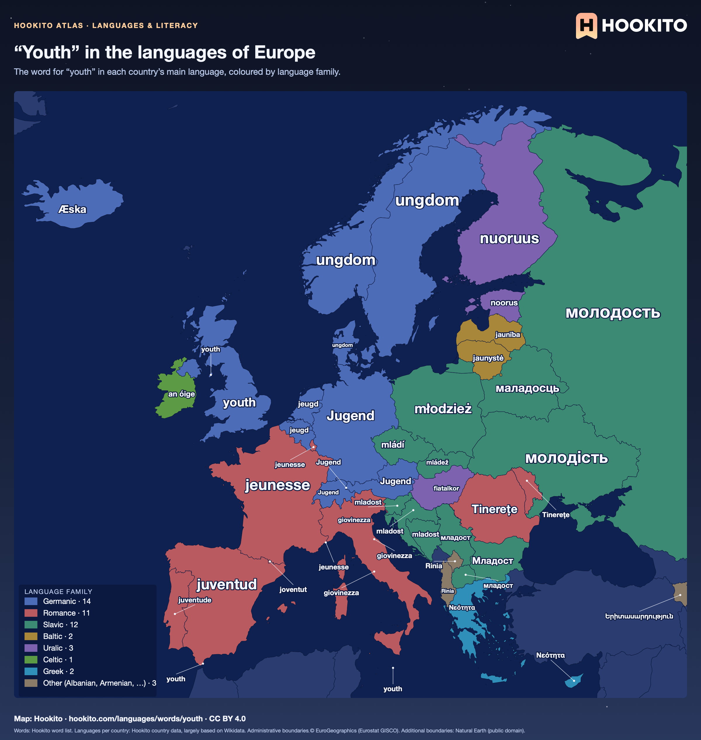
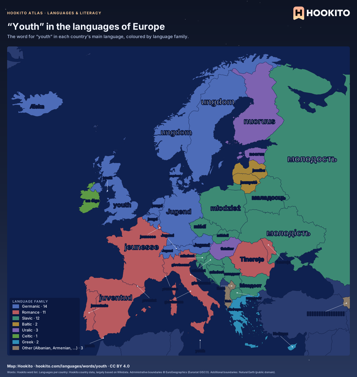
“Youth” in the languages of Europe

Map of Europe with the word for “youth” written across each country in its main language, such as Jugend (German), jeunesse (French), молодёжь (Russian), Νεότητα (Greek).

Each country shows its main language, the majority or national one where several are official (German for Switzerland, Dutch for Belgium, Nynorsk for Norway, and Croatian for Bosnia and Herzegovina, as Bosnian is not in the list). Where that language has no suitable entry, the next listed one is used (English for Ireland and Malta, French for Luxembourg). Faroe Islands, Georgia and Montenegro stay blank: Hookito’s word list has no entry in their languages.

Embed this map

Words: Hookito word list. Languages per country: Hookito country data, largely based on Wikidata. Administrative boundaries © EuroGeographics (Eurostat GISCO). Additional boundaries: Natural Earth (public domain).
Reusing the maps

You’re welcome to share, print or adapt these maps. The renderings are licensed CC BY 4.0: credit them as “Map: Hookito, hookito.com”, with a link to this page where you can.

The underlying data keeps its own terms, so keep its credits too. Administrative boundaries © EuroGeographics (Eurostat GISCO), which also applies to most country outlines. Additional boundaries are from Natural Earth (public domain). Each map lists its other sources: Wikidata and GeoNames for country facts, Our World in Data for the statistics, Unicode CLDR and the IANA time zone database for the calendar and clock maps, flag-icons (MIT) for the flags, Wikimedia Commons for the paintings, NASA Earth Observatory for the night imagery. The maps are offered as finished images only; the boundary data itself isn’t available for download here.
Where to next?

Back to the globe
Hookito landscape illustration