Hookito

The Hookito atlas

Printable map quizzes: blank and labelled maps

All world maps →

Numbered blank maps of every continent with answer keys, labelled maps with country names, European capitals and a blank world map. Free to print for class, revision or a quiz night.

About these maps

The collection brings together data Hookito already uses: the capitals and facts behind the country pages, the outlines from the countries list, the paintings in Art, the album lists in Audio and the night side of the globe. The boundaries combine Eurostat GISCO and Natural Earth data. The world maps use a plain equirectangular projection, cropped at 84° north and 58° south; the continent and Europe maps are zoomed from more detailed boundaries.

Spotted a mistake? Write to submissions@hookito.com.

14 maps

Printable quiz maps

Numbered blank maps with answer keys, labelled maps and a blank world map, free to print for class or practice.

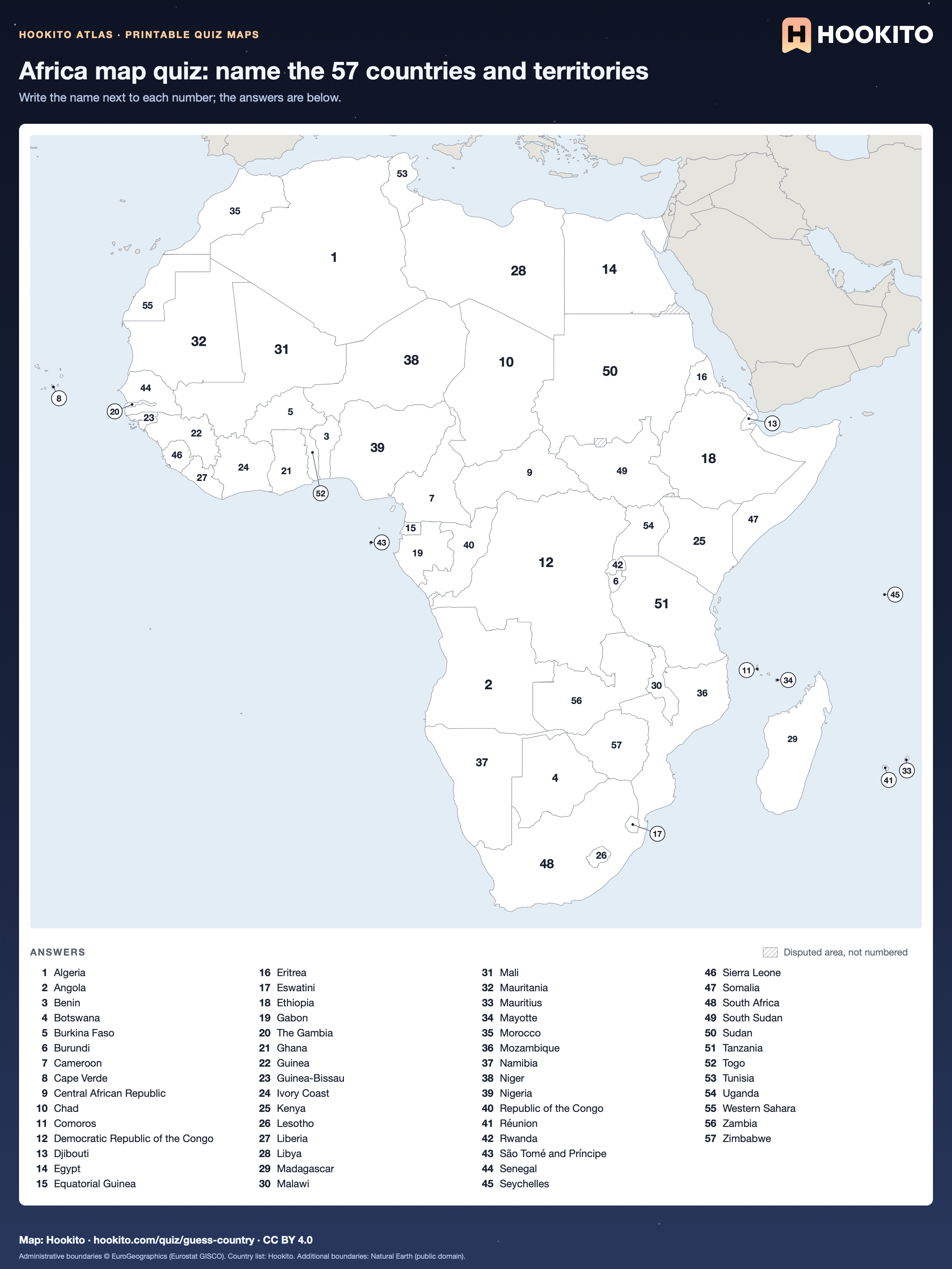
Africa map quiz: name the 57 countries and territories
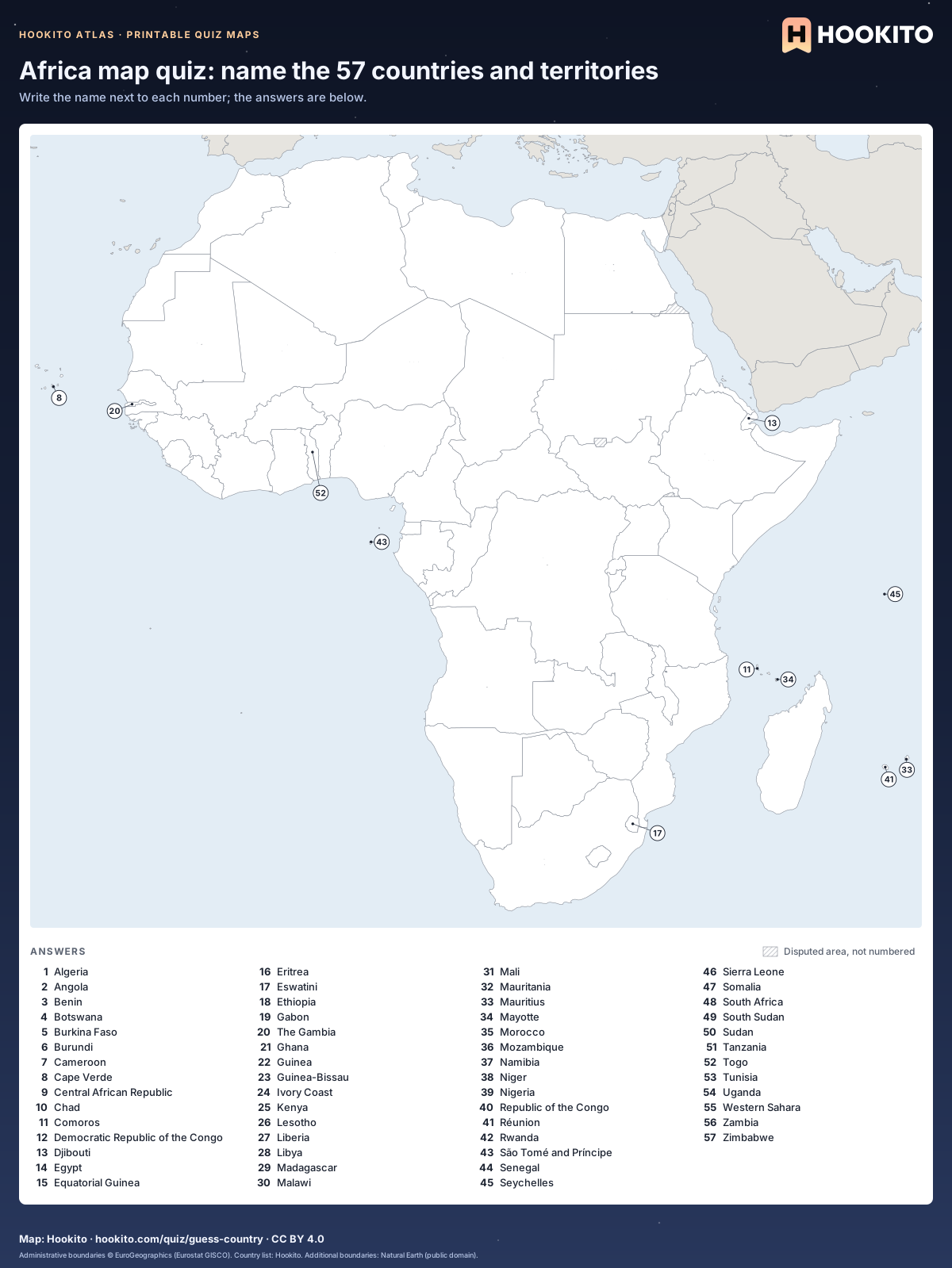
Printable blank map of Africa with 57 numbered countries and territories and an alphabetical answer key below the map.

Free to print for classrooms and practice under CC BY 4.0. Numbers follow the 57 countries and territories in Hookito’s Africa list alphabetically; small ones have a numbered circle on a leader line, and grey land belongs to other continents; hatched areas are disputed.

Embed this map

Administrative boundaries © EuroGeographics (Eurostat GISCO). Country list: Hookito. Additional boundaries: Natural Earth (public domain).
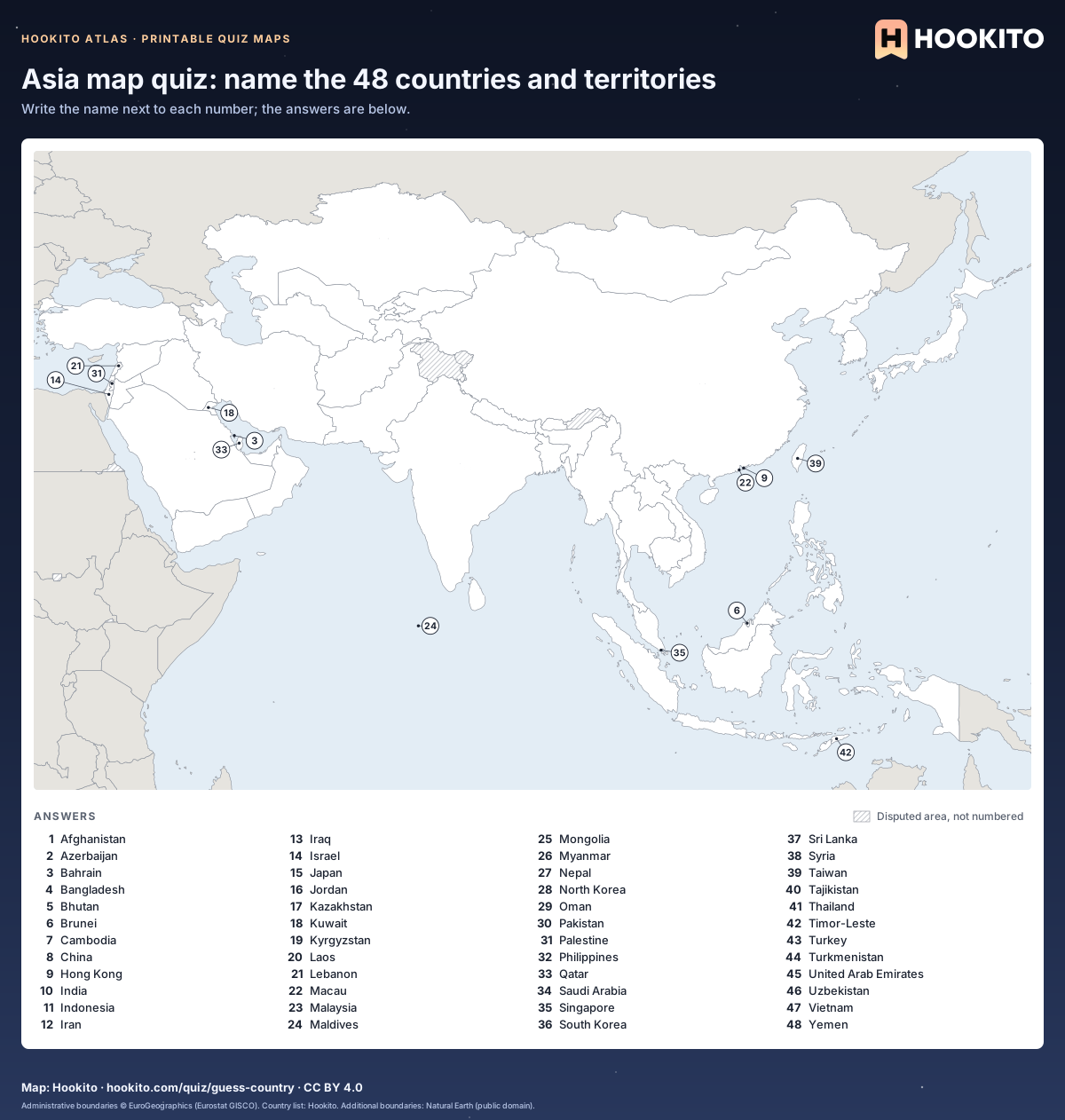
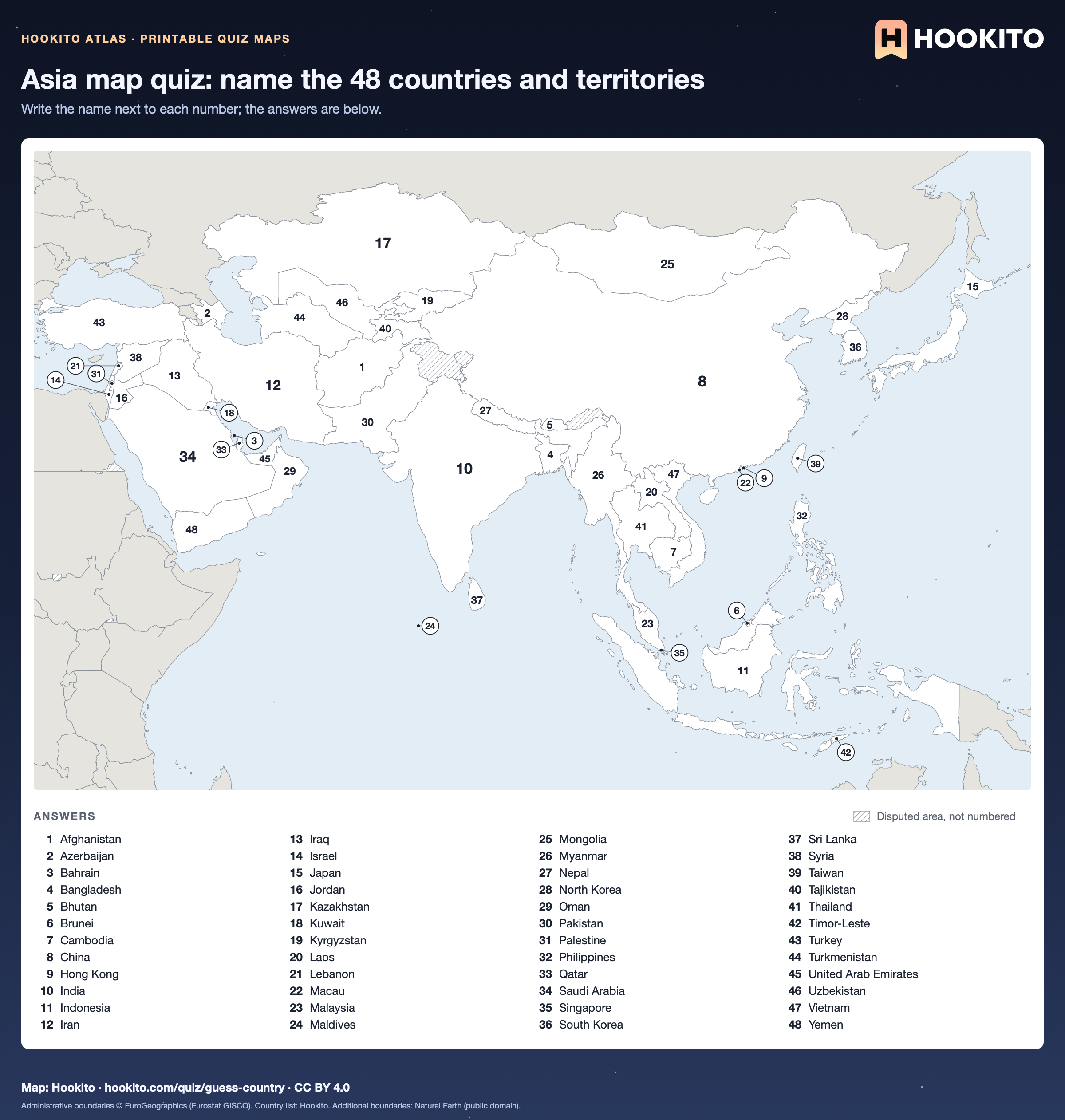
Asia map quiz: name the 48 countries and territories

Printable blank map of Asia with 48 numbered countries and territories and an alphabetical answer key below the map.

Free to print for classrooms and practice under CC BY 4.0. Numbers follow the 48 countries and territories in Hookito’s Asia list alphabetically; small ones have a numbered circle on a leader line, and grey land belongs to other continents; hatched areas are disputed.

Embed this map

Administrative boundaries © EuroGeographics (Eurostat GISCO). Country list: Hookito. Additional boundaries: Natural Earth (public domain).
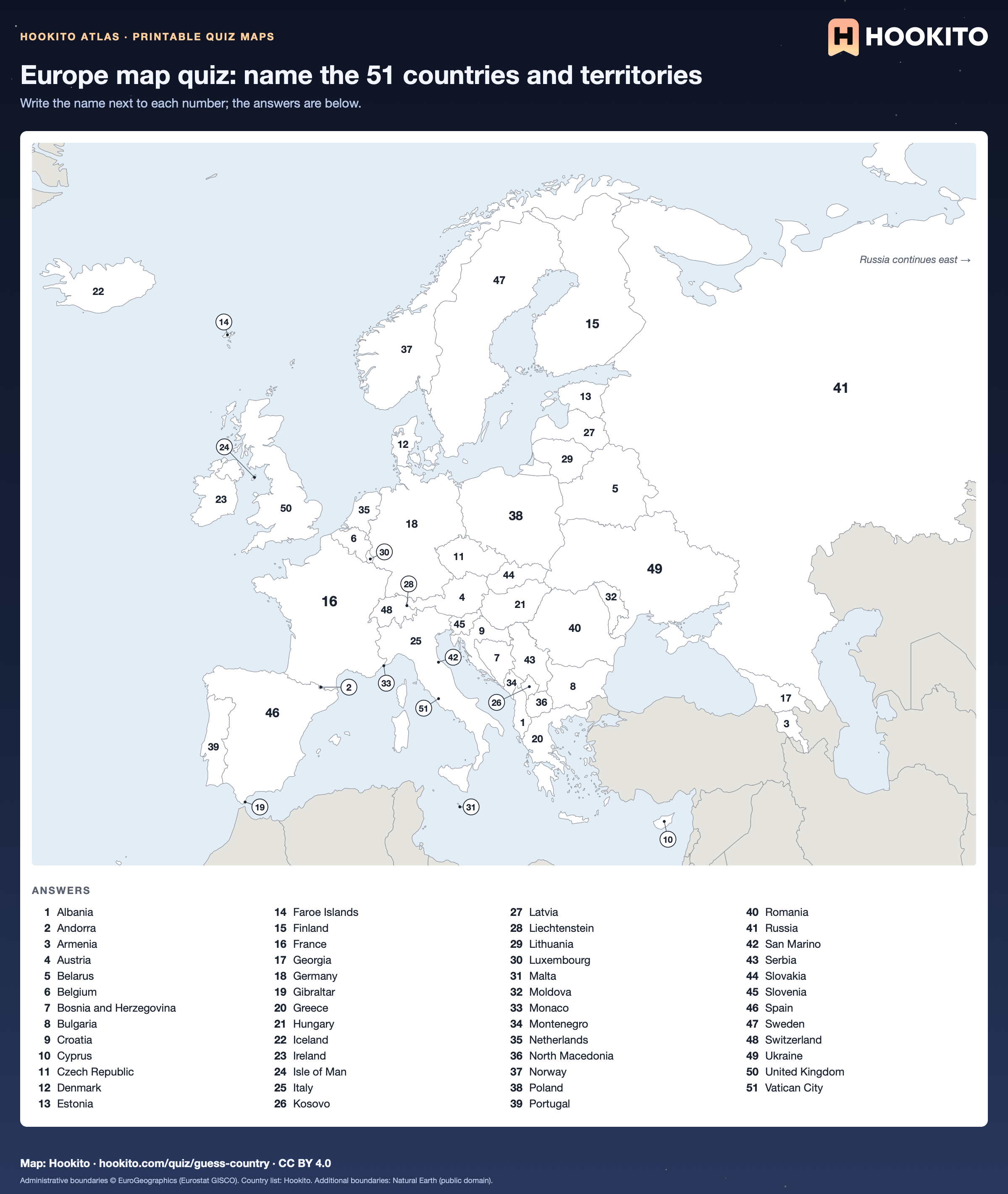
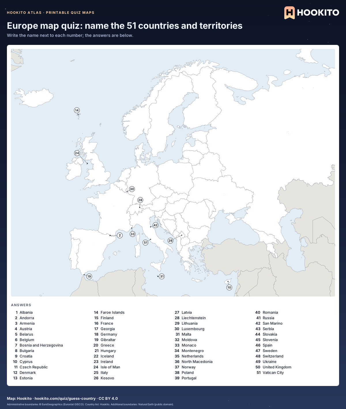
Europe map quiz: name the 51 countries and territories

Printable blank map of Europe with 51 numbered countries and territories and an alphabetical answer key below the map.

Free to print for classrooms and practice under CC BY 4.0. Numbers follow the 51 countries and territories in Hookito’s Europe list alphabetically; small ones have a numbered circle on a leader line, and grey land belongs to other continents. Russia is cut off at 62° E.

Embed this map

Administrative boundaries © EuroGeographics (Eurostat GISCO). Country list: Hookito. Additional boundaries: Natural Earth (public domain).
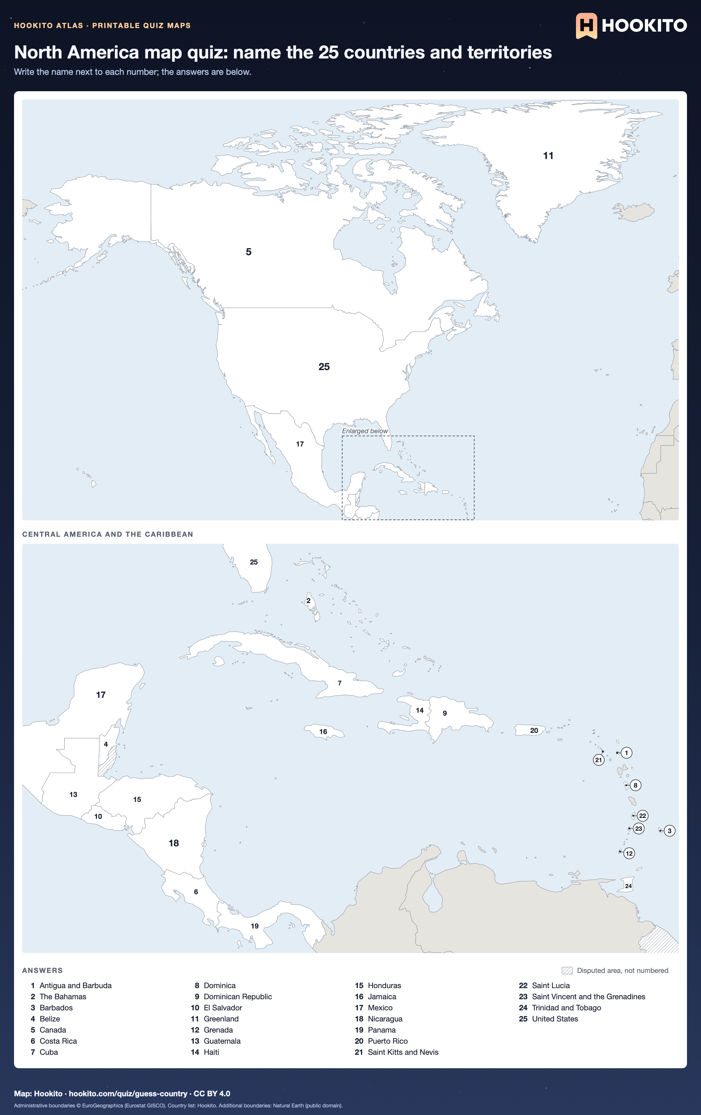
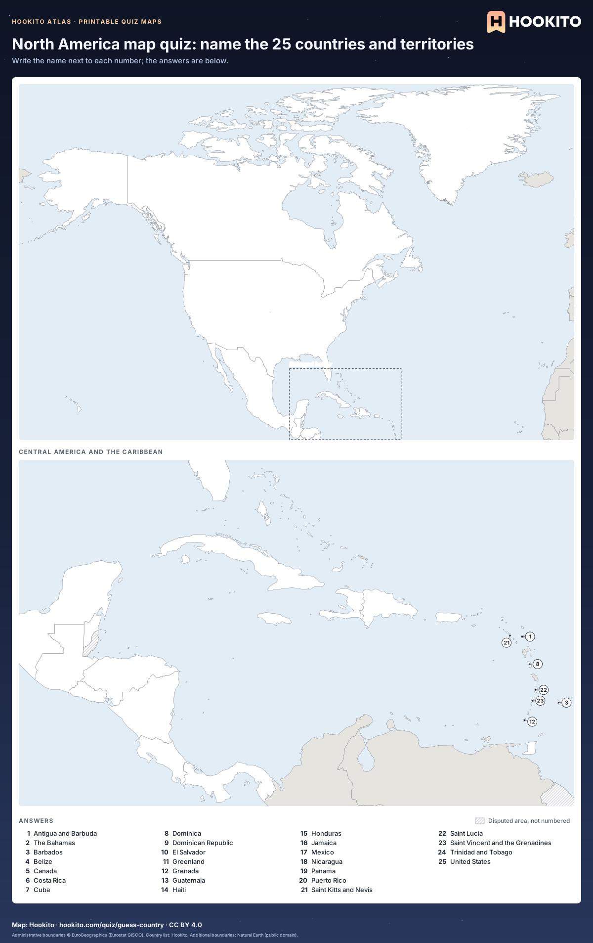
North America map quiz: name the 25 countries and territories

Printable blank map of North America with 25 numbered countries and territories and an alphabetical answer key below the map.

Free to print for classrooms and practice under CC BY 4.0. Numbers follow the 25 countries and territories in Hookito’s North America list alphabetically; small ones have a numbered circle on a leader line, and grey land belongs to other continents; hatched areas are disputed. Central America and the Caribbean are enlarged below the main map.

Embed this map

Administrative boundaries © EuroGeographics (Eurostat GISCO). Country list: Hookito. Additional boundaries: Natural Earth (public domain).
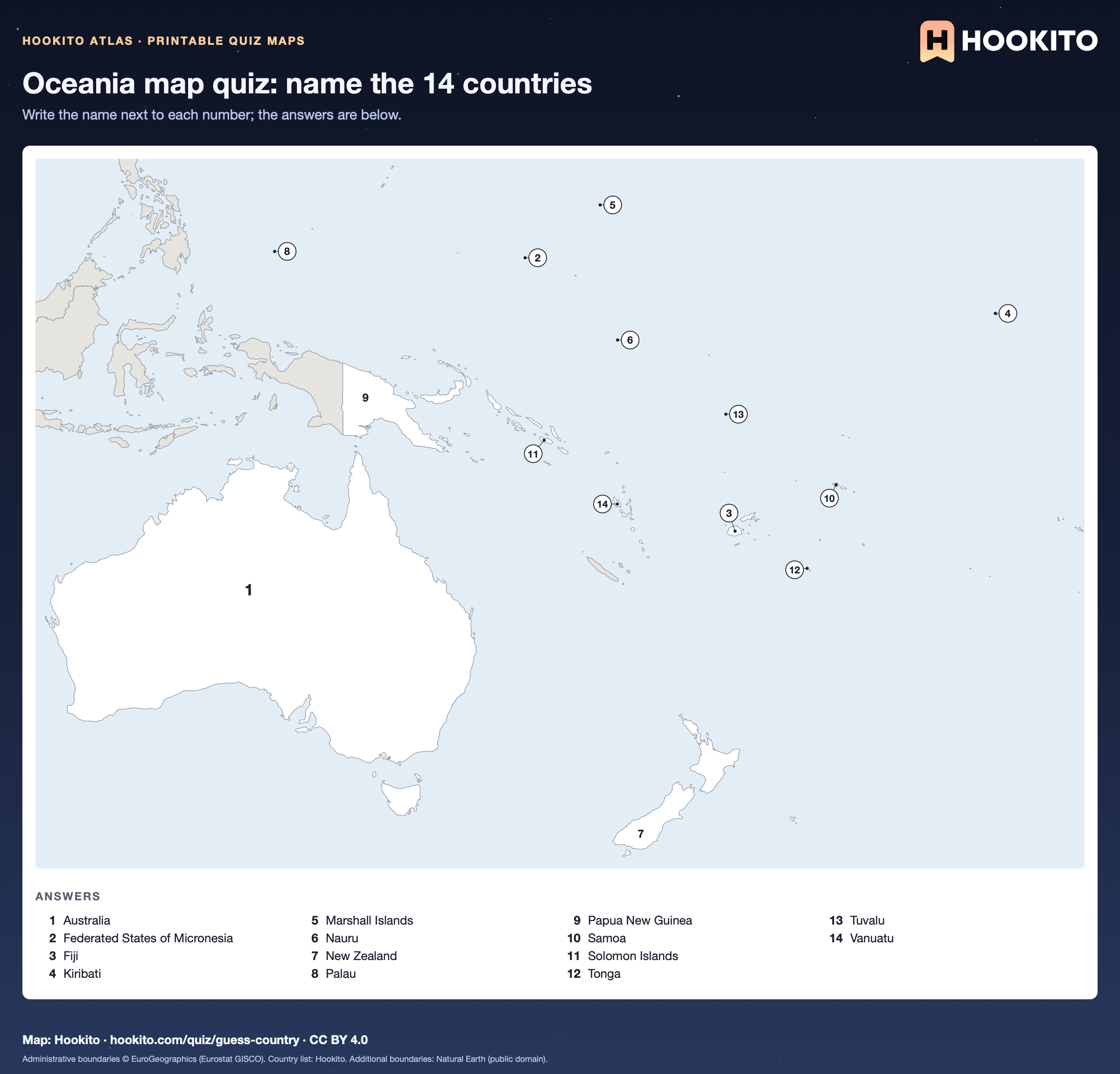
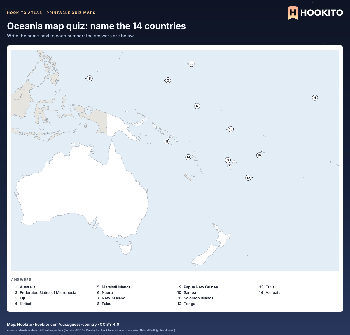
Oceania map quiz: name the 14 countries

Printable blank map of Oceania with 14 numbered countries and an alphabetical answer key below the map.

Free to print for classrooms and practice under CC BY 4.0. Numbers follow the 14 countries in Hookito’s Oceania list alphabetically; small ones have a numbered circle on a leader line, and grey land belongs to other continents.

Embed this map

Administrative boundaries © EuroGeographics (Eurostat GISCO). Country list: Hookito. Additional boundaries: Natural Earth (public domain).
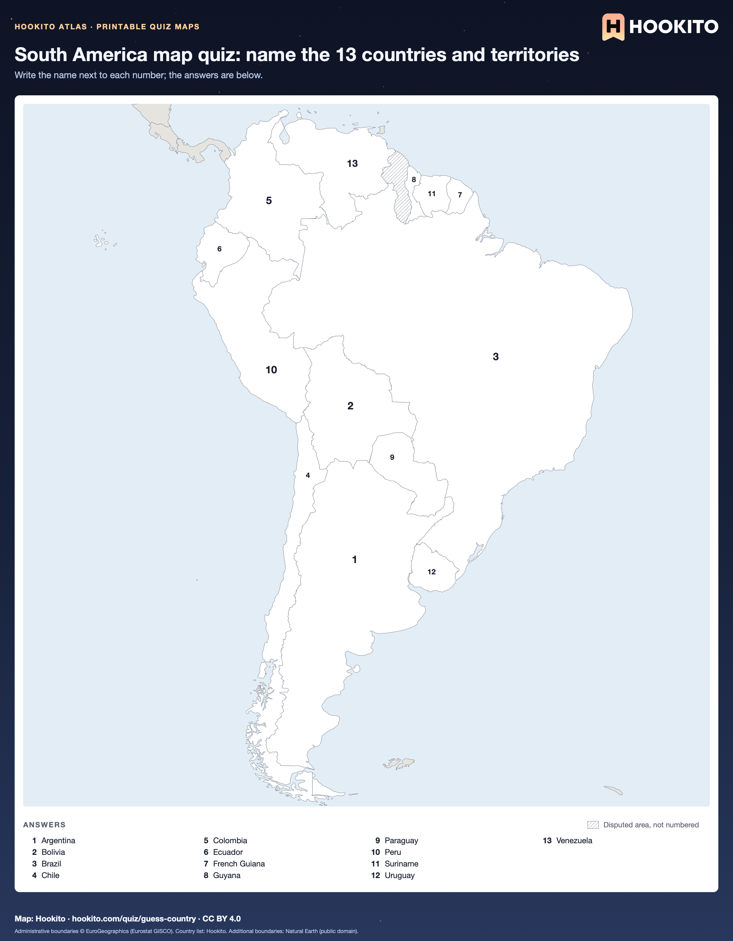
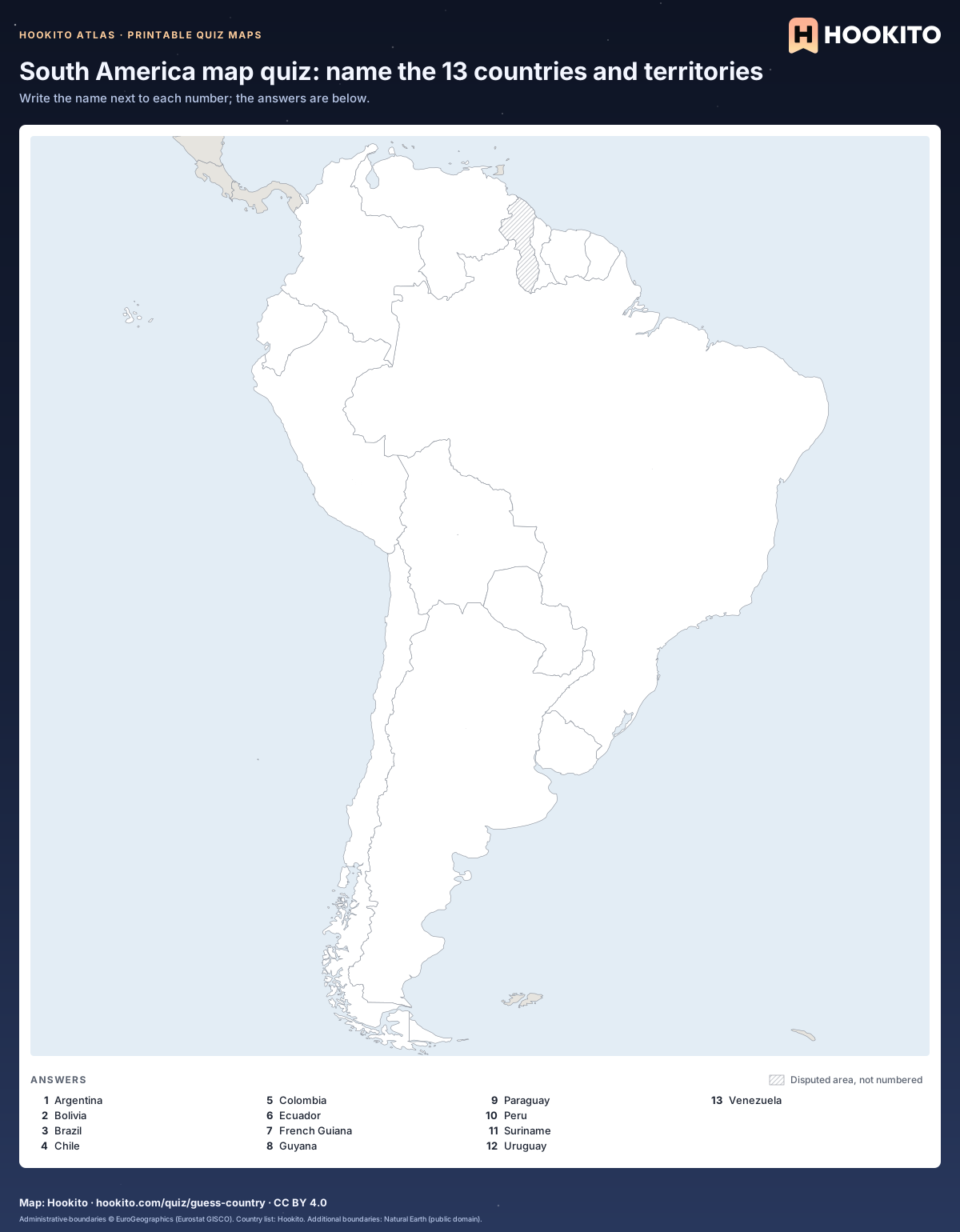
South America map quiz: name the 13 countries and territories

Printable blank map of South America with 13 numbered countries and territories and an alphabetical answer key below the map.

Free to print for classrooms and practice under CC BY 4.0. Numbers follow the 13 countries and territories in Hookito’s South America list alphabetically; small ones have a numbered circle on a leader line, and grey land belongs to other continents; hatched areas are disputed.

Embed this map

Administrative boundaries © EuroGeographics (Eurostat GISCO). Country list: Hookito. Additional boundaries: Natural Earth (public domain).
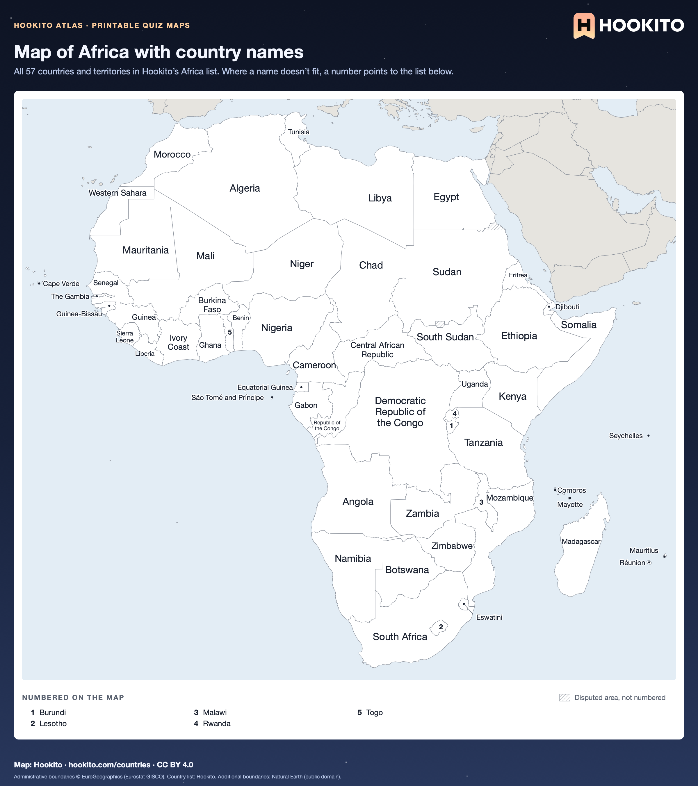
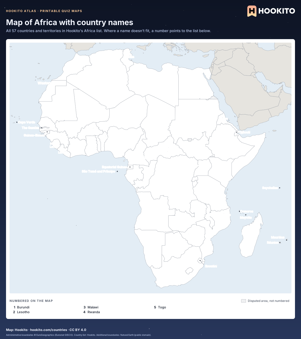
Map of Africa with country names

Printable map of Africa with the names of 52 countries and territories written on the map and 5 smaller ones numbered, with a key below.

Free to print for classrooms and practice under CC BY 4.0. Shows the 57 countries and territories in Hookito’s Africa list; grey land belongs to other continents; hatched areas are disputed.

Embed this map

Administrative boundaries © EuroGeographics (Eurostat GISCO). Country list: Hookito. Additional boundaries: Natural Earth (public domain).
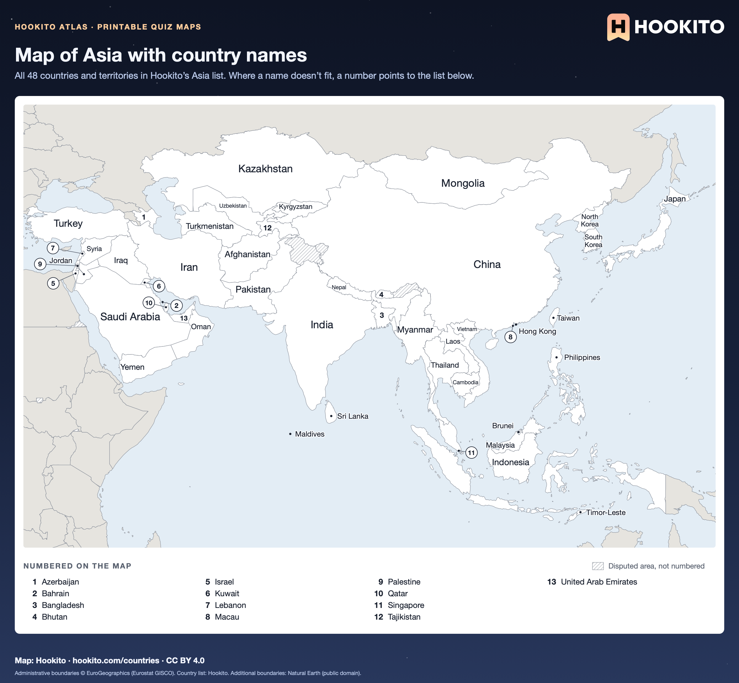
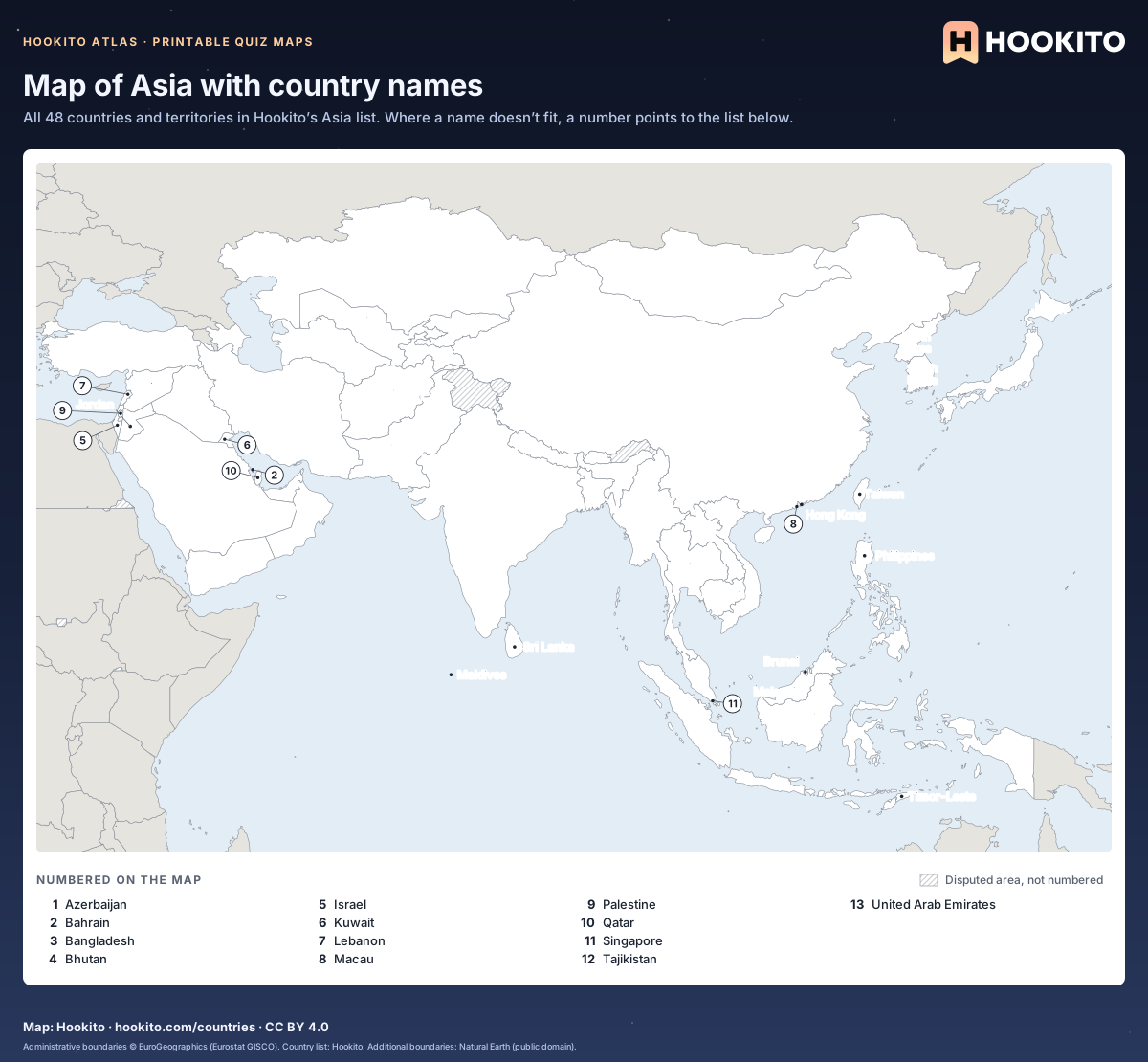
Map of Asia with country names

Printable map of Asia with the names of 35 countries and territories written on the map and 13 smaller ones numbered, with a key below.

Free to print for classrooms and practice under CC BY 4.0. Shows the 48 countries and territories in Hookito’s Asia list; grey land belongs to other continents; hatched areas are disputed.

Embed this map

Administrative boundaries © EuroGeographics (Eurostat GISCO). Country list: Hookito. Additional boundaries: Natural Earth (public domain).
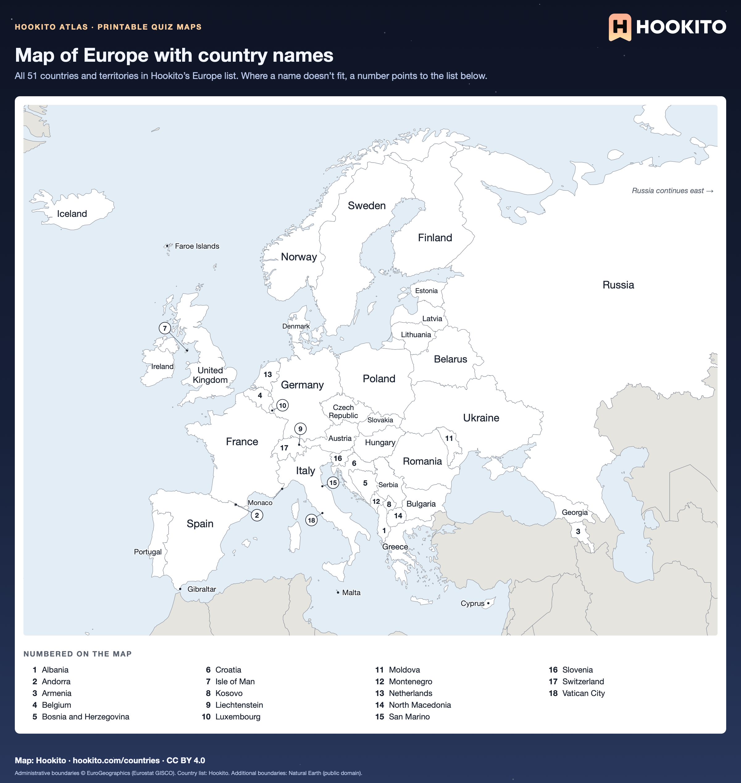
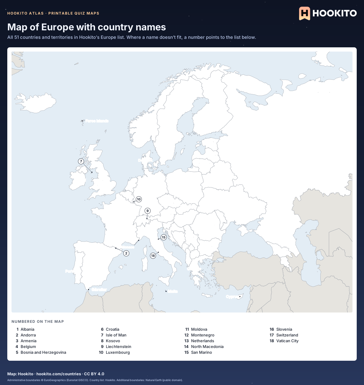
Map of Europe with country names

Printable map of Europe with the names of 33 countries and territories written on the map and 18 smaller ones numbered, with a key below.

Free to print for classrooms and practice under CC BY 4.0. Shows the 51 countries and territories in Hookito’s Europe list; grey land belongs to other continents. Russia is cut off at 62° E.

Embed this map

Administrative boundaries © EuroGeographics (Eurostat GISCO). Country list: Hookito. Additional boundaries: Natural Earth (public domain).
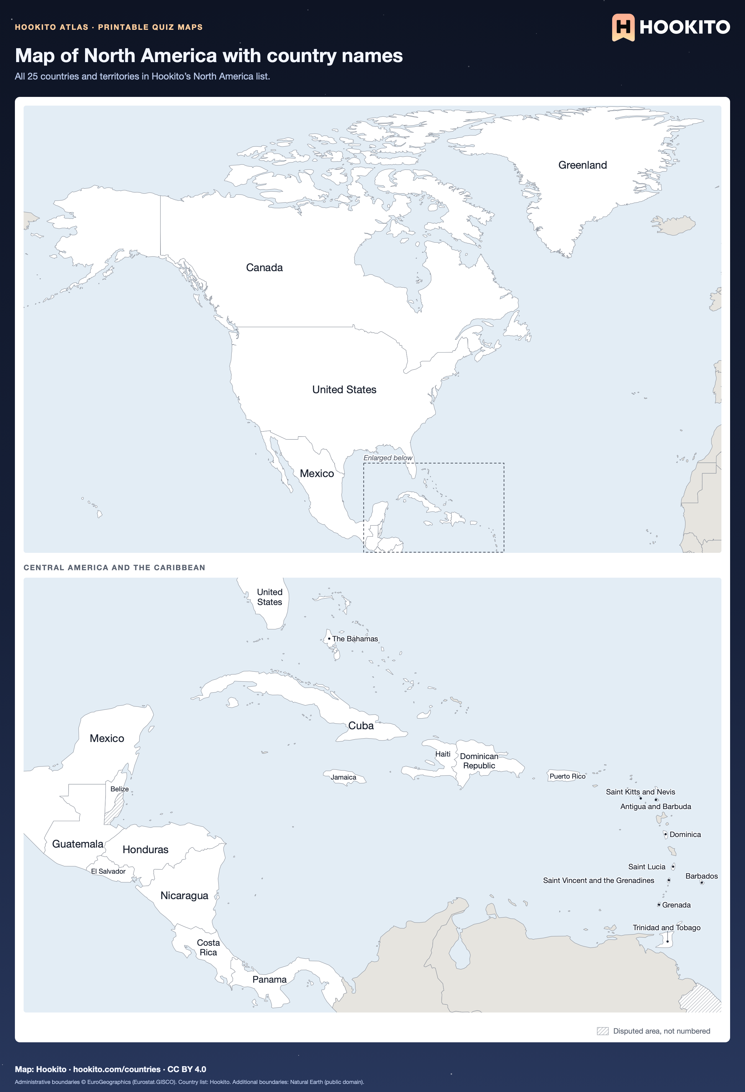
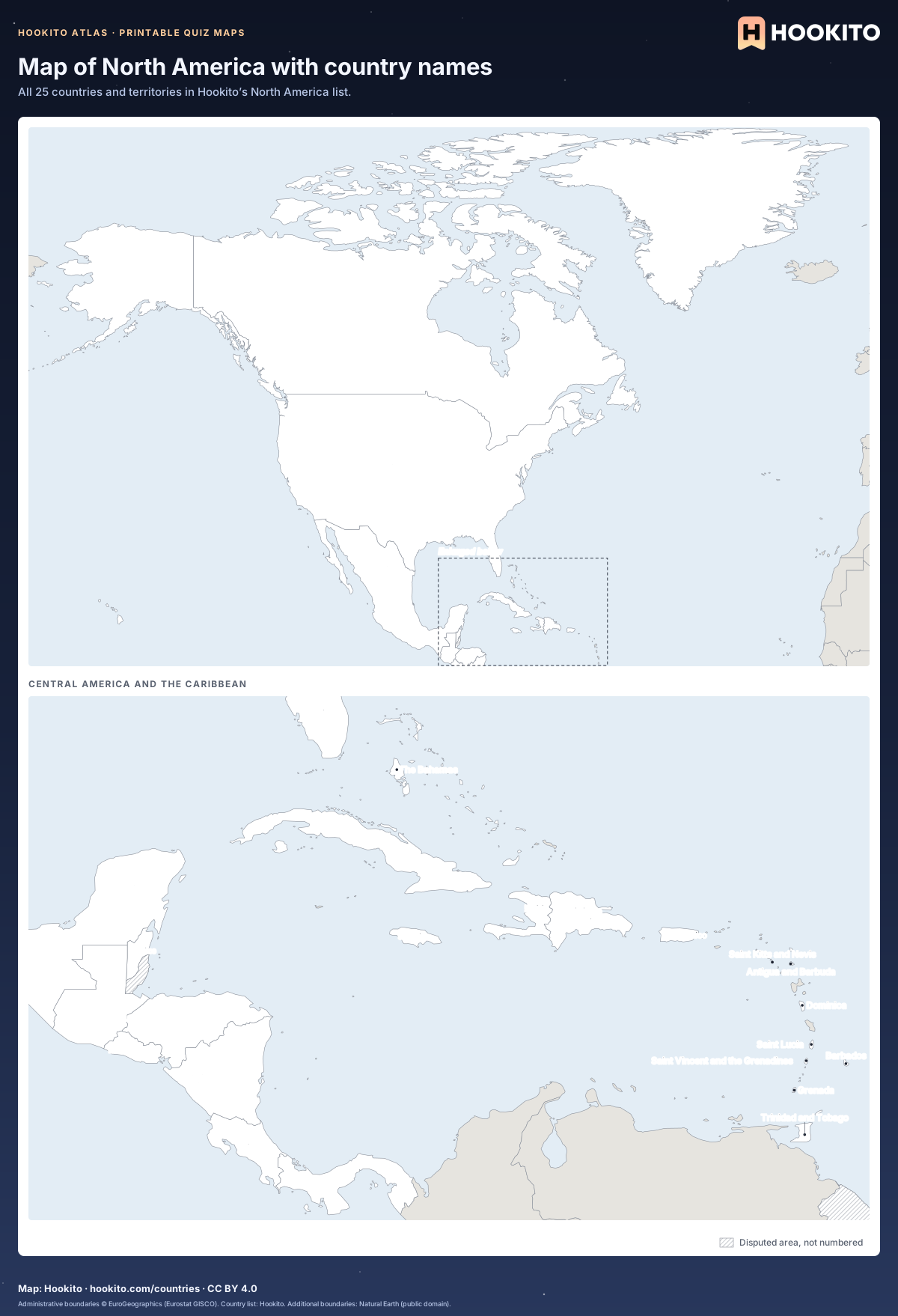
Map of North America with country names

Printable map of North America with the names of 25 countries and territories written on the map.

Free to print for classrooms and practice under CC BY 4.0. Shows the 25 countries and territories in Hookito’s North America list; grey land belongs to other continents; hatched areas are disputed. Central America and the Caribbean are enlarged below the main map.

Embed this map

Administrative boundaries © EuroGeographics (Eurostat GISCO). Country list: Hookito. Additional boundaries: Natural Earth (public domain).
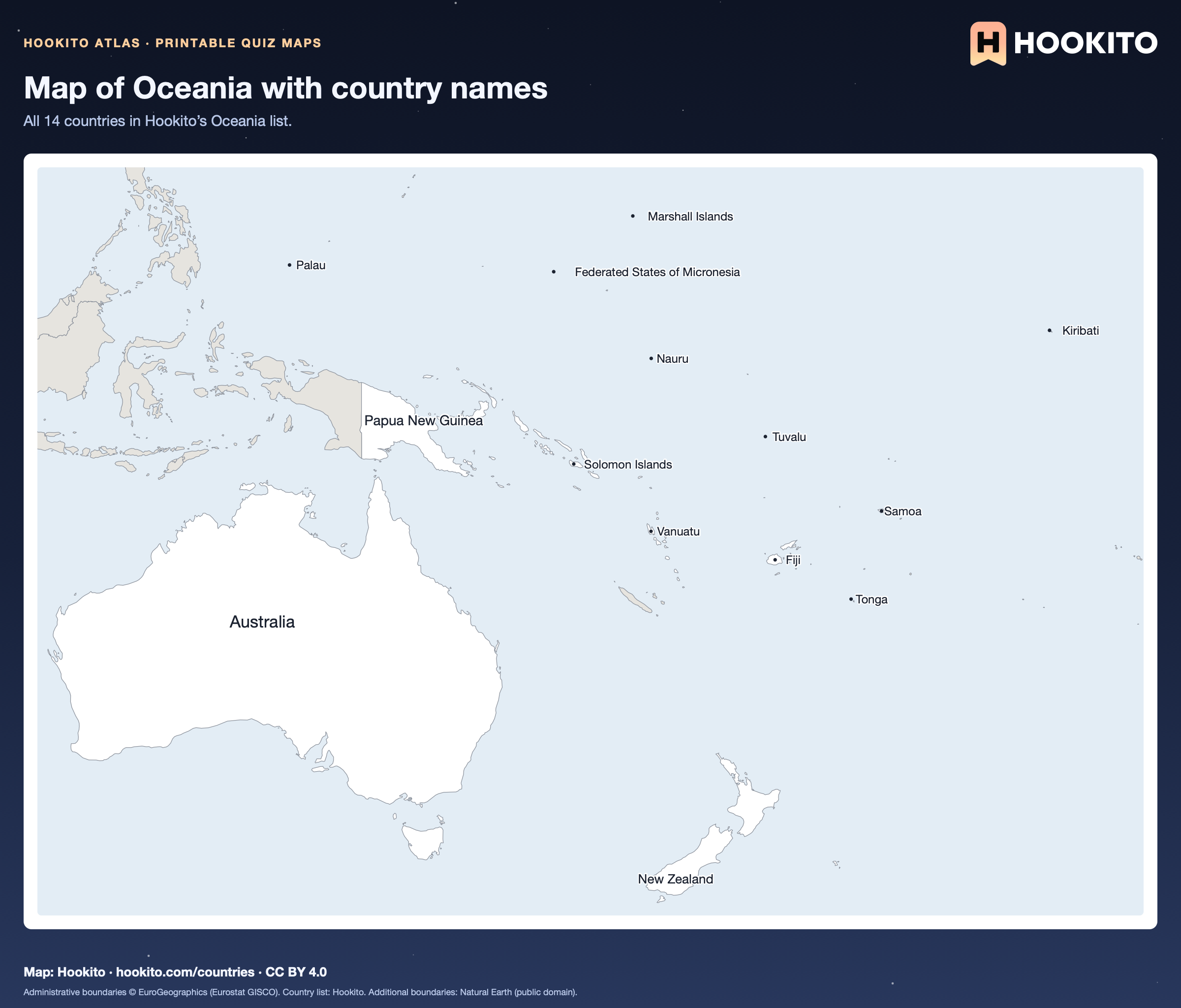
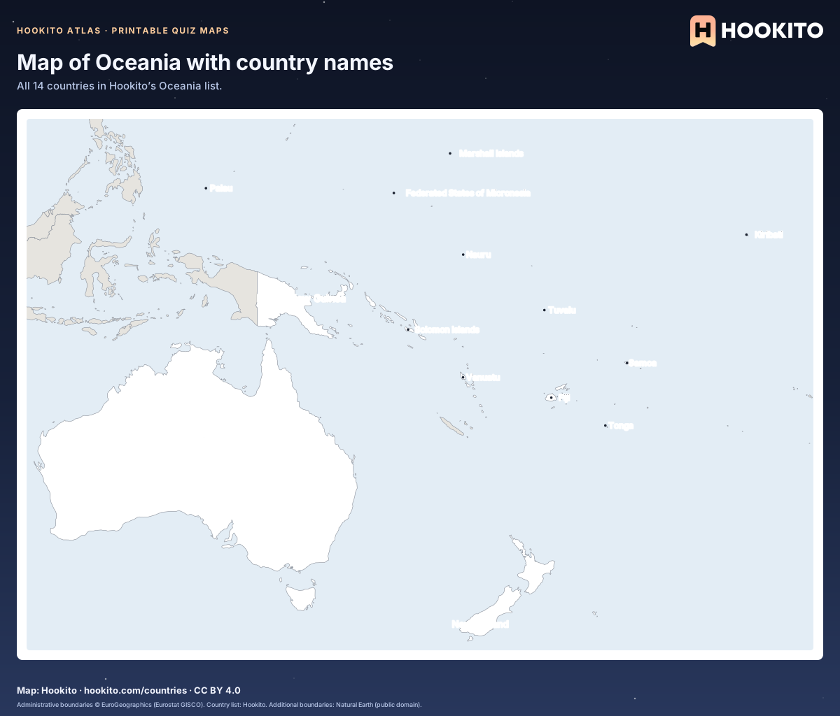
Map of Oceania with country names

Printable map of Oceania with the names of 14 countries written on the map.

Free to print for classrooms and practice under CC BY 4.0. Shows the 14 countries in Hookito’s Oceania list; grey land belongs to other continents.

Embed this map

Administrative boundaries © EuroGeographics (Eurostat GISCO). Country list: Hookito. Additional boundaries: Natural Earth (public domain).
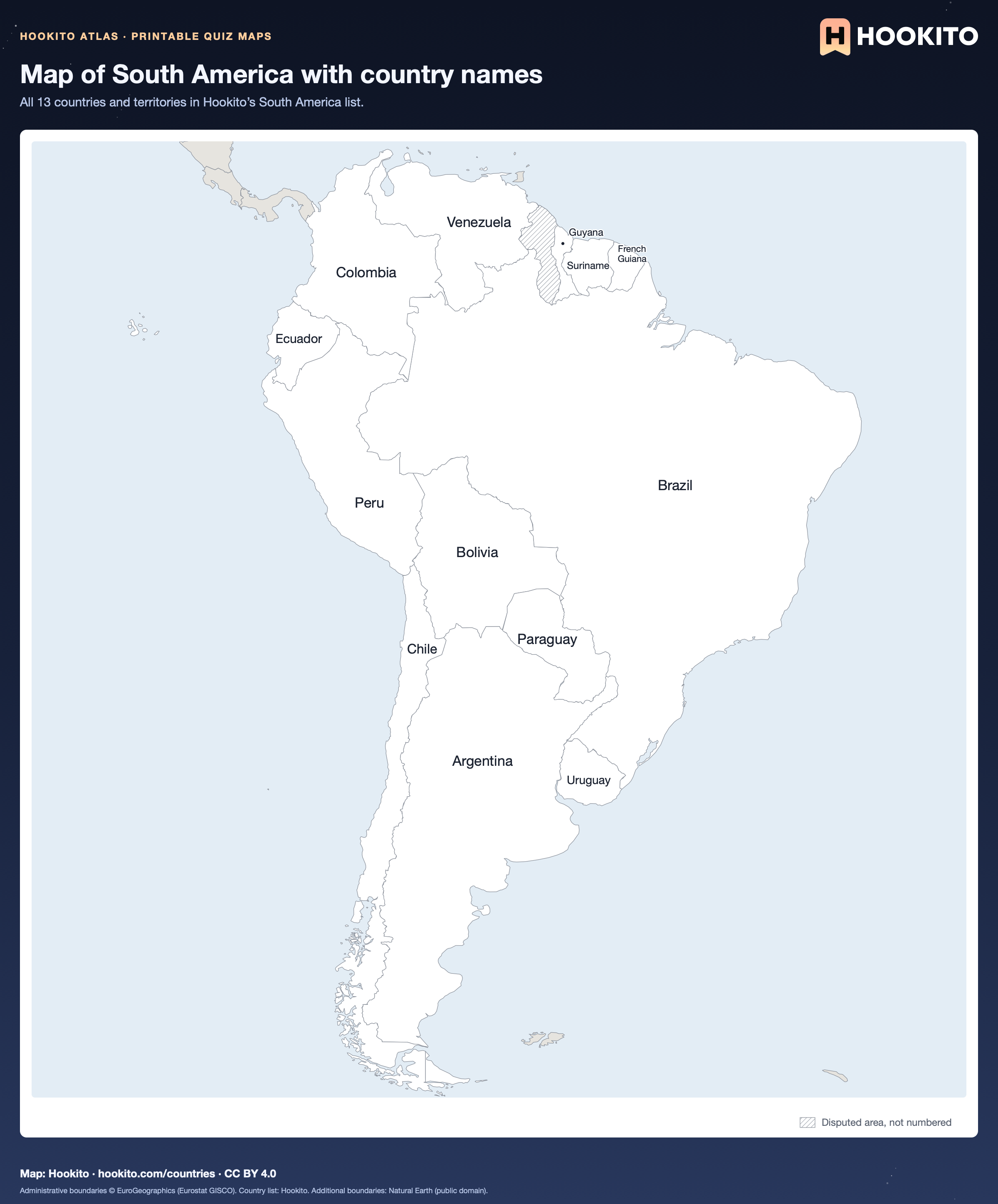
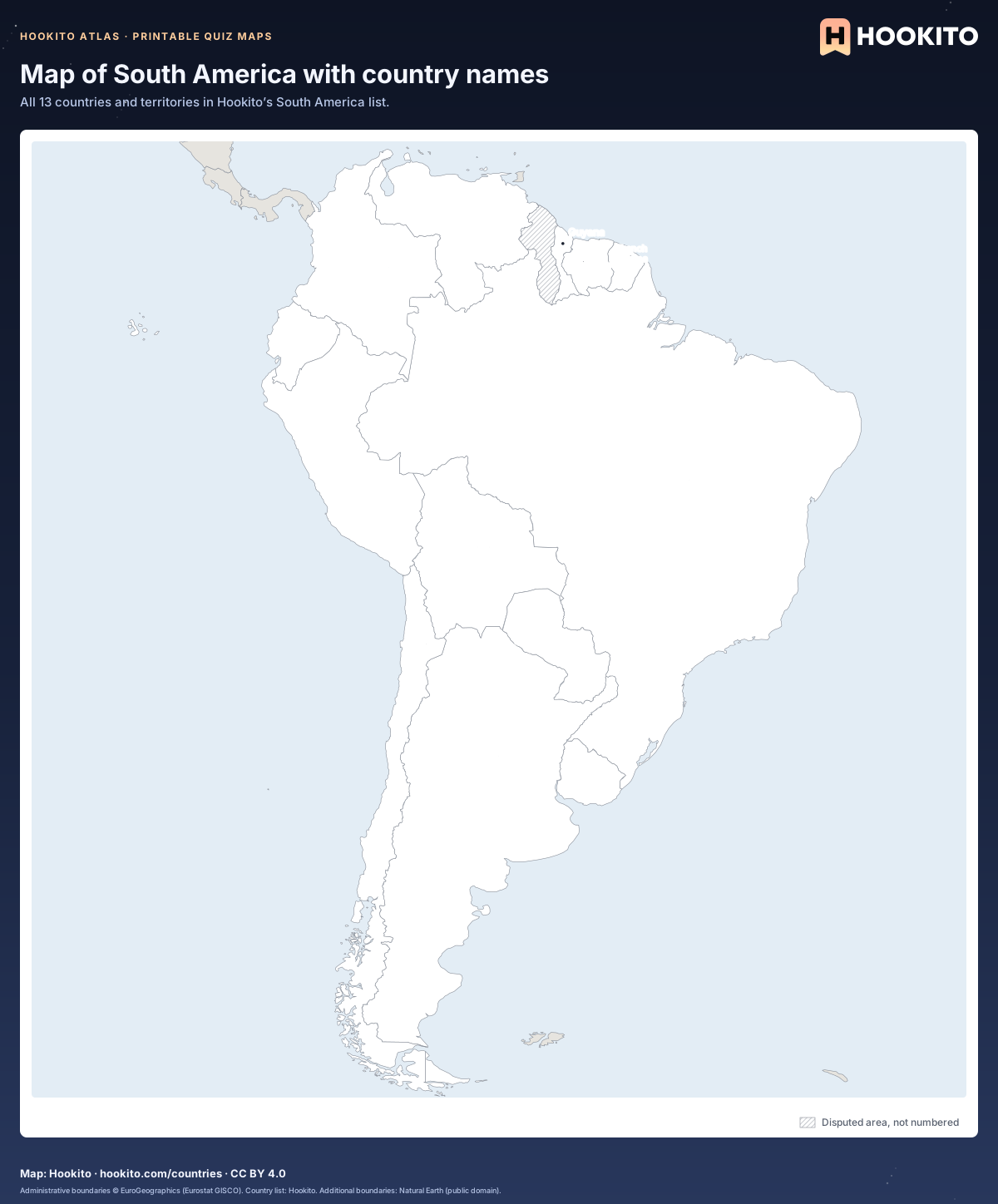
Map of South America with country names

Printable map of South America with the names of 13 countries and territories written on the map.

Free to print for classrooms and practice under CC BY 4.0. Shows the 13 countries and territories in Hookito’s South America list; grey land belongs to other continents; hatched areas are disputed.

Embed this map

Administrative boundaries © EuroGeographics (Eurostat GISCO). Country list: Hookito. Additional boundaries: Natural Earth (public domain).
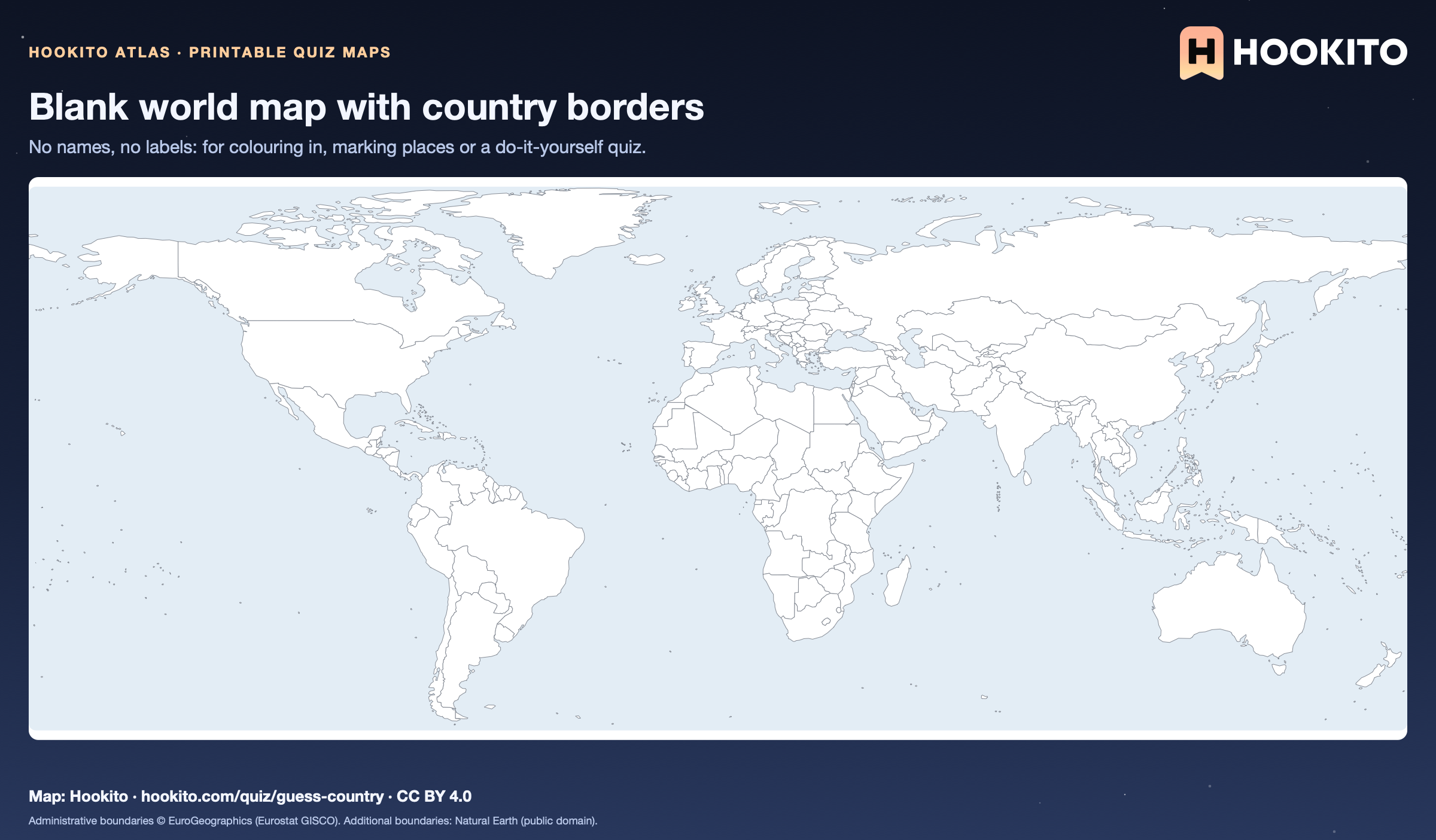
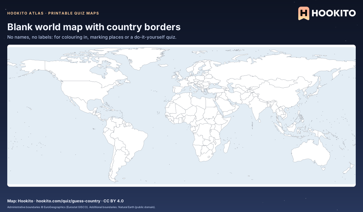
Blank world map with country borders

Printable blank world map with white countries, grey borders and a pale blue sea, without any labels.

Free to print for classrooms and practice under CC BY 4.0. Equirectangular projection from 84° N to 58° S; Antarctica is left out and the smallest islands are too small to show at this scale.

Embed this map

Administrative boundaries © EuroGeographics (Eurostat GISCO). Additional boundaries: Natural Earth (public domain).

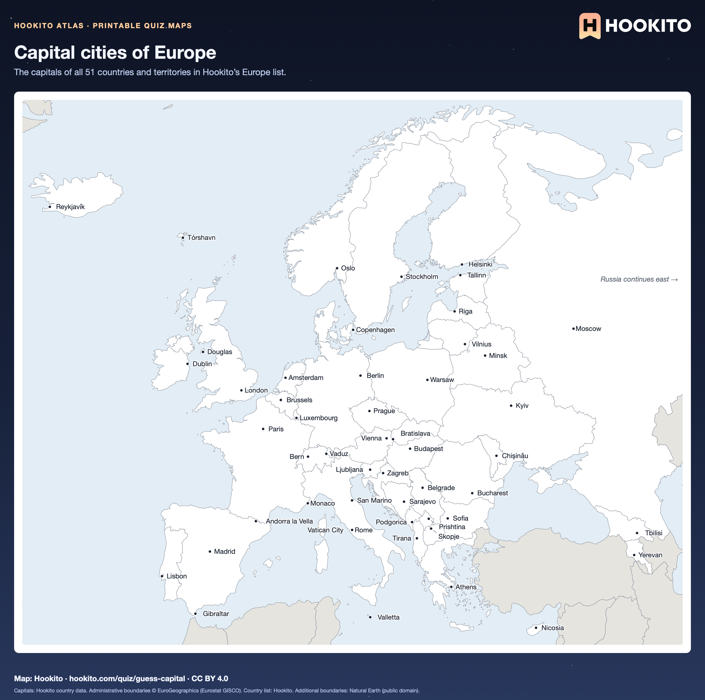
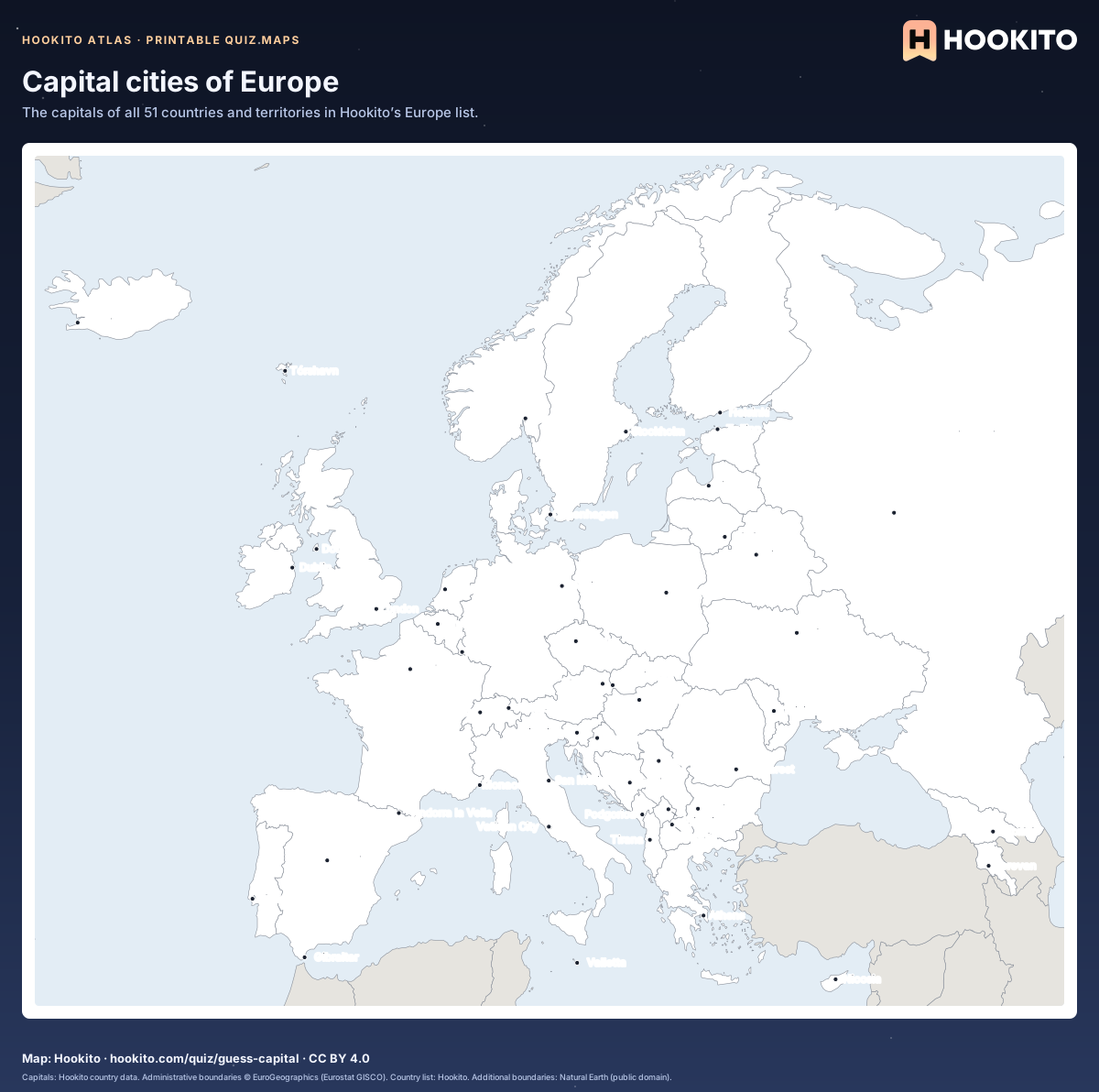
Capital cities of Europe

Printable map of Europe with a dot and the name of the capital of each of 51 countries and territories.

Free to print for classrooms and practice under CC BY 4.0. Montenegro’s capital is shown as Podgorica, the seat of government. Russia is cut off at 50° E.

Embed this map

Capitals: Hookito country data. Administrative boundaries © EuroGeographics (Eurostat GISCO). Country list: Hookito. Additional boundaries: Natural Earth (public domain).

Reusing the maps

You’re welcome to share, print or adapt these maps. The renderings are licensed CC BY 4.0: credit them as “Map: Hookito, hookito.com”, with a link to this page where you can.

The underlying data keeps its own terms, so keep its credits too. Administrative boundaries © EuroGeographics (Eurostat GISCO), which also applies to most country outlines. Additional boundaries are from Natural Earth (public domain). Each map lists its other sources: Wikidata and GeoNames for country facts, Our World in Data for the statistics, Unicode CLDR and the IANA time zone database for the calendar and clock maps, flag-icons (MIT) for the flags, Wikimedia Commons for the paintings, NASA Earth Observatory for the night imagery. The maps are offered as finished images only; the boundary data itself isn’t available for download here.
Where to next?

Back to the globe
Hookito landscape illustration