Hookito

The Hookito atlas

Geography maps: countries, capitals and outlines

All world maps →

Explore country shapes, sizes, borders, coastlines and the lines that cross the world.

About these maps

The collection brings together data Hookito already uses: the capitals and facts behind the country pages, the outlines from the countries list, the paintings in Art, the album lists in Audio and the night side of the globe. The boundaries combine Eurostat GISCO and Natural Earth data. The world maps use a plain equirectangular projection, cropped at 84° north and 58° south.

Spotted a mistake? Write to submissions@hookito.com.

10 maps

Geography

Country size, coastlines, capitals and the borders between places.

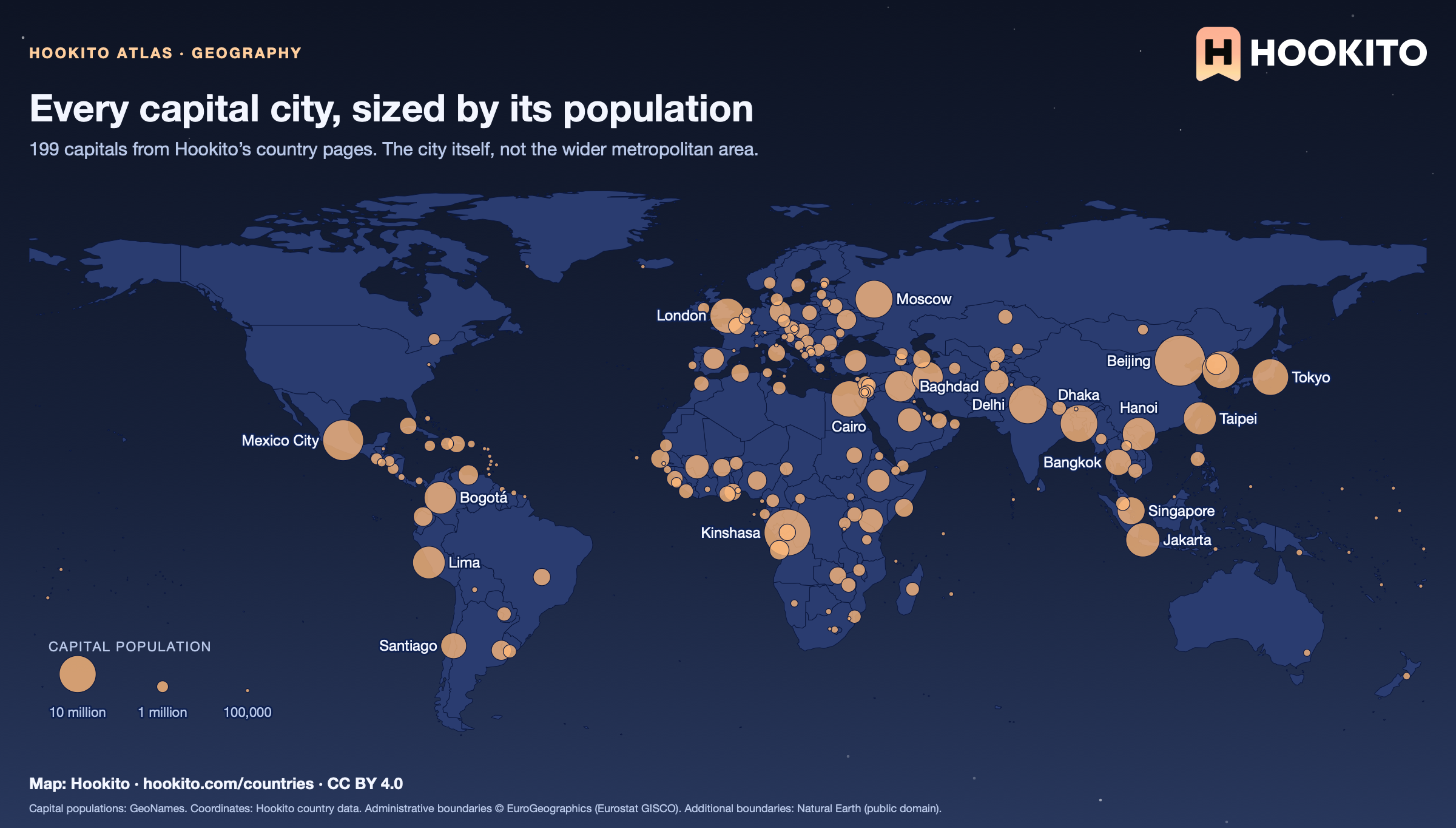
Every capital city, sized by its population
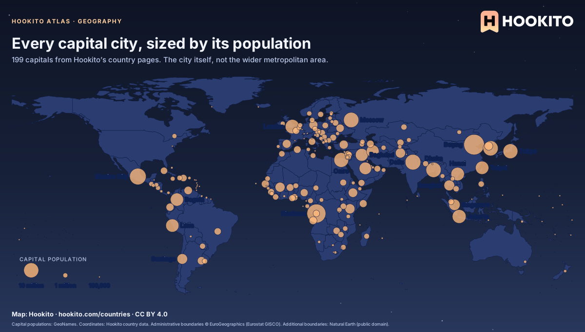
World map with one orange dot per capital city, 199 in all; the dot size shows the capital’s population.

Beijing, Kinshasa and Mexico City are the largest dots. At the other end, 25 capitals have fewer than 50,000 people. Each country page lists its largest cities.

Embed this map

Capital populations: GeoNames. Coordinates: Hookito country data. Administrative boundaries © EuroGeographics (Eurostat GISCO). Additional boundaries: Natural Earth (public domain).
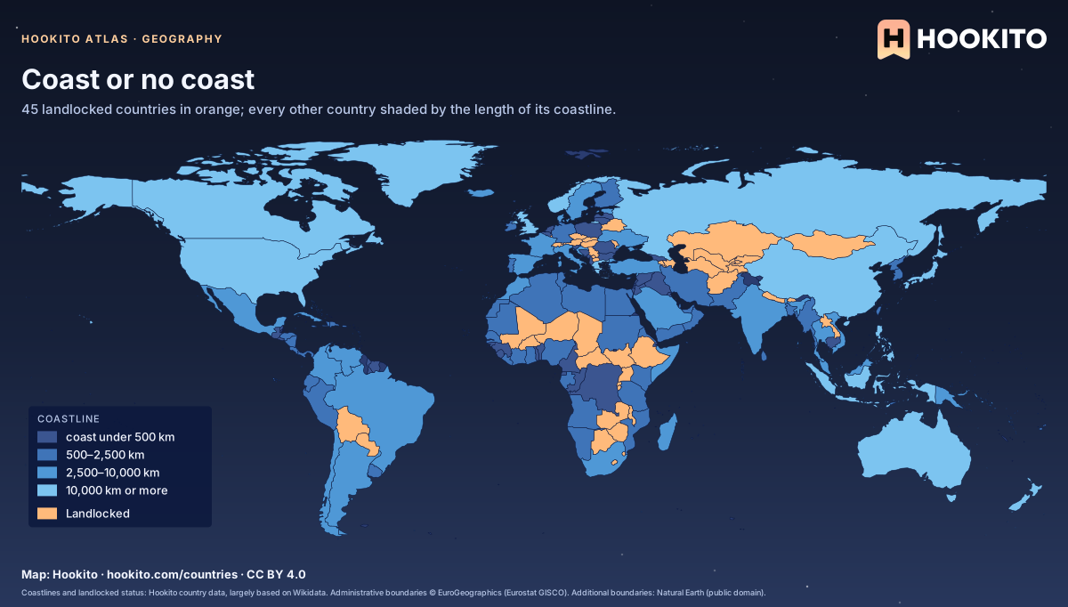
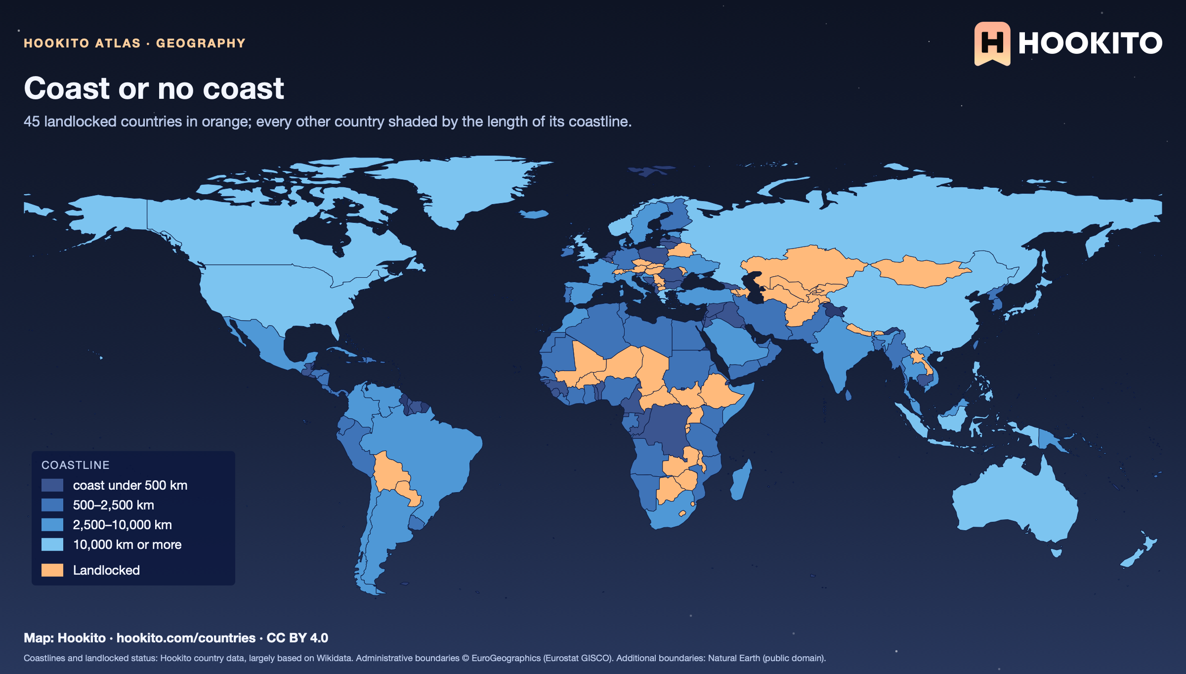
Coast or no coast

World map with 45 landlocked countries in orange and coastal countries in four shades of blue by coastline length.

45 countries have no coast at all. Liechtenstein and Uzbekistan are surrounded only by other landlocked countries, so the sea is at least two borders away; Canada has the longest coastline, about 202,080 km.

Embed this map

Coastlines and landlocked status: Hookito country data, largely based on Wikidata. Administrative boundaries © EuroGeographics (Eurostat GISCO). Additional boundaries: Natural Earth (public domain).
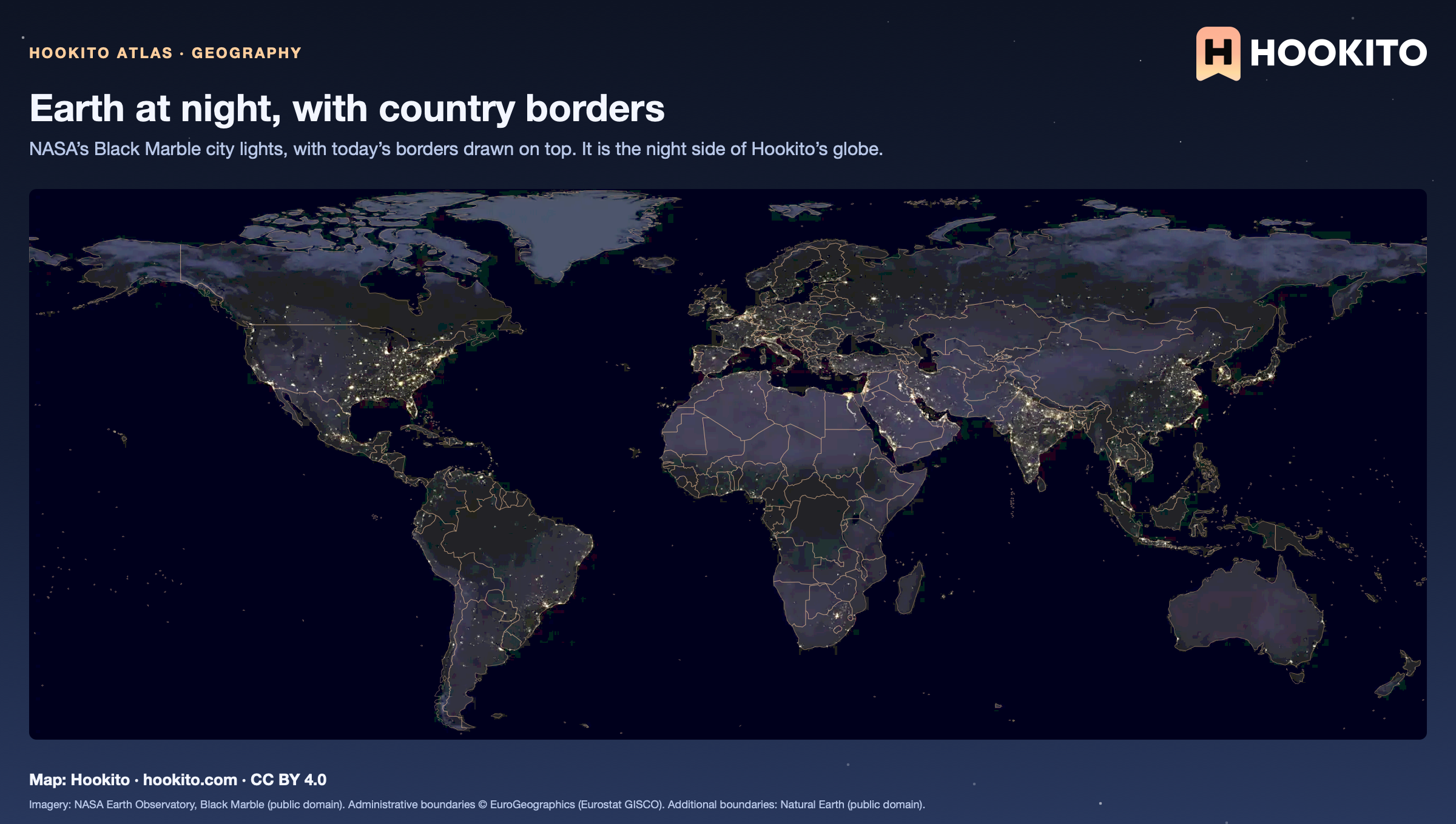
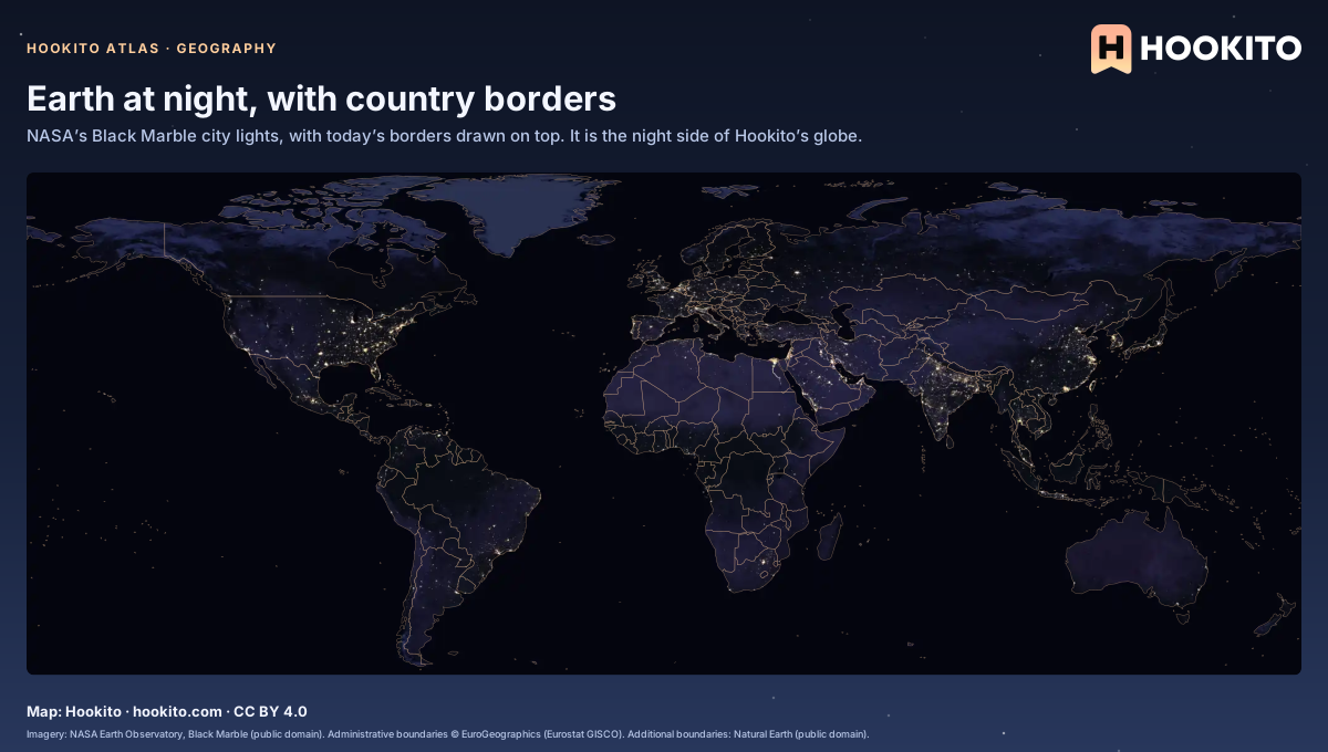
Earth at night, with country borders

Satellite image of Earth at night with thin orange country borders; city lights glow along coasts and rivers.

City lights follow coasts and rivers more than borders: the Nile shows as a thin line of light through the desert. The borders are the only thing on this map you can’t see from space.

Embed this map

Imagery: NASA Earth Observatory, Black Marble (public domain). Administrative boundaries © EuroGeographics (Eurostat GISCO). Additional boundaries: Natural Earth (public domain).
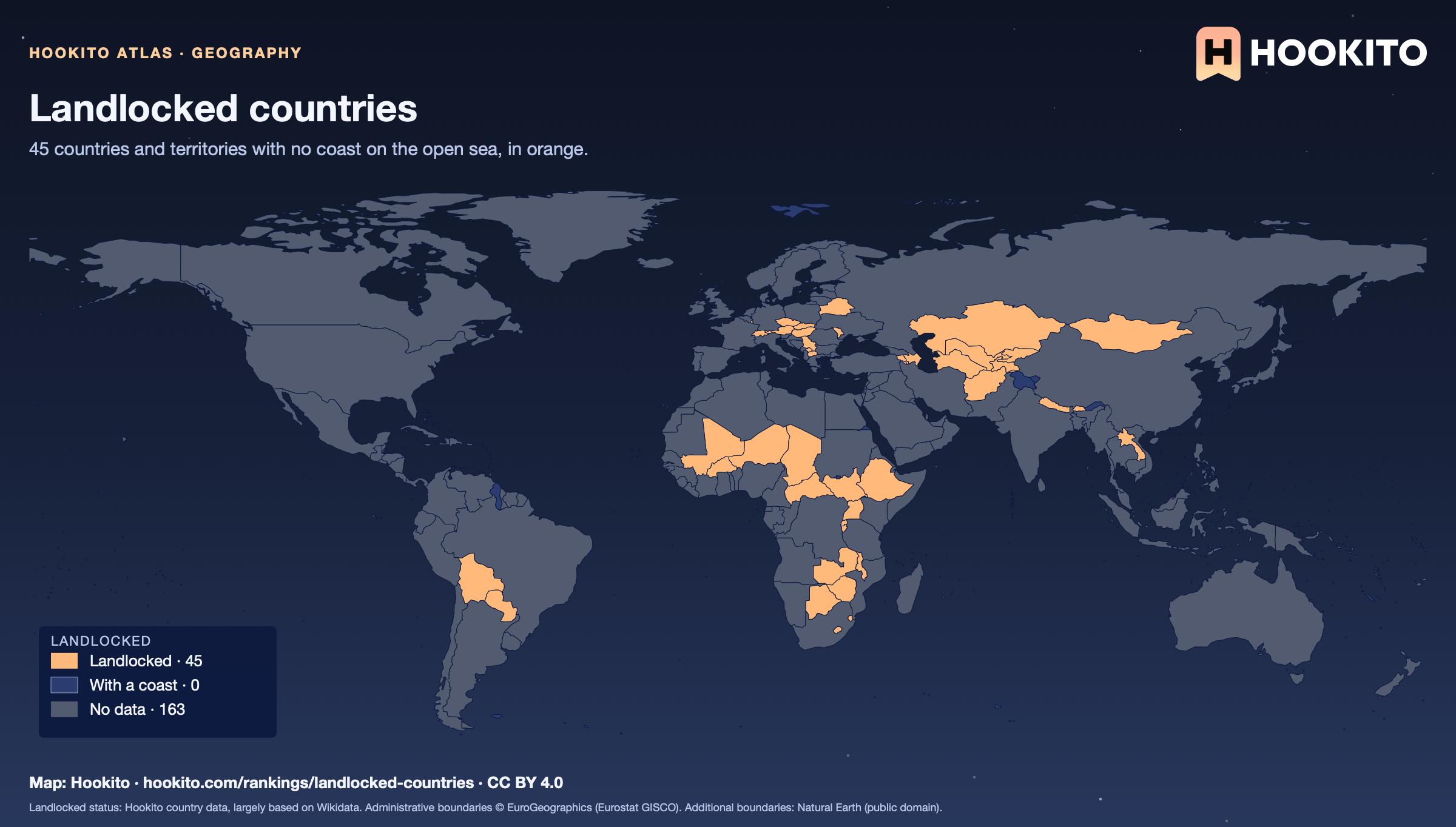
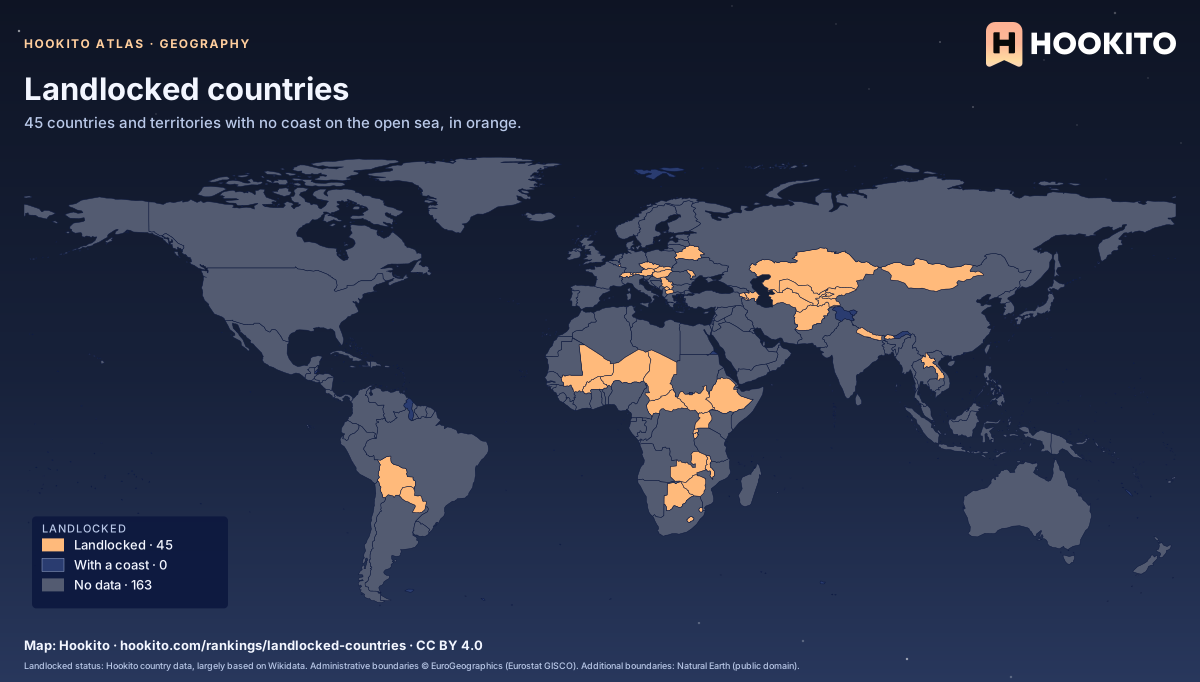
Landlocked countries

World map with 45 landlocked countries in orange, most of them in Africa, Europe and Central Asia, and every other country in dark blue.

Africa and Europe have 16 each; Kazakhstan is the largest landlocked country. Liechtenstein and Uzbekistan border only other landlocked countries.

Embed this map

Landlocked status: Hookito country data, largely based on Wikidata. Administrative boundaries © EuroGeographics (Eurostat GISCO). Additional boundaries: Natural Earth (public domain).
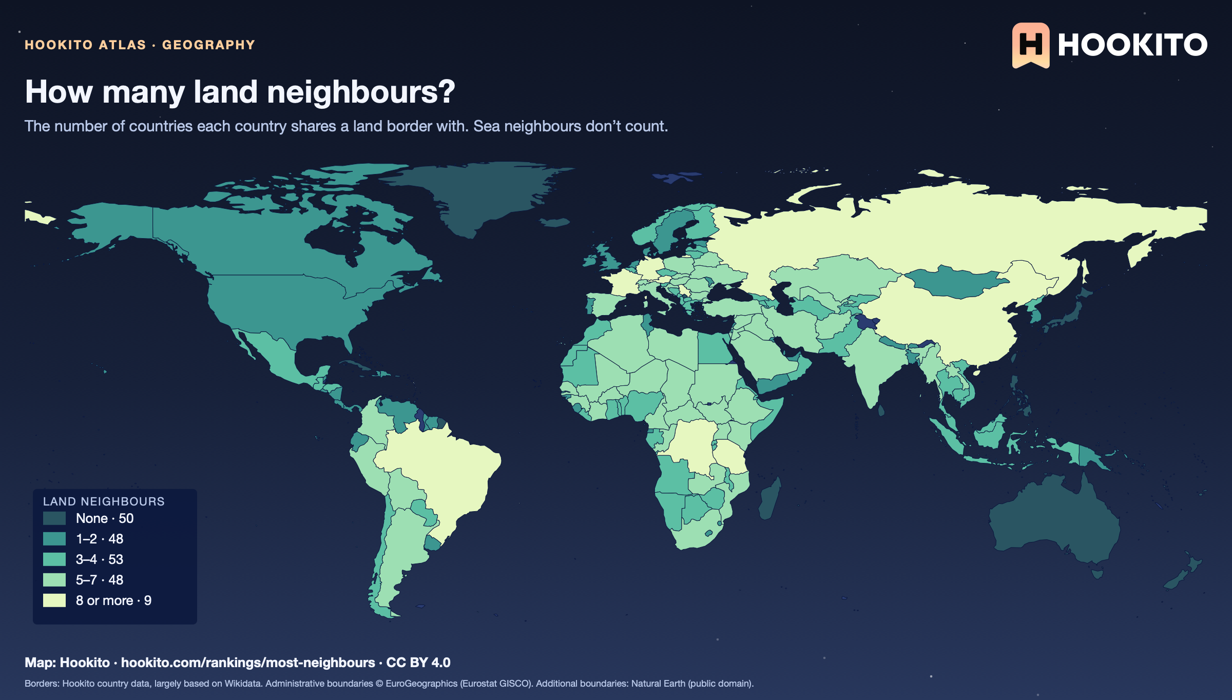
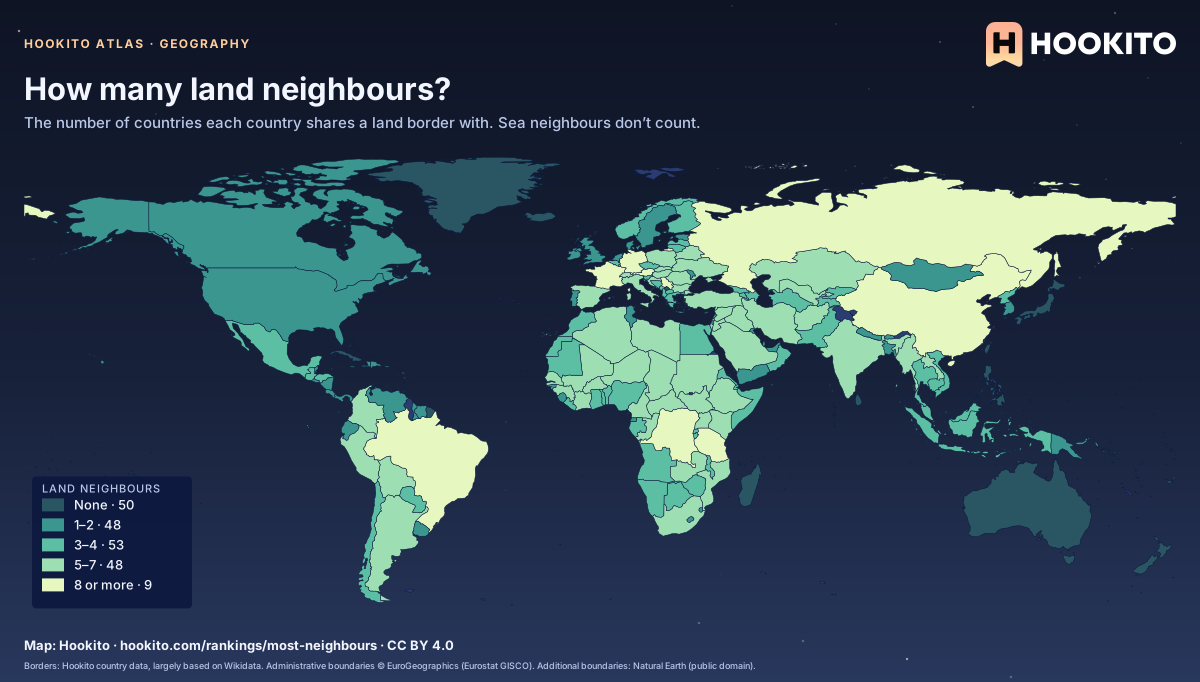
How many land neighbours?

World map shading countries by their number of land neighbours, from dark teal (none, mostly islands) to pale green (8 or more: Russia, China, Brazil, Germany, DR Congo and others).

Russia has the most land neighbours (14), then China (13); Brazil, DR Congo and Germany have 9 each. 50 countries, most of them islands, have none. A border counts where the country data lists it and the GISCO map shows the two touching.

Embed this map

Borders: Hookito country data, largely based on Wikidata. Administrative boundaries © EuroGeographics (Eurostat GISCO). Additional boundaries: Natural Earth (public domain).
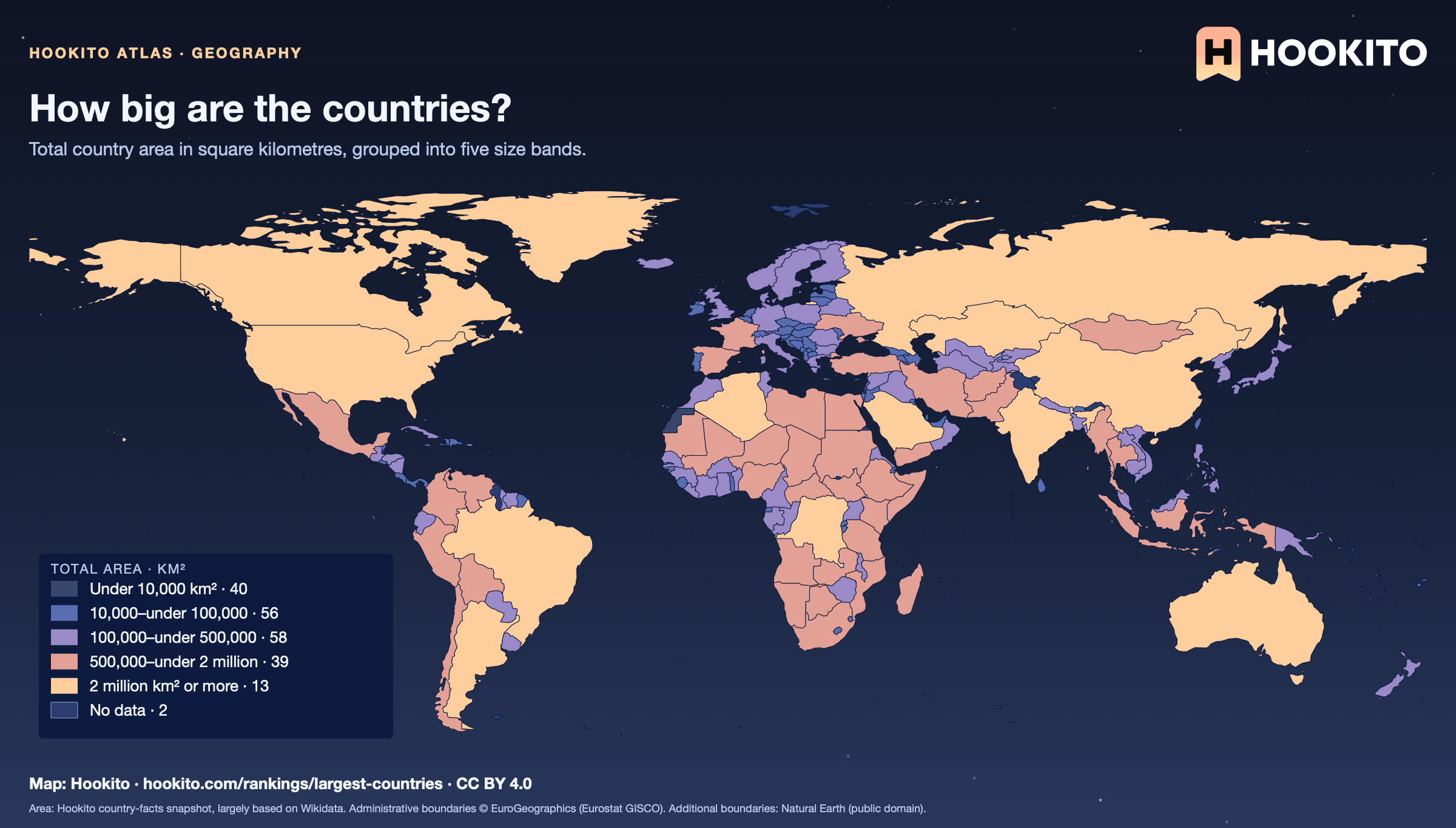
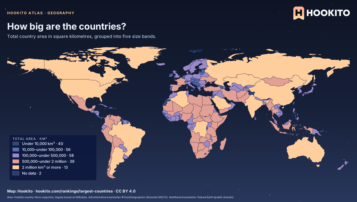
How big are the countries?

How big are the countries?: world map coloured by total area · km², with 206 countries classified and 2 without data.

Colour compares the area figures in Hookito’s country data. The shapes use an equirectangular projection, which enlarges places at high latitudes; use the colour rather than the apparent shape size to compare area.

Embed this map

Area: Hookito country-facts snapshot, largely based on Wikidata. Administrative boundaries © EuroGeographics (Eurostat GISCO). Additional boundaries: Natural Earth (public domain).
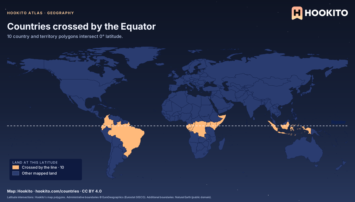
Countries crossed by the Equator

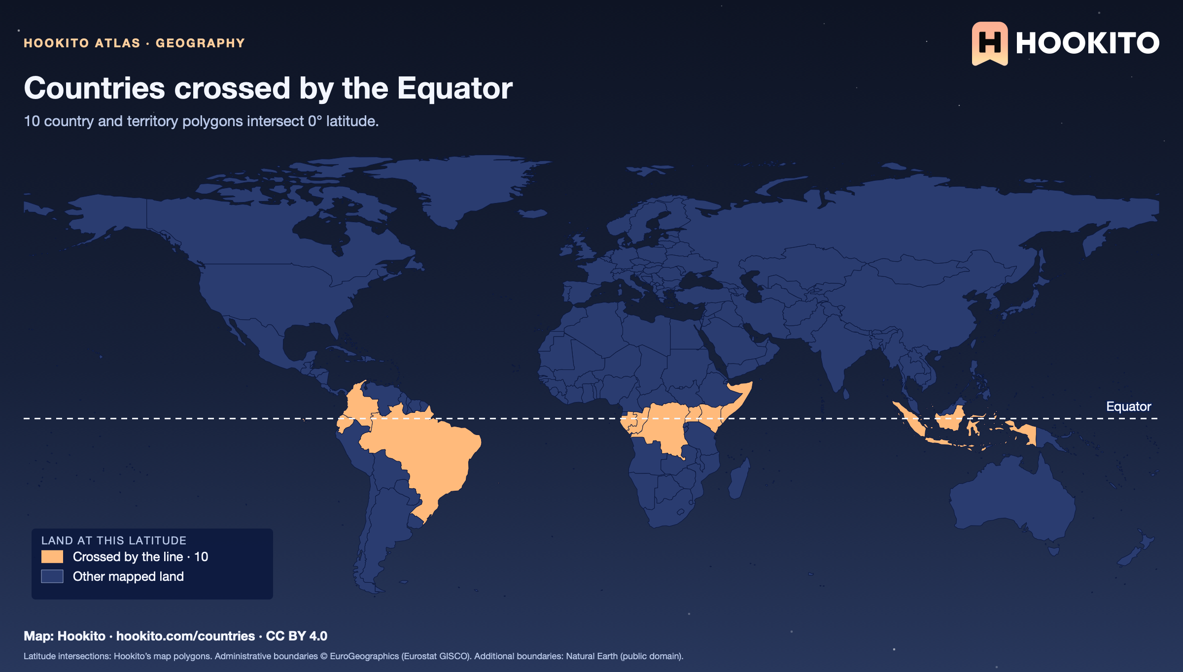
World map with the Equator drawn as a dashed line and the countries whose mapped land crosses it highlighted in orange.

Brazil, DR Congo, Republic of the Congo, Colombia, Ecuador, Gabon, Indonesia, Kenya, Somalia, Uganda. The line is tested against land polygons, not territorial waters. Boundaries are simplified at world-map scale, so very small islands can be omitted. The tropical and polar-circle latitudes are approximate.

Embed this map

Latitude intersections: Hookito’s map polygons. Administrative boundaries © EuroGeographics (Eurostat GISCO). Additional boundaries: Natural Earth (public domain).
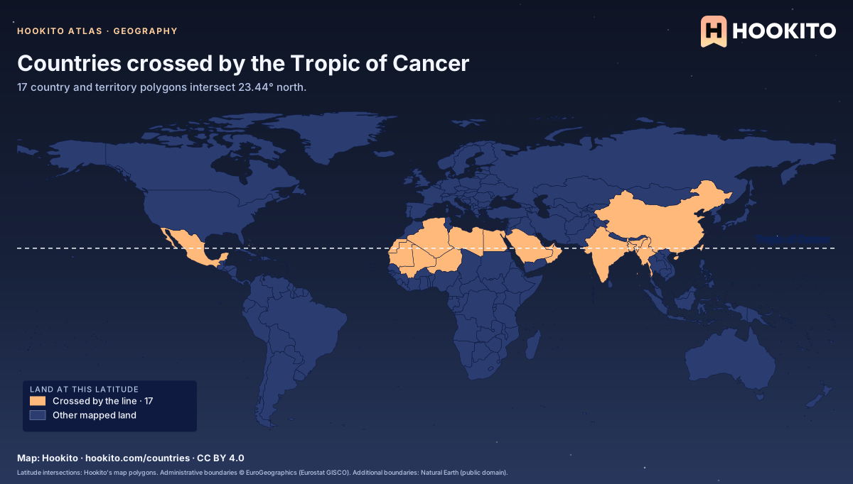
Countries crossed by the Tropic of Cancer

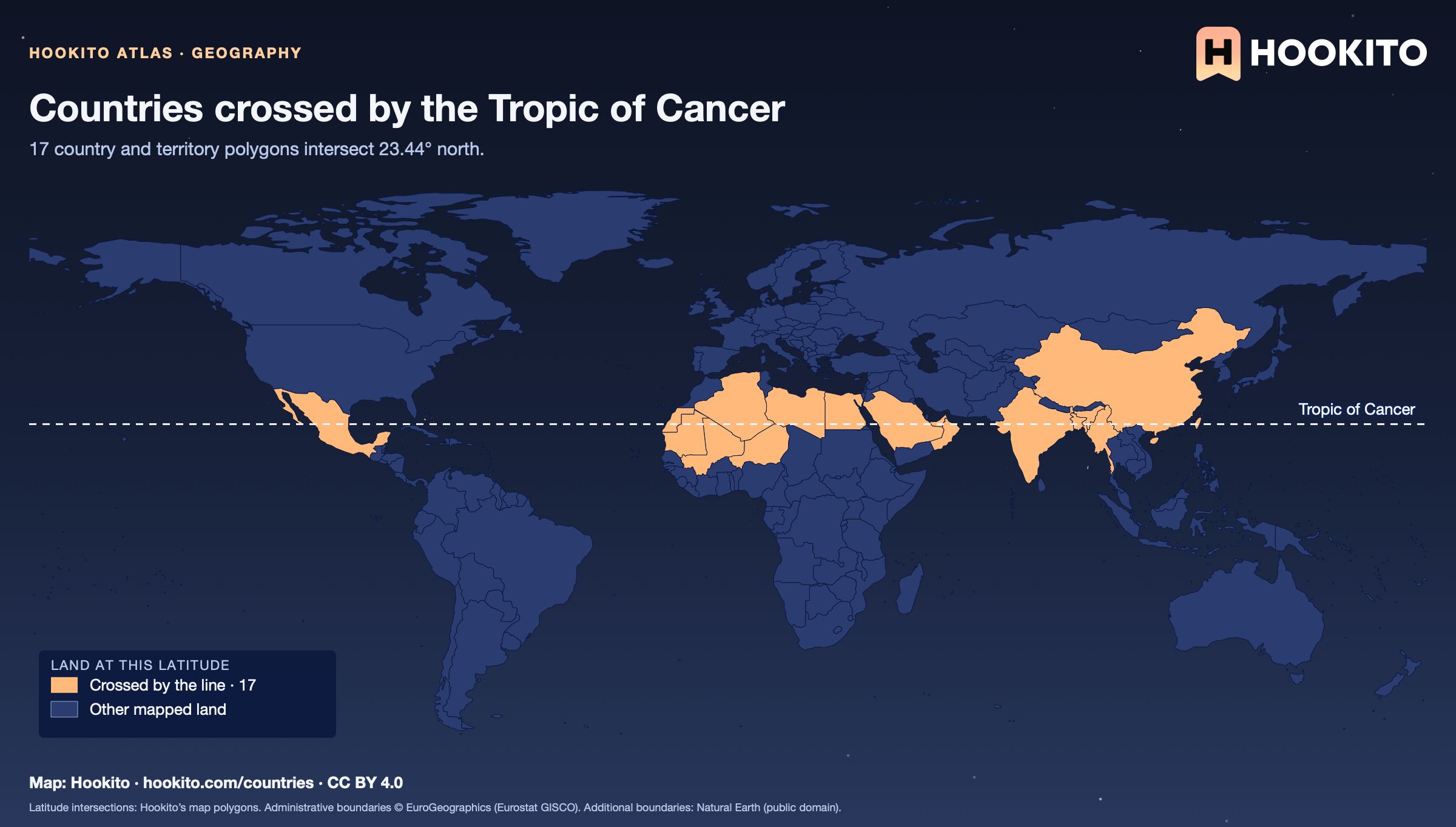
World map with the Tropic of Cancer drawn as a dashed line and the countries whose mapped land crosses it highlighted in orange.

United Arab Emirates, Bangladesh, The Bahamas, China, Algeria, Egypt, Western Sahara, India, Libya, Mali, Myanmar, Mauritania, Mexico, Niger, Oman, Saudi Arabia, Taiwan. The line is tested against land polygons, not territorial waters. Boundaries are simplified at world-map scale, so very small islands can be omitted. The tropical and polar-circle latitudes are approximate.

Embed this map

Latitude intersections: Hookito’s map polygons. Administrative boundaries © EuroGeographics (Eurostat GISCO). Additional boundaries: Natural Earth (public domain).
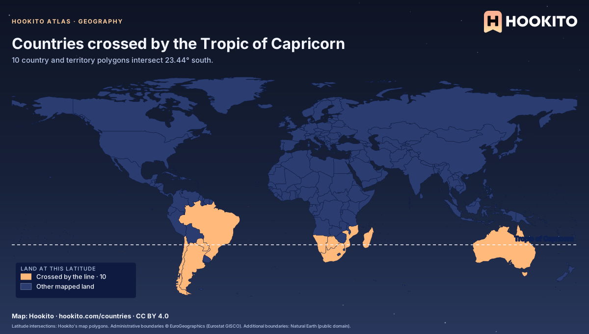
Countries crossed by the Tropic of Capricorn

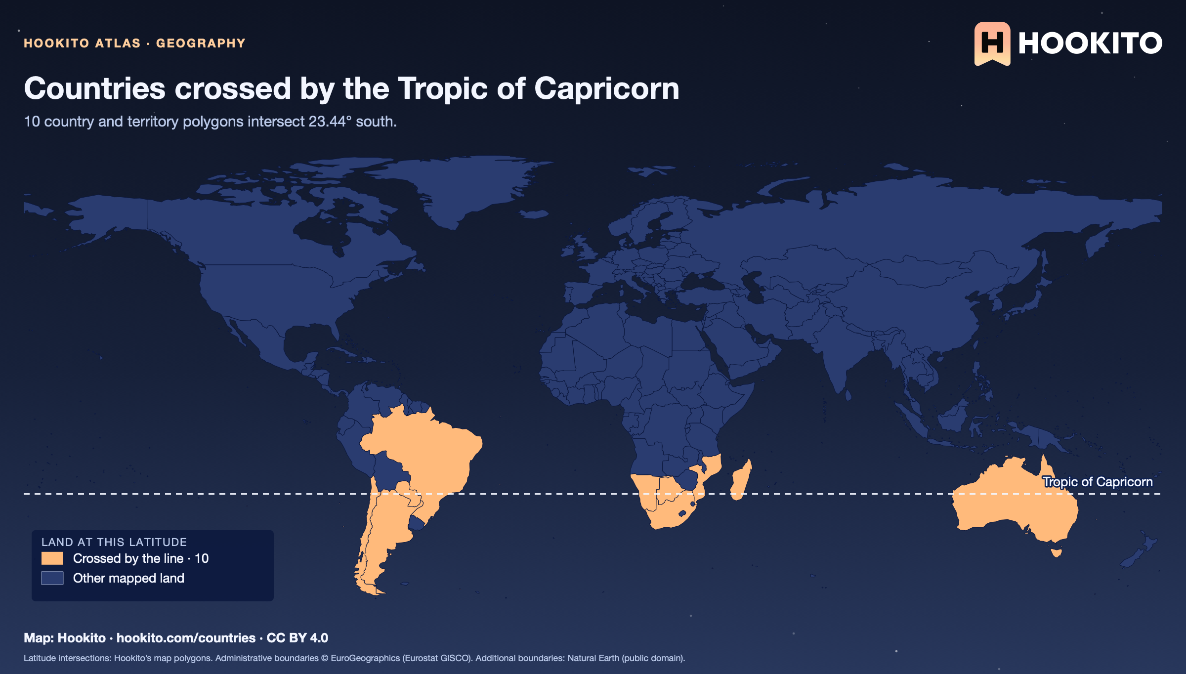
World map with the Tropic of Capricorn drawn as a dashed line and the countries whose mapped land crosses it highlighted in orange.

Argentina, Australia, Brazil, Botswana, Chile, Madagascar, Mozambique, Namibia, Paraguay, South Africa. The line is tested against land polygons, not territorial waters. Boundaries are simplified at world-map scale, so very small islands can be omitted. The tropical and polar-circle latitudes are approximate.

Embed this map

Latitude intersections: Hookito’s map polygons. Administrative boundaries © EuroGeographics (Eurostat GISCO). Additional boundaries: Natural Earth (public domain).
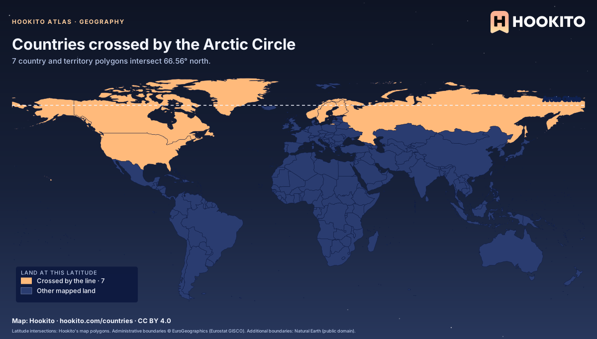
Countries crossed by the Arctic Circle

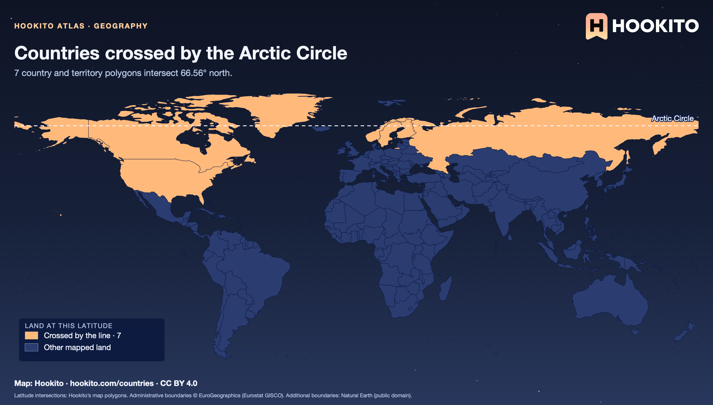
World map with the Arctic Circle drawn as a dashed line and the countries whose mapped land crosses it highlighted in orange.

Canada, Finland, Greenland, Norway, Russia, Sweden, USA. The line is tested against land polygons, not territorial waters. Boundaries are simplified at world-map scale, so very small islands can be omitted. The tropical and polar-circle latitudes are approximate.

Embed this map

Latitude intersections: Hookito’s map polygons. Administrative boundaries © EuroGeographics (Eurostat GISCO). Additional boundaries: Natural Earth (public domain).
6 maps

Country outlines

Every country and territory in our directory, grouped by continent. Learn the shapes or cover the labels and test yourself.

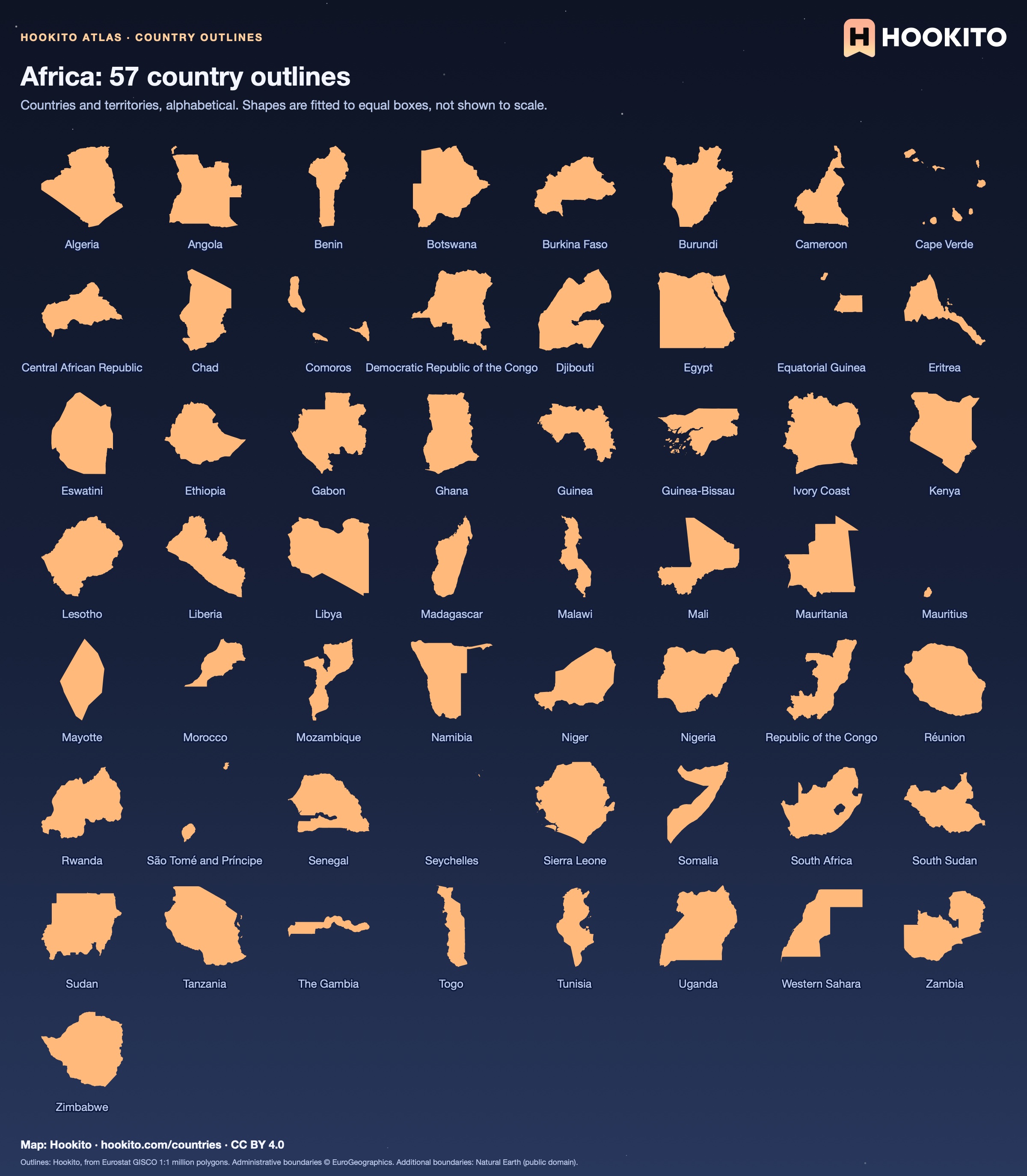
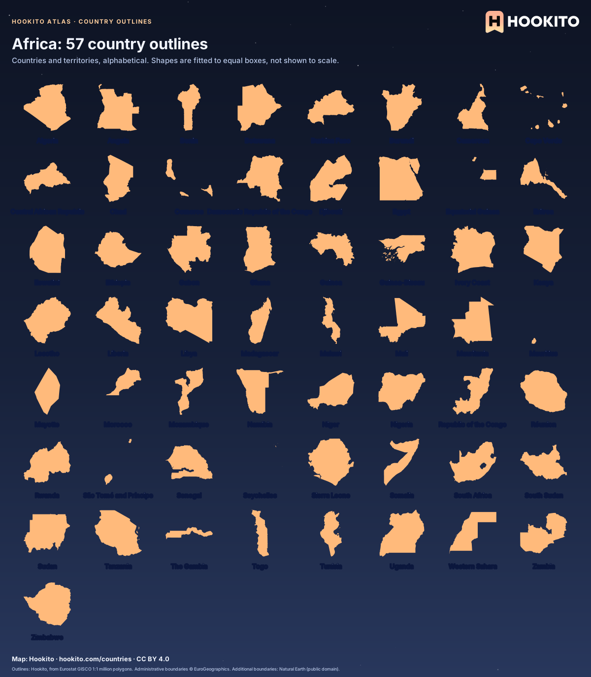
Africa: 57 country outlines

Every country and territory in Hookito’s Africa directory, shown as a labelled outline on a starry background.

Some countries you’d know from the shape alone; others only once you read the name. Cover the labels and see how many you get.

Embed this map

Outlines: Hookito, from Eurostat GISCO 1:1 million polygons. Administrative boundaries © EuroGeographics. Additional boundaries: Natural Earth (public domain).
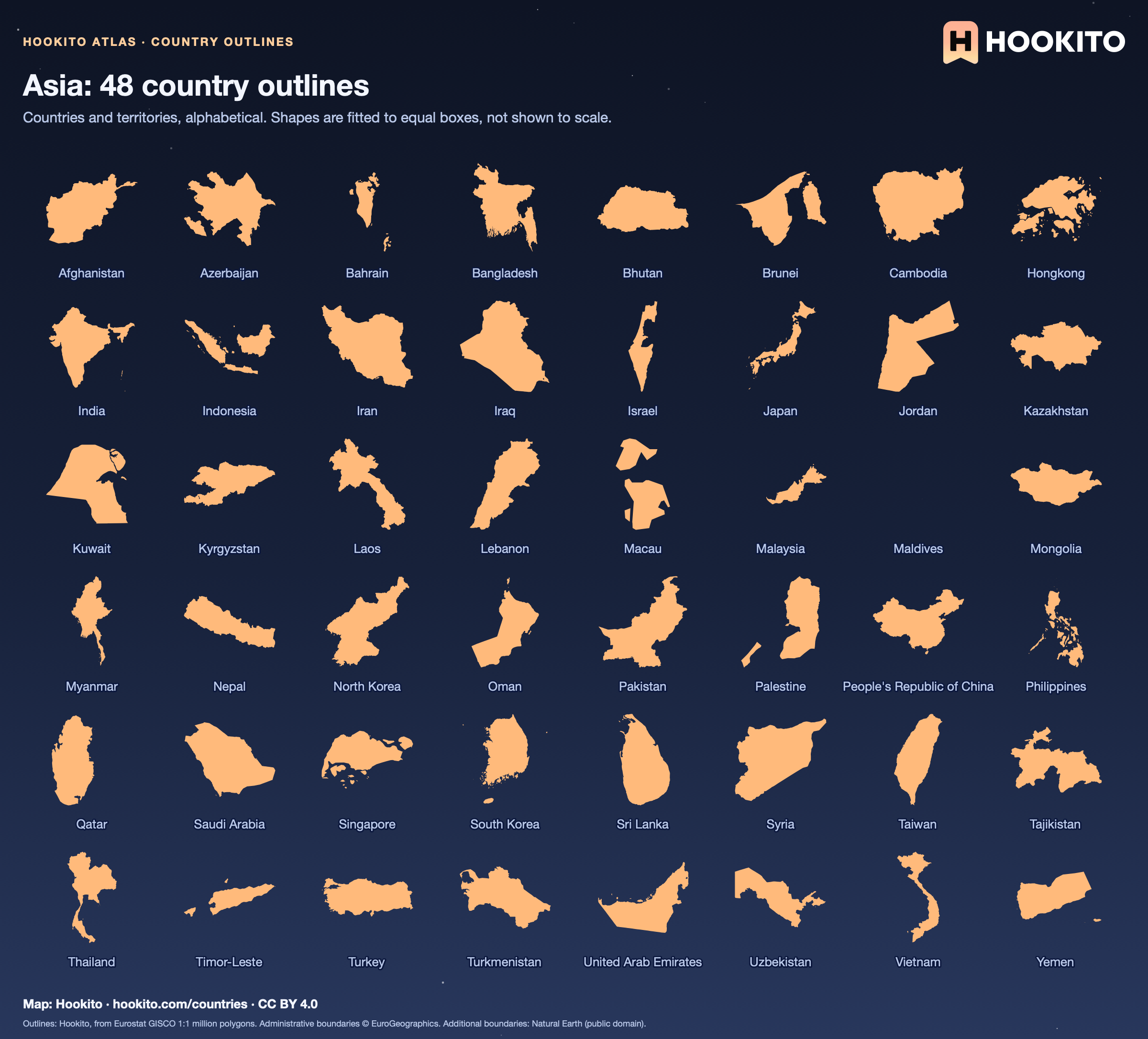
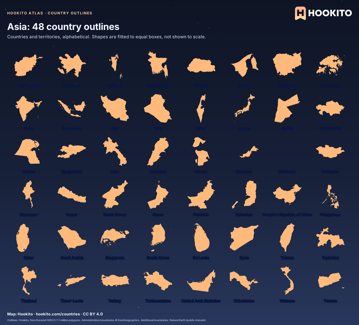
Asia: 48 country outlines

Every country and territory in Hookito’s Asia directory, shown as a labelled outline on a starry background.

Some countries you’d know from the shape alone; others only once you read the name. Cover the labels and see how many you get.

Embed this map

Outlines: Hookito, from Eurostat GISCO 1:1 million polygons. Administrative boundaries © EuroGeographics. Additional boundaries: Natural Earth (public domain).
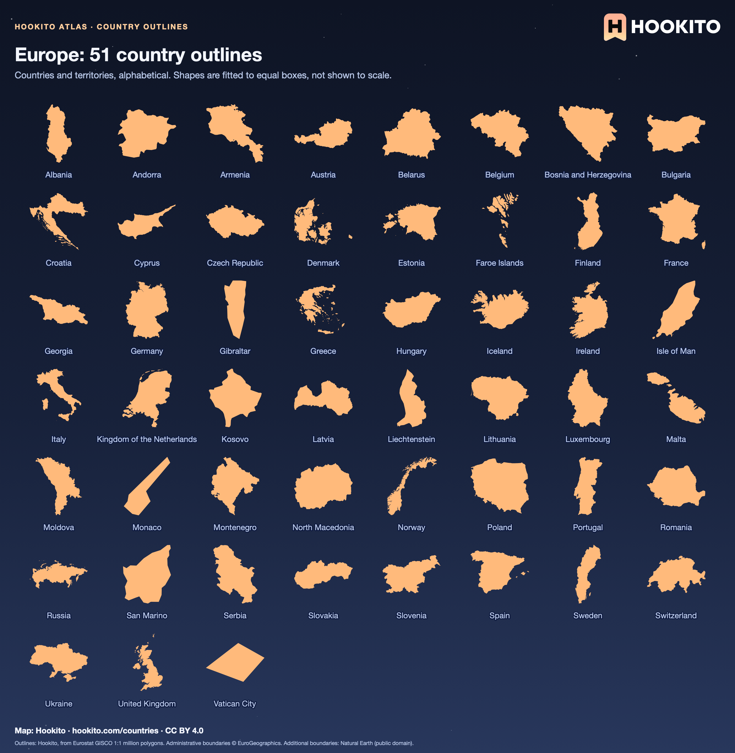
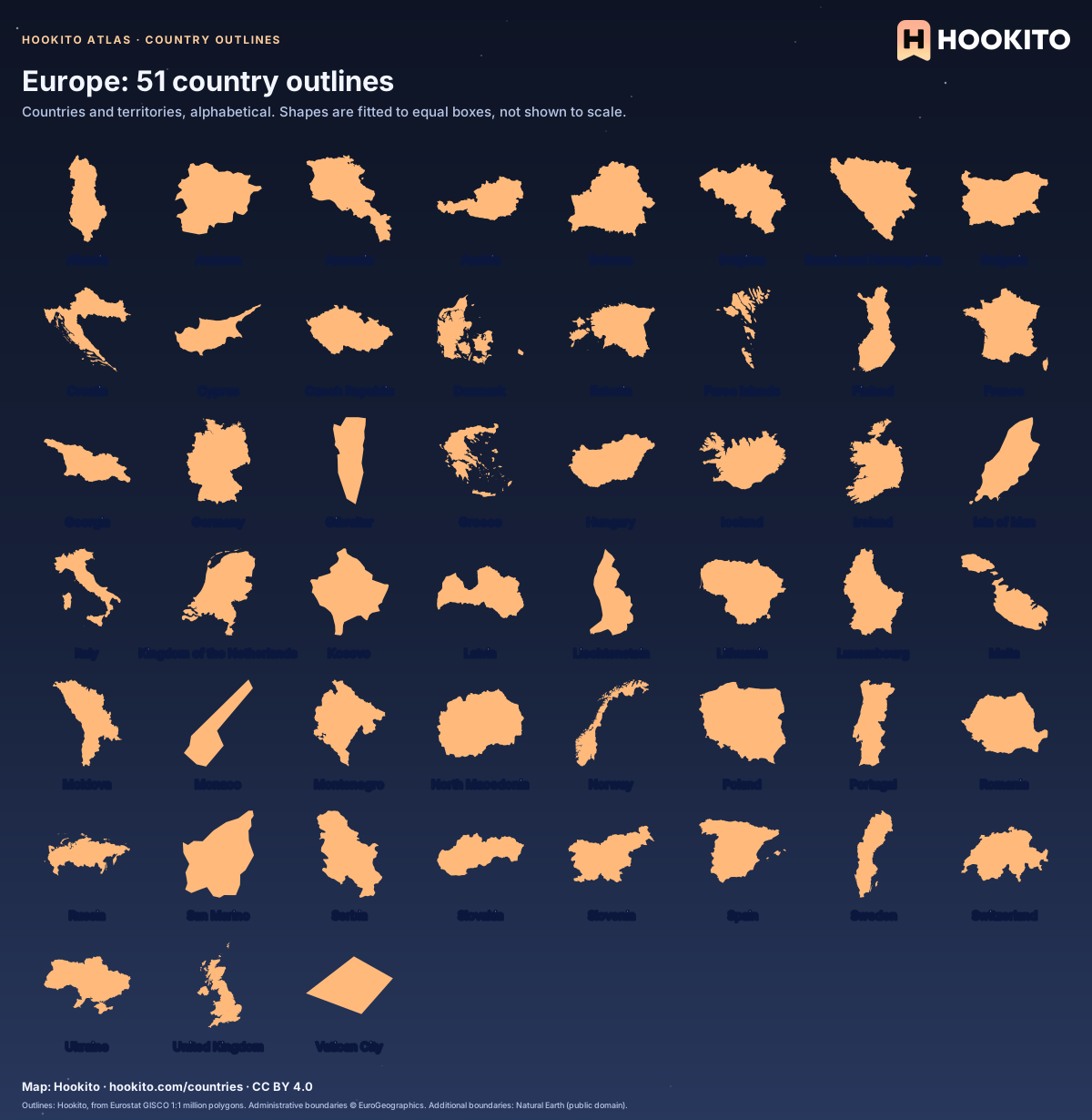
Europe: 51 country outlines

Every country and territory in Hookito’s Europe directory, shown as a labelled outline on a starry background.

Some countries you’d know from the shape alone; others only once you read the name. Cover the labels and see how many you get.

Embed this map

Outlines: Hookito, from Eurostat GISCO 1:1 million polygons. Administrative boundaries © EuroGeographics. Additional boundaries: Natural Earth (public domain).
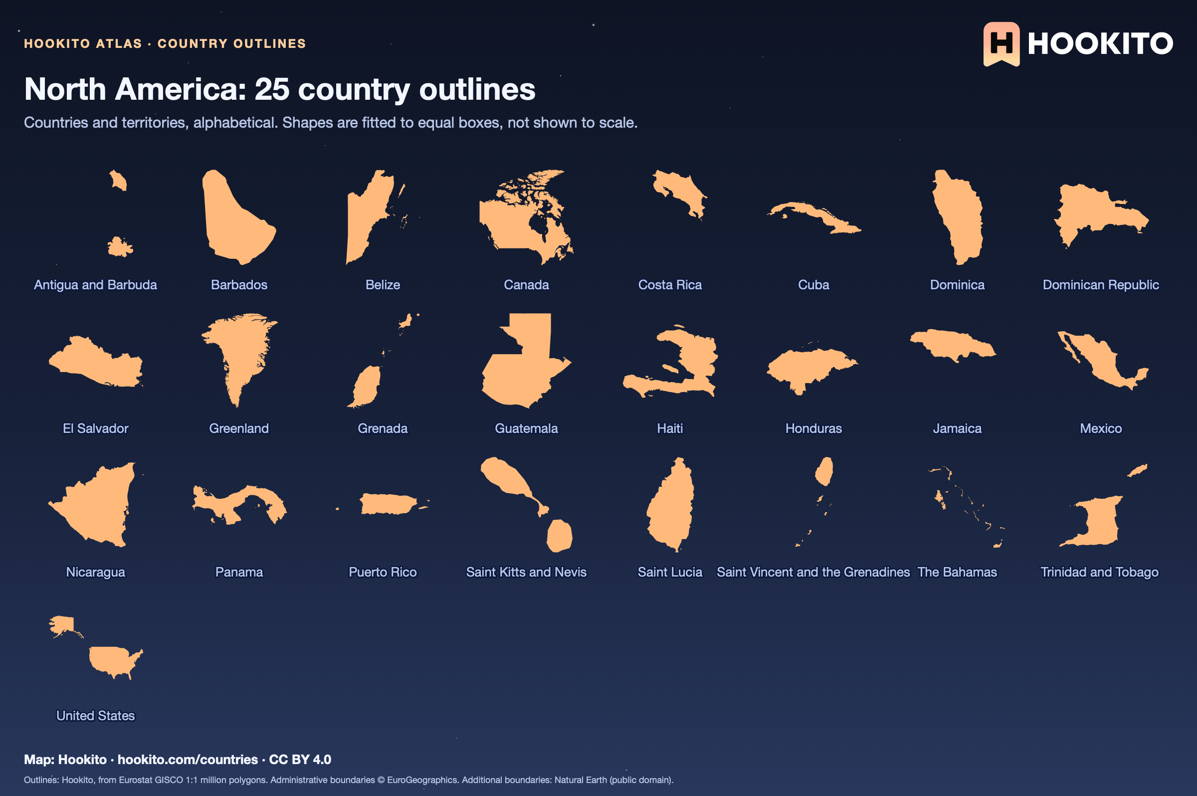
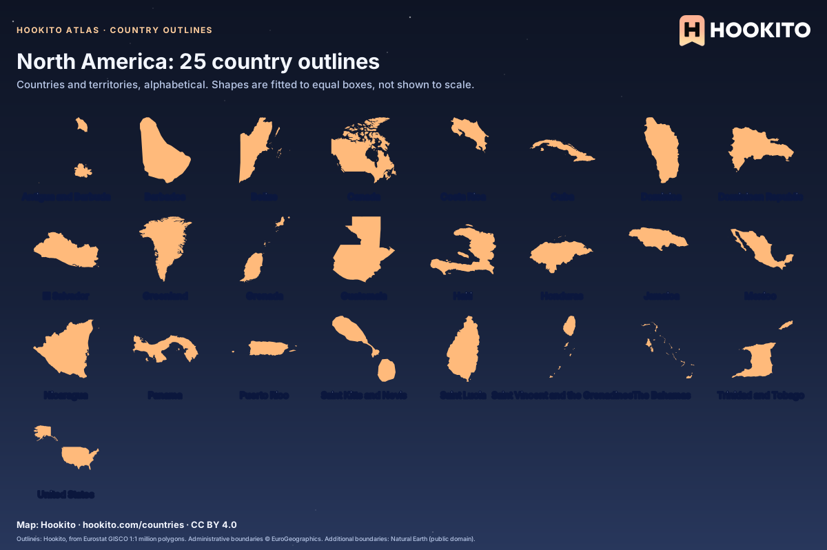
North America: 25 country outlines

Every country and territory in Hookito’s North America directory, shown as a labelled outline on a starry background.

Some countries you’d know from the shape alone; others only once you read the name. Cover the labels and see how many you get.

Embed this map

Outlines: Hookito, from Eurostat GISCO 1:1 million polygons. Administrative boundaries © EuroGeographics. Additional boundaries: Natural Earth (public domain).
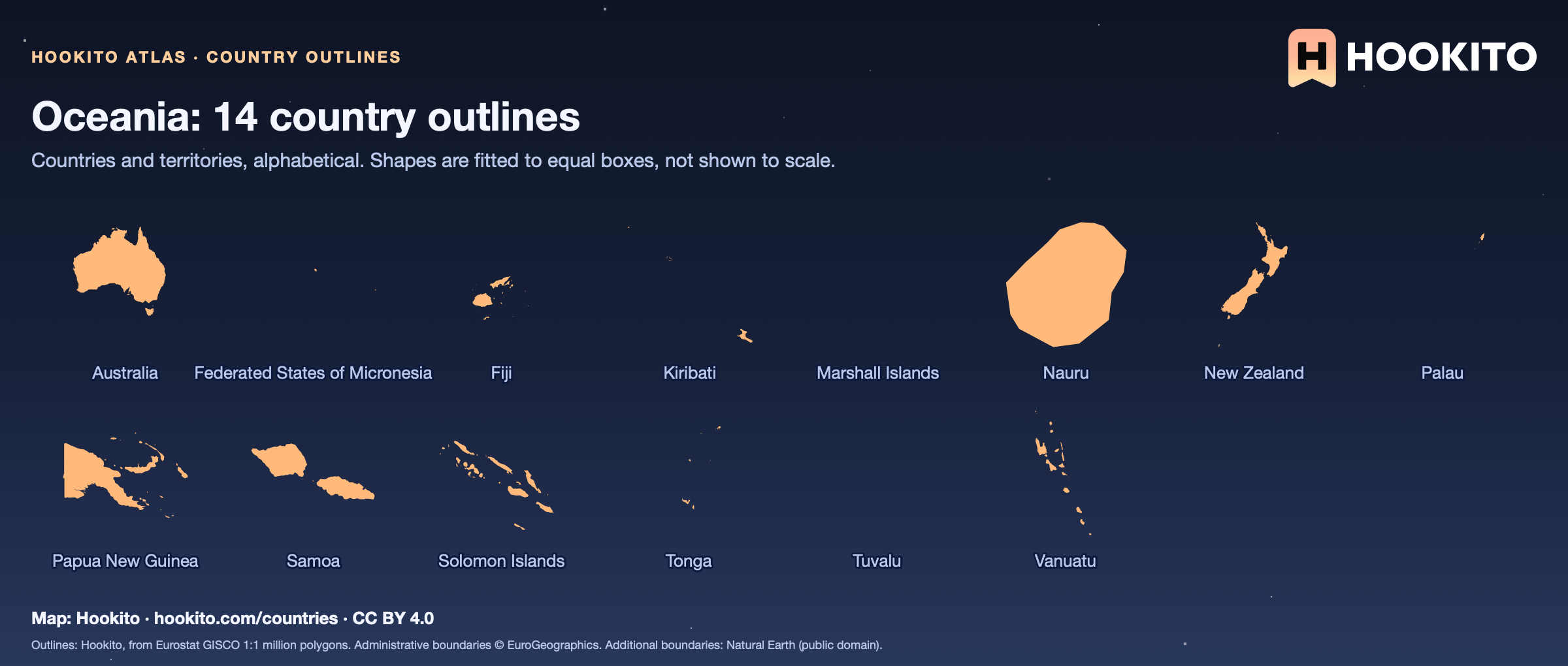
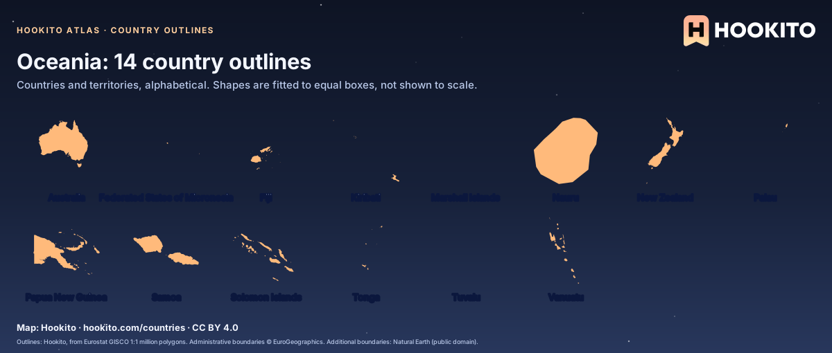
Oceania: 14 country outlines

Every country and territory in Hookito’s Oceania directory, shown as a labelled outline on a starry background.

Some countries you’d know from the shape alone; others only once you read the name. Cover the labels and see how many you get.

Embed this map

Outlines: Hookito, from Eurostat GISCO 1:1 million polygons. Administrative boundaries © EuroGeographics. Additional boundaries: Natural Earth (public domain).

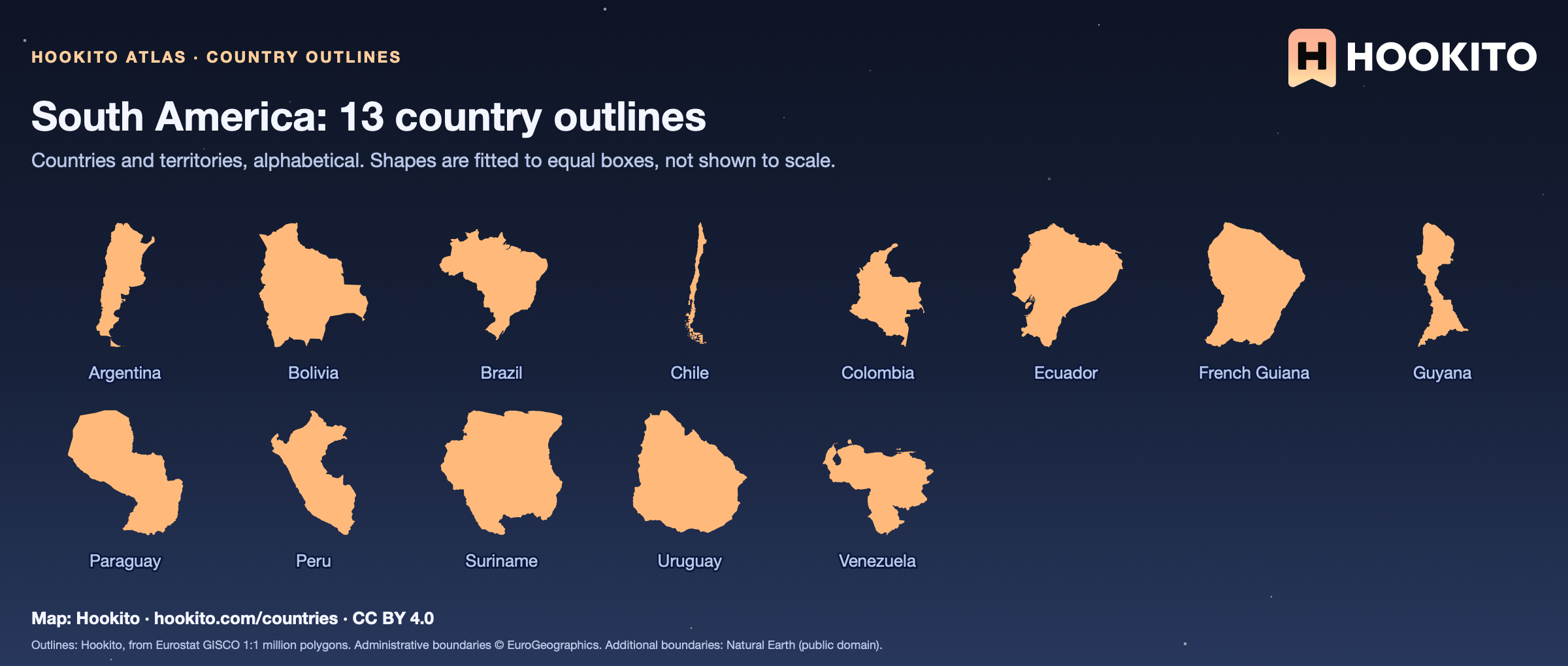
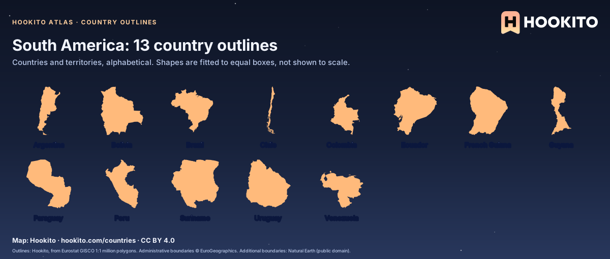
South America: 13 country outlines

Every country and territory in Hookito’s South America directory, shown as a labelled outline on a starry background.

Some countries you’d know from the shape alone; others only once you read the name. Cover the labels and see how many you get.

Embed this map

Outlines: Hookito, from Eurostat GISCO 1:1 million polygons. Administrative boundaries © EuroGeographics. Additional boundaries: Natural Earth (public domain).
Reusing the maps

You’re welcome to share, print or adapt these maps. The renderings are licensed CC BY 4.0: credit them as “Map: Hookito, hookito.com”, with a link to this page where you can.

The underlying data keeps its own terms, so keep its credits too. Administrative boundaries © EuroGeographics (Eurostat GISCO), which also applies to most country outlines. Additional boundaries are from Natural Earth (public domain). Each map lists its other sources: Wikidata and GeoNames for country facts, Wikimedia Commons for the paintings, NASA Earth Observatory for the night imagery. The maps are offered as finished images only; the boundary data itself isn’t available for download here.
Where to next?

Back to the globe
Hookito landscape illustration